
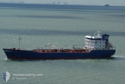
STELLA MARIS
Oil/Chemical Tanker
Current Trip
NLRTM>NOGIK
| Time Travelled | 13 h, 55 mins |
|---|---|
| Remaining Time | --- |
| Distance Travelled | 120.22 nm |
| Remaining Distance | --- |
| AVG Speed | 9.9 Knots |
| MAX Speed | 11.8 Knots |
| AVG Wind | 25.7 knots |
| MAX Wind | 27.8 knots |
| MIN Temp | 7.8°C / 46.04°F |
| MAX Temp | 9.6°C / 49.28°F |
| Dybgang | 6.8 m |
| Position Modtaget | 1 h, 48 m siden |
Current Position
| Longitude | 4.82967° |
|---|---|
| Latitude | 53.59857° |
| Status | Under way using engine |
| Fart | 9.9 Knots |
| Kurs | 23.2° |
| Område | North Sea |
| Station | T-AIS |
| Position Modtaget | 1 h, 48 m siden |
Info
Information
The current position of STELLA MARIS is in North Sea with coordinates 53.59857° / 4.82967° as reported on 2024-04-19 11:23 by AIS to our vessel tracker app. The vessel's current speed is 9.9 Knots
The vessel STELLA MARIS (IMO: 9297101, MMSI: 246315000) is a Oil/Chemical Tanker that was built in 2004 ( 20 år gamle ). It's sailing under the flag of [NL] Netherlands.
In this page you can find informations about the vessels current position, last detected port calls, and current voyage information. If the vessels is not in coverage by AIS you will find the latest position.
The current position of STELLA MARIS is detected by our AIS receivers and we are not responsible for the reliability of the data. The last position was recorded while the vessel was in Coverage by the Ais receivers of our vessel tracking app.
The current draught of STELLA MARIS as reported by AIS is 6.8 meters
Weather
| Temperature | 8°C / 46.4°F |
|---|---|
| Wind Speed | 27 knots |
| Direction | 329° NNW |
| Pressure | 1007.3 hPa |
| Humidity | 73 % |
| Cloud Coverage | 98 % |
Featured Company
Last Port Calls
| Port | Arrival | Departure | Time In Port |
|---|---|---|---|
| 2024-04-18 06:56 | 2024-04-18 23:17 | 16 h | |
| 2024-04-17 12:56 | 2024-04-18 06:34 | 17 h | |
| 2024-04-04 23:18 | 2024-04-05 05:29 | 6 h | |
| 2024-04-01 08:10 | 2024-04-02 03:11 | 19 h | |
| 2024-03-30 14:08 | 2024-03-31 09:17 | 19 h | |
| 2024-03-28 13:44 | 2024-03-29 06:22 | 16 h | |
| 2024-03-26 12:57 | 2024-03-27 22:46 | 1 d | |
| 2024-03-25 05:22 | 2024-03-26 12:22 | 1 d | |
| 2024-03-22 08:33 | 2024-03-25 04:49 | 2 d | |
| 2024-03-07 06:28 | 2024-03-08 01:03 | 18 h |
Most Visited Ports (Last year)
| Port | Arrivals | |
|---|---|---|
| 18 | ||
| 11 | ||
| 10 | ||
| 4 | ||
| 3 | ||
| 3 |
Last Trips
| Origin | Departure | Destination | Arrival | Distance | |
|---|---|---|---|---|---|
| 2024-04-18 08:34 | 2024-04-18 08:56 | 1.54 nm | |||
| 2024-04-05 07:29 | 2024-04-17 14:56 | 1320.02 nm | |||
| 2024-04-02 05:11 | 2024-04-05 01:18 | 552.05 nm | |||
| 2024-03-31 11:17 | 2024-04-01 10:10 | 259.80 nm | |||
| 2024-03-29 06:22 | 2024-03-30 15:08 | 169.82 nm | |||
| 2024-03-27 23:46 | 2024-03-28 13:44 | 164.38 nm | |||
| 2024-03-26 13:22 | 2024-03-26 13:57 | 2.64 nm | |||
| 2024-03-25 05:49 | 2024-03-25 06:22 | 3.97 nm | |||
| 2024-03-08 01:03 | 2024-03-22 09:33 | 811.39 nm | |||
| 2024-03-06 18:59 | 2024-03-07 06:28 | 129.37 nm |
Events
| Tid | Hændelsen | Detaljer | Position / Dest | Info |
|---|---|---|---|---|
| 2024-04-19 11:23 | Udenfor Dækning |
53.59857 / 4.82967
North Sea
NLRTM>NOGIK
|
Fart: 9.9 kn Kurs: 23.2° |
|
| 2024-04-19 06:41 | ETA er ændret | 2024/04/20 19:00 2024/04/20 09:00 |
52.89411 / 4.27561
NLRTM>NOGIK
|
Fart: 9.7 kn Kurs: 22.1° |
| 2024-04-18 23:17 | Afsejlet fra sidste havn |
|
51.89643 / 4.29917
NLRTM>NOGIK
|
Fart: 7.9 kn Kurs: 297° |
| 2024-04-18 22:56 | Status er ændret | Under way using engine Moored |
51.88983 / 4.27329
[NL] BOTLEK - ROTTERDAM
|
Fart: 3.2 kn Kurs: 153° |
| 2024-04-18 22:55 | START Sejllads |
51.89012 / 4.27302
[NL] BOTLEK - ROTTERDAM
|
Fart: 3.1 kn Kurs: 153° |
|
| 2024-04-18 22:30 | Dybgangen er ændret | 6.8 5.7 |
51.89150 / 4.27107
[NL] BOTLEK - ROTTERDAM
|
Fart: Kurs: 161° |
| 2024-04-18 16:29 | Destination er ændret | NLRTM>NOGIK NLRTM>NLRTM |
51.89149 / 4.27097
[NL] BOTLEK - ROTTERDAM
|
Fart: Kurs: 161° |
| 2024-04-18 16:29 | ETA er ændret | 2024/04/20 09:00 2024/04/11 06:00 |
51.89149 / 4.27097
[NL] BOTLEK - ROTTERDAM
|
Fart: Kurs: 161° |
| 2024-04-18 07:22 | Status er ændret | Moored Under way using engine |
51.89149 / 4.27111
[NL] BOTLEK - ROTTERDAM
|
Fart: Kurs: 160° |
| 2024-04-18 07:20 | Status er ændret | Under way using engine Moored |
51.89149 / 4.27117
[NL] BOTLEK - ROTTERDAM
|
Fart: Kurs: 160° |