
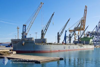
STAR NORITA
Bulk Carrier
Current Trip
| Time Travelled | 5 days |
|---|---|
| Remaining Time | --- |
| Distance Travelled | 1212.71 nm |
| Remaining Distance | --- |
| AVG Speed | 10.9 Knots |
| MAX Speed | 12.8 Knots |
| AVG Wind | 12.1 knots |
| MAX Wind | 22.2 knots |
| MIN Temp | 7.4°C / 45.32°F |
| MAX Temp | 14.4°C / 57.92°F |
| Dybgang | 12.7 m |
| Position Modtaget | 2 h, 38 m siden |
Current Position
| Longitude | -125.93359° |
|---|---|
| Latitude | 33.28455° |
| Status | Under way using engine |
| Fart | 11.2 Knots |
| Kurs | 157.8° |
| Område | North Pacific Ocean |
| Station | T-AIS |
| Position Modtaget | 2 h, 38 m siden |
Info
Information
The current position of STAR NORITA is in North Pacific Ocean with coordinates 33.28455° / -125.93359° as reported on 2024-04-19 20:03 by AIS to our vessel tracker app. The vessel's current speed is 11.2 Knots and is heading at the port of ACAJUTLA. The estimated time of arrival as calculated by MyShipTracking vessel tracking app is 2024-04-29 12:00 LT
The vessel STAR NORITA (IMO: 9583134, MMSI: 257854000) is a Bulk Carrier that was built in 2012 ( 12 år gamle ). It's sailing under the flag of [NO] Norway.
In this page you can find informations about the vessels current position, last detected port calls, and current voyage information. If the vessels is not in coverage by AIS you will find the latest position.
The current position of STAR NORITA is detected by our AIS receivers and we are not responsible for the reliability of the data. The last position was recorded while the vessel was in Coverage by the Ais receivers of our vessel tracking app.
The current draught of STAR NORITA as reported by AIS is 12.7 meters
Weather
| Temperature | 14.4°C / 57.92°F |
|---|---|
| Wind Speed | 13 knots |
| Direction | 329° NNW |
| Pressure | 1018.8 hPa |
| Humidity | 75.8 % |
| Cloud Coverage | --- |
Featured Company
Events
| Tid | Hændelsen | Detaljer | Position / Dest | Info |
|---|---|---|---|---|
| 2024-04-19 20:06 | Status er ændret | Default Under way using engine |
33.27730 / -125.93012
SV AQJ
|
Fart: 11.2 kn Kurs: 157.8° |
| 2024-04-19 20:03 | Status er ændret | Under way using engine Default |
33.28455 / -125.93359
SV AQJ
|
Fart: 11 kn Kurs: 159° |
| 2024-04-19 20:03 | Indenfor Dækning |
33.28455 / -125.93359
North Pacific Ocean
SV AQJ
|
Fart: 11.2 kn Kurs: 157.8° |
|
| 2024-04-19 20:03 | Udenfor Dækning |
33.28455 / -125.93359
North Pacific Ocean
SV AQJ
|
Fart: 11.2 kn Kurs: 157.8° |
|
| 2024-04-19 07:48 | Udenfor Dækning |
35.45200 / -127.02147
North Pacific Ocean
SV AQJ
|
Fart: 11.2 kn Kurs: 160.1° |
|
| 2024-04-19 07:38 | Indenfor Dækning |
35.47447 / -127.03264
North Pacific Ocean
SV AQJ
|
Fart: 11.3 kn Kurs: 156.7° |
|
| 2024-04-18 17:53 | Status er ændret | Default Under way using engine |
37.88958 / -128.28294
SV AQJ
|
Fart: 11.2 kn Kurs: 159.2° |
| 2024-04-18 17:37 | Status er ændret | Under way using engine Default |
37.93520 / -128.30785
SV AQJ
|
Fart: 11.1 kn Kurs: 158° |
| 2024-04-18 17:37 | Udenfor Dækning |
37.93520 / -128.30785
North Pacific Ocean
SV AQJ
|
Fart: 11.2 kn Kurs: 159.2° |
|
| 2024-04-18 17:34 | Status er ændret | Default Under way using engine |
37.94378 / -128.31255
SV AQJ
|
Fart: 11.2 kn Kurs: 157.1° |