
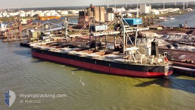
SPRING NEXUS
Cargo
Current Trip
GNBRP
| Time Travelled | 41 days |
|---|---|
| Remaining Time | --- |
| Distance Travelled | 11382.37 nm |
| Remaining Distance | --- |
| AVG Speed | 11.8 Knots |
| MAX Speed | 16.4 Knots |
| AVG Wind | 13.4 knots |
| MAX Wind | 38.4 knots |
| MIN Temp | -0.4°C / 31.28°F |
| MAX Temp | 30.3°C / 86.54°F |
| Dybgang | 9.7 m |
| Position Modtaget | 5 d siden |
Current Position
| Longitude | 17.33057° |
|---|---|
| Latitude | -33.72446° |
| Status | Under way using engine |
| Fart | 13.8 Knots |
| Kurs | 313.9° |
| Område | South Atlantic Ocean |
| Station | T-AIS |
| Position Modtaget | 5 d siden |
Info
Information
The current position of SPRING NEXUS is in South Atlantic Ocean with coordinates -33.72446° / 17.33057° as reported on 2024-04-13 07:34 by AIS to our vessel tracker app. The vessel's current speed is 13.8 Knots
The vessel SPRING NEXUS (IMO: 9595400, MMSI: 355354000) is a Cargo It's sailing under the flag of [PA] Panama.
In this page you can find informations about the vessels current position, last detected port calls, and current voyage information. If the vessels is not in coverage by AIS you will find the latest position.
The current position of SPRING NEXUS is detected by our AIS receivers and we are not responsible for the reliability of the data. The last position was recorded while the vessel was in Coverage by the Ais receivers of our vessel tracking app.
The current draught of SPRING NEXUS as reported by AIS is 9.7 meters
Weather
| Temperature | 27.1°C / 80.78°F |
|---|---|
| Wind Speed | 10 knots |
| Direction | 118° ESE |
| Pressure | 1011.3 hPa |
| Humidity | 78 % |
| Cloud Coverage | 100 % |
Featured Company
Last Port Calls
| Port | Arrival | Departure | Time In Port |
|---|---|---|---|
| 2024-03-08 07:34 | |||
| 2024-02-27 22:07 | 2024-03-01 18:46 | 2 d | |
| 2024-02-07 09:05 | 2024-02-09 01:50 | 1 d |
Last Trips
| Origin | Departure | Destination | Arrival | Distance | |
|---|---|---|---|---|---|
| 2024-02-09 09:50 | 2024-02-28 07:07 | 3681.43 nm | |||
| 2024-01-24 08:55 | 2024-02-07 17:05 | 3890.65 nm |
Events
| Tid | Hændelsen | Detaljer | Position / Dest | Info |
|---|---|---|---|---|
| 2024-04-13 07:38 | Status er ændret | Default Under way using engine |
-33.71261 / 17.31590
GNBRP
|
Fart: 13.8 kn Kurs: 313.9° |
| 2024-04-13 07:34 | Udenfor Dækning |
-33.72446 / 17.33057
South Atlantic Ocean
GNBRP
|
Fart: 13.8 kn Kurs: 313.9° |
|
| 2024-04-13 07:33 | Status er ændret | Under way using engine Default |
-33.72628 / 17.33281
GNBRP
|
Fart: 13.6 kn Kurs: 315° |
| 2024-04-13 07:25 | Status er ændret | Default Under way using engine |
-33.74923 / 17.36077
GNBRP
|
Fart: 13.3 kn Kurs: 315° |
| 2024-04-13 07:11 | Status er ændret | Under way using engine Default |
-33.78391 / 17.40197
GNBRP
|
Fart: 13.3 kn Kurs: 316° |
| 2024-04-13 06:56 | Status er ændret | Default Under way using engine |
-33.82435 / 17.44947
GNBRP
|
Fart: 13 kn Kurs: 316.7° |
| 2024-04-13 06:36 | Status er ændret | Under way using engine Default |
-33.87599 / 17.50916
GNBRP
|
Fart: 12.9 kn Kurs: 315° |
| 2024-04-13 05:56 | Status er ændret | Default Under way using engine |
-33.97910 / 17.63245
GNBRP
|
Fart: 12.9 kn Kurs: 323.4° |
| 2024-04-13 05:50 | Status er ændret | Under way using engine Default |
-33.99583 / 17.64769
GNBRP
|
Fart: 13 kn Kurs: 328° |
| 2024-04-13 05:04 | Status er ændret | Default Under way using engine |
-34.14412 / 17.72924
GNBRP
|
Fart: 12.8 kn Kurs: 334.5° |