
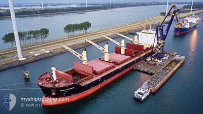
SPAR SCORPIO
Bulk Carrier
Current Trip
| Time Travelled | 33 days |
|---|---|
| Remaining Time | --- |
| Distance Travelled | 9204.39 nm |
| Remaining Distance | --- |
| AVG Speed | 11.2 Knots |
| MAX Speed | 14.8 Knots |
| AVG Wind | 10.1 knots |
| MAX Wind | 27 knots |
| MIN Temp | 8°C / 46.4°F |
| MAX Temp | 30.1°C / 86.18°F |
| Dybgang | 10.9 m |
| Position Modtaget | 2 d siden |
Current Position
| Longitude | 15.76898° |
|---|---|
| Latitude | -32.40456° |
| Status | Under way using engine |
| Fart | 11.6 Knots |
| Kurs | 331.5° |
| Område | South Atlantic Ocean |
| Station | T-AIS |
| Position Modtaget | 2 d siden |
Info
Information
The current position of SPAR SCORPIO is in South Atlantic Ocean with coordinates -32.40456° / 15.76898° as reported on 2024-04-21 02:00 by AIS to our vessel tracker app. The vessel's current speed is 11.6 Knots and is heading at the port of TANGER MED. The estimated time of arrival as calculated by MyShipTracking vessel tracking app is 2024-05-08 08:00 LT
The vessel SPAR SCORPIO (IMO: 9307578, MMSI: 257795000) is a Bulk Carrier that was built in 2006 ( 18 år gamle ). It's sailing under the flag of [NO] Norway.
In this page you can find informations about the vessels current position, last detected port calls, and current voyage information. If the vessels is not in coverage by AIS you will find the latest position.
The current position of SPAR SCORPIO is detected by our AIS receivers and we are not responsible for the reliability of the data. The last position was recorded while the vessel was in Coverage by the Ais receivers of our vessel tracking app.
The current draught of SPAR SCORPIO as reported by AIS is 10.9 meters
Weather
| Temperature | 21.2°C / 70.16°F |
|---|---|
| Wind Speed | 18 knots |
| Direction | 155° SSE |
| Pressure | 1017.4 hPa |
| Humidity | 76.9 % |
| Cloud Coverage | 82 % |
Featured Company
Last Port Calls
| Port | Arrival | Departure | Time In Port |
|---|---|---|---|
| 2024-03-21 09:34 | |||
| 2024-03-01 07:24 | 2024-03-13 10:21 | 12 d | |
| 2024-02-22 11:35 | 2024-02-24 06:47 | 1 d |
Most Visited Ports (Last year)
| Port | Arrivals | |
|---|---|---|
| 2 | ||
| 1 | ||
| 1 | ||
| 1 | ||
| 1 | ||
| 1 |
Last Trips
| Origin | Departure | Destination | Arrival | Distance | |
|---|---|---|---|---|---|
| 2024-02-24 14:47 | 2024-03-01 16:24 | 667.91 nm | |||
| 2024-01-23 05:46 | 2024-02-22 19:35 | 5726.48 nm |
Events
| Tid | Hændelsen | Detaljer | Position / Dest | Info |
|---|---|---|---|---|
| 2024-04-21 02:07 | Status er ændret | Default Under way using engine |
-32.38500 / 15.75500
MA PTM
|
Fart: 11.6 kn Kurs: 331.5° |
| 2024-04-21 02:00 | Status er ændret | Under way using engine Default |
-32.40456 / 15.76898
MA PTM
|
Fart: 11.6 kn Kurs: 333° |
| 2024-04-21 02:00 | Udenfor Dækning |
-32.40456 / 15.76898
South Atlantic Ocean
MA PTM
|
Fart: 11.6 kn Kurs: 331.5° |
|
| 2024-04-21 01:58 | Status er ændret | Default Under way using engine |
-32.40967 / 15.77235
MA PTM
|
Fart: 11.5 kn Kurs: 319.1° |
| 2024-04-21 01:51 | Dybgangen er ændret | 10.9 11.5 |
-32.42761 / 15.78731
MA PTM
|
Fart: 11.4 kn Kurs: 316.9° |
| 2024-04-21 01:51 | ETA er ændret | 2024/05/08 08:00 2024/03/07 12:00 |
-32.42761 / 15.78731
MA PTM
|
Fart: 11.4 kn Kurs: 316.9° |
| 2024-04-21 01:41 | Status er ændret | Under way using engine Default |
-32.45328 / 15.81227
MA PTM
|
Fart: 11.6 kn Kurs: 320° |
| 2024-04-21 00:49 | Status er ændret | Default Under way using engine |
-32.58333 / 15.94667
MA PTM
|
Fart: 12.2 kn Kurs: 317.6° |
| 2024-04-21 00:45 | Status er ændret | Under way using engine Default |
-32.59437 / 15.95645
MA PTM
|
Fart: 12.3 kn Kurs: 313° |
| 2024-04-21 00:45 | Indenfor Dækning |
-32.59351 / 15.95556
South Atlantic Ocean
|
Fart: 12.2 kn Kurs: 317.6° |