
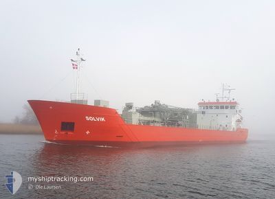
SOLVIK
Cargo
Current Trip
| Time Travelled | 3 days |
|---|---|
| Remaining Time | 2 h, 35 mins |
| Distance Travelled | 685.32 nm |
| Remaining Distance | 22.47 nm |
| AVG Speed | 8.4 Knots |
| MAX Speed | 11.8 Knots |
| AVG Wind | 16.4 knots |
| MAX Wind | 24 knots |
| MIN Temp | 6.2°C / 43.16°F |
| MAX Temp | 12.8°C / 55.04°F |
| Dybgang | 6 m |
| Position Modtaget | 1 m siden |
Current Position
| Longitude | 0.83677° |
|---|---|
| Latitude | 51.49132° |
| Status | Under way using engine |
| Fart | 11.4 Knots |
| Kurs | 268.1° |
| Område | North Sea |
| Station | T-AIS |
| Position Modtaget | 1 m siden |
Info
Information
The current position of SOLVIK is in North Sea with coordinates 51.49132° / 0.83677° as reported on 2024-04-24 11:09 by AIS to our vessel tracker app. The vessel's current speed is 11.4 Knots and is heading at the port of TILBURY. The estimated time of arrival as calculated by MyShipTracking vessel tracking app is 2024-04-24 13:45 LT
The vessel SOLVIK (IMO: 9944089, MMSI: 210515000) is a Cargo It's sailing under the flag of [CY] Cyprus.
In this page you can find informations about the vessels current position, last detected port calls, and current voyage information. If the vessels is not in coverage by AIS you will find the latest position.
The current position of SOLVIK is detected by our AIS receivers and we are not responsible for the reliability of the data. The last position was recorded while the vessel was in Coverage by the Ais receivers of our vessel tracking app.
The current draught of SOLVIK as reported by AIS is 6 meters
Weather
| Temperature | 7.9°C / 46.22°F |
|---|---|
| Wind Speed | 15 knots |
| Direction | 342° NNW |
| Pressure | 1015.5 hPa |
| Humidity | 63.4 % |
| Cloud Coverage | 44 % |
Featured Company
Last Port Calls
| Port | Arrival | Departure | Time In Port |
|---|---|---|---|
| 2024-04-20 15:24 | 2024-04-21 07:57 | 16 h | |
| 2024-04-12 16:52 | 2024-04-13 05:34 | 12 h | |
| 2024-03-19 03:47 | 2024-03-19 03:52 | 5 m | |
| 2024-03-19 02:47 | 2024-03-19 03:18 | 30 m | |
| 2024-03-17 17:13 | 2024-03-19 02:27 | 1 d | |
| 2024-03-17 16:21 | 2024-03-17 16:50 | 28 m | |
| 2024-02-21 22:42 | 2024-02-22 22:39 | 23 h | |
| 2024-02-17 23:55 | 2024-02-18 20:02 | 20 h | |
| 2024-02-14 22:17 | 2024-02-15 15:06 | 16 h | |
| 2024-02-08 22:57 | 2024-02-11 14:15 | 2 d |
Last Trips
| Origin | Departure | Destination | Arrival | Distance | |
|---|---|---|---|---|---|
| 2024-04-13 06:34 | 2024-04-20 17:24 | 963.20 nm | |||
| 2024-03-19 03:52 | 2024-04-12 17:52 | 1689.40 nm | |||
| 2024-03-19 03:18 | 2024-03-19 03:47 | 5.11 nm | |||
| 2024-03-19 02:27 | 2024-03-19 02:47 | 1.50 nm | |||
| 2024-03-17 16:50 | 2024-03-17 17:13 | 1.94 nm | |||
| 2024-02-22 22:39 | 2024-03-17 16:21 | 3207.99 nm | |||
| 2024-02-18 21:02 | 2024-02-21 22:42 | 386.67 nm | |||
| 2024-02-15 15:06 | 2024-02-18 00:55 | 392.76 nm | |||
| 2024-02-11 15:15 | 2024-02-14 22:17 | 719.11 nm | |||
| 2024-01-22 08:30 | 2024-02-08 23:57 | 3038.47 nm |
Events
| Tid | Hændelsen | Detaljer | Position / Dest | Info |
|---|---|---|---|---|
| 2024-04-24 11:07 | START Sejllads | 5 nm, North East of SHEERNESS |
51.49139 / .84609
TILBURY GB
|
Fart: 11.2 kn Kurs: 268.7° |
| 2024-04-24 11:06 | STOP Sejllads | 5.12 nm, North East of SHEERNESS |
51.49147 / .85001
TILBURY GB
|
Fart: Kurs: 0° |
| 2024-04-24 10:46 | START Sejllads | 7.63 nm, North East of SHEERNESS |
51.49158 / .92673
TILBURY GB
|
Fart: 3.1 kn Kurs: 2° |
| 2024-04-24 10:39 | STOP Sejllads | 7.65 nm, East of SHEERNESS |
51.48716 / .93019
TILBURY GB
|
Fart: Kurs: 0° |
| 2024-04-24 09:53 | START Sejllads | 8.09 nm, North of WHITSTABLE |
51.49851 / 1.03808
TILBURY GB
|
Fart: 9.4 kn Kurs: 268.8° |
| 2024-04-24 09:53 | STOP Sejllads | 8.09 nm, North of WHITSTABLE |
51.49831 / 1.04136
TILBURY GB
|
Fart: Kurs: 0° |
| 2024-04-24 09:48 | START Sejllads | 8.07 nm, North of WHITSTABLE |
51.49644 / 1.06113
TILBURY GB
|
Fart: 9.3 kn Kurs: 279.3° |
| 2024-04-24 09:47 | STOP Sejllads | 8.06 nm, North of WHITSTABLE |
51.49607 / 1.06427
TILBURY GB
|
Fart: Kurs: 0° |
| 2024-04-24 09:12 | START Sejllads | 10.13 nm, North East of WHITSTABLE |
51.48651 / 1.21060
TILBURY GB
|
Fart: 9.4 kn Kurs: 273.3° |
| 2024-04-24 09:12 | STOP Sejllads | 10.21 nm, North East of WHITSTABLE |
51.48638 / 1.21388
TILBURY GB
|
Fart: Kurs: 0° |