
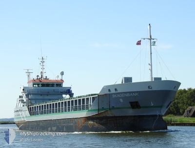
SKAGENBANK
General Cargo
Current Trip
| Trip Time | 7 h, 41 mins |
|---|---|
| Trip Distance | 67.78 nm |
| AVG Speed | 9 Knots |
| MAX Speed | 12.3 Knots |
| Dybgang | 4.9 m |
| AVG Wind | 9.3 knots |
| MAX Wind | 11.6 knots |
| MIN Temp | -0.5°C / 31.1°F |
| MAX Temp | 0.3°C / 32.54°F |
| Position Modtaget | 4 d siden |
Current Position
| Longitude | 20.66970° |
|---|---|
| Latitude | 63.47979° |
| Status | Under way using engine |
| Fart | 11.7 Knots |
| Kurs | 29.3° |
| Område | Gulf of Bothnia |
| Station | T-AIS |
| Position Modtaget | 4 d siden |
Info
Information
The current position of SKAGENBANK is in Gulf of Bothnia with coordinates 63.47979° / 20.66970° as reported on 2024-04-13 20:55 by AIS to our vessel tracker app. The vessel's current speed is 11.7 Knots and is currently inside the port of HARAHOLMEN.
The vessel SKAGENBANK (IMO: 9313864, MMSI: 245306000) is a General Cargo that was built in 2005 ( 19 år gamle ). It's sailing under the flag of [NL] Netherlands.
In this page you can find informations about the vessels current position, last detected port calls, and current voyage information. If the vessels is not in coverage by AIS you will find the latest position.
The current position of SKAGENBANK is detected by our AIS receivers and we are not responsible for the reliability of the data. The last position was recorded while the vessel was in Coverage by the Ais receivers of our vessel tracking app.
The current draught of SKAGENBANK as reported by AIS is 4.9 meters
Weather
| Temperature | -6.1°C / 21.02°F |
|---|---|
| Wind Speed | 5 knots |
| Direction | 355° N |
| Pressure | 1018.1 hPa |
| Humidity | 97 % |
| Cloud Coverage | 95 % |
Featured Company
Last Port Calls
| Port | Arrival | Departure | Time In Port |
|---|---|---|---|
| 2024-04-16 20:16 | |||
| 2024-04-14 11:02 | 2024-04-16 12:35 | 2 d | |
| 2024-04-08 04:12 | 2024-04-08 17:49 | 13 h | |
| 2024-04-07 16:40 | 2024-04-07 17:53 | 1 h | |
| 2024-04-05 06:48 | 2024-04-05 22:31 | 15 h | |
| 2024-03-04 12:01 | 2024-03-06 13:22 | 2 d | |
| 2024-02-29 00:52 | 2024-03-01 06:17 | 1 d | |
| 2024-02-27 13:14 | |||
| 2024-02-14 05:28 | 2024-02-15 19:52 | 1 d | |
| 2024-02-02 14:28 | 2024-02-14 05:04 | 11 d |
Most Visited Ports (Last year)
| Port | Arrivals | |
|---|---|---|
| 6 | ||
| 3 | ||
| 3 | ||
| 2 | ||
| 2 | ||
| 2 |
Last Trips
| Origin | Departure | Destination | Arrival | Distance | |
|---|---|---|---|---|---|
| 2024-04-16 14:35 | 2024-04-16 22:16 | 67.78 nm | |||
| 2024-04-08 18:49 | 2024-04-14 13:02 | 1307.46 nm | |||
| 2024-04-07 18:53 | 2024-04-08 05:12 | 39.65 nm | |||
| 2024-04-06 00:31 | 2024-04-07 17:40 | 226.57 nm | |||
| 2024-03-06 14:22 | 2024-04-05 08:48 | 2240.66 nm | |||
| 2024-03-01 08:17 | 2024-03-04 13:01 | 860.02 nm | |||
| 2024-02-27 15:14 | 2024-02-29 02:52 | 452.36 nm | |||
| 2024-02-14 07:04 | 2024-02-14 07:28 | 0.49 nm | |||
| 2024-01-31 16:36 | 2024-02-02 16:28 | 580.25 nm |
Events
| Tid | Hændelsen | Detaljer | Position / Dest | Info |
|---|---|---|---|---|
| 2024-04-16 20:24 | STOP Sejllads |
65.23761 / 21.62319
[SE] HARAHOLMEN
|
Fart: 0.3 kn Kurs: 141° |
|
| 2024-04-16 20:16 | Skibe i havn |
|
65.23879 / 21.61950
[SE] HARAHOLMEN
|
Fart: 2.3 kn Kurs: 72° |
| 2024-04-16 12:35 | Afsejlet fra sidste havn |
|
65.53868 / 22.30702
LULEA VIA NOK
|
Fart: 9.5 kn Kurs: 104° |
| 2024-04-16 12:27 | START Sejllads |
65.54583 / 22.25433
[SE] LULEA
|
Fart: 8.5 kn Kurs: 105° |
|
| 2024-04-14 11:18 | STOP Sejllads |
65.54775 / 22.24696
[SE] LULEA
|
Fart: Kurs: 282° |
|
| 2024-04-14 11:02 | Skibe i havn |
|
65.54477 / 22.26983
[SE] LULEA
|
Fart: 10.2 kn Kurs: 290° |
| 2024-04-14 10:34 | START Sejllads | 7.27 nm, South East of LULEA |
65.49764 / 22.39173
LULEA VIA NOK
|
Fart: 7.6 kn Kurs: 308° |
| 2024-04-14 10:30 | STOP Sejllads | 7.45 nm, South East of LULEA |
65.49571 / 22.39722
LULEA VIA NOK
|
Fart: Kurs: 311° |
| 2024-04-14 09:06 | START Sejllads |
65.31775 / 22.77149
LULEA VIA NOK
|
Fart: 10.5 kn Kurs: 351° |
|
| 2024-04-14 08:38 | STOP Sejllads |
65.30492 / 22.76865
LULEA VIA NOK
|
Fart: 0.2 kn Kurs: 331° |