
SHAN HU HAI
Cargo
Current Trip
HN PCR
| Time Travelled | 1 day |
|---|---|
| Remaining Time | --- |
| Distance Travelled | 266.46 nm |
| Remaining Distance | --- |
| AVG Speed | 11.1 Knots |
| MAX Speed | 11.6 Knots |
| AVG Wind | 12.2 knots |
| MAX Wind | 14.6 knots |
| MIN Temp | 27.1°C / 80.78°F |
| MAX Temp | 28.4°C / 83.12°F |
| Dybgang | 10.5 m |
| Position Modtaget | 11 d siden |
Current Position
| Longitude | -93.49560° |
|---|---|
| Latitude | 28.58761° |
| Status | Under way using engine |
| Fart | 10.9 Knots |
| Kurs | 129.7° |
| Område | Gulf of Mexico |
| Station | T-AIS |
| Position Modtaget | 11 d siden |
Info
Information
The current position of SHAN HU HAI is in Gulf of Mexico with coordinates 28.58761° / -93.49560° as reported on 2024-04-12 18:02 by AIS to our vessel tracker app. The vessel's current speed is 10.9 Knots
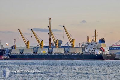
The vessel SHAN HU HAI (IMO: 9738117, MMSI: 477730100) is a Cargo It's sailing under the flag of [HK] Hong Kong.
In this page you can find informations about the vessels current position, last detected port calls, and current voyage information. If the vessels is not in coverage by AIS you will find the latest position.
The current position of SHAN HU HAI is detected by our AIS receivers and we are not responsible for the reliability of the data. The last position was recorded while the vessel was in Coverage by the Ais receivers of our vessel tracking app.
The current draught of SHAN HU HAI as reported by AIS is 10.5 meters
Weather
| Temperature | 27.7°C / 81.86°F |
|---|---|
| Wind Speed | 13 knots |
| Direction | 63° ENE |
| Pressure | 1014.1 hPa |
| Humidity | 76.7 % |
| Cloud Coverage | 67 % |
Featured Company
Last Port Calls
| Port | Arrival | Departure | Time In Port |
|---|---|---|---|
| 2024-04-19 11:52 | 2024-04-22 20:09 | 3 d | |
| 2024-04-05 07:28 | 2024-04-12 06:52 | 6 d | |
| 2024-03-25 18:35 | 2024-03-28 23:33 | 3 d | |
| 2024-03-24 03:34 | 2024-03-24 21:52 | 18 h | |
| 2024-03-19 19:46 | 2024-03-19 19:58 | 12 m | |
| 2024-03-18 21:54 | 2024-03-18 22:05 | 11 m |
Last Trips
| Origin | Departure | Destination | Arrival | Distance | |
|---|---|---|---|---|---|
| 2024-04-12 01:52 | 2024-04-19 05:52 | 1089.26 nm | |||
| 2024-03-28 17:33 | 2024-04-05 02:28 | 515.66 nm | |||
| 2024-03-24 15:52 | 2024-03-25 12:35 | 239.66 nm | |||
| 2024-03-19 14:58 | 2024-03-23 21:34 | 1277.93 nm | |||
| 2024-03-18 17:05 | 2024-03-19 14:46 | 5.28 nm | |||
| 2024-01-28 18:41 | 2024-03-18 16:54 | 13531.26 nm |
Events
| Tid | Hændelsen | Detaljer | Position / Dest | Info |
|---|---|---|---|---|
| 2024-04-22 20:09 | Afsejlet fra sidste havn |
|
15.85742 / -87.96606
HN PCR
|
Fart: 5.8 kn Kurs: 304° |
| 2024-04-19 11:52 | Skibe i havn |
|
15.84289 / -87.95248
[HN] PUERTO CORTES
|
Fart: 3.7 kn Kurs: 88° |
| 2024-04-17 17:23 | STOP Sejllads | 1.69 nm, West of PUERTO CORTES |
15.83641 / -87.97459
HN PCR
|
Fart: Kurs: 59° |
| 2024-04-17 15:18 | START Sejllads | 8.74 nm, North of OMOA |
15.92860 / -88.06248
HN PCR
|
Fart: 5 kn Kurs: 124° |
| 2024-04-17 05:02 | STOP Sejllads | 12.28 nm, North of PUERTO CORTES |
16.03536 / -87.92092
HN PCR
|
Fart: 0.3 kn Kurs: 92° |
| 2024-04-17 00:25 | START Sejllads | 7.19 nm, North of PUERTO CORTES |
15.94788 / -87.97624
HN PCR
|
Fart: 4.5 kn Kurs: 39° |
| 2024-04-16 17:48 | STOP Sejllads | 9.59 nm, North of PUERTO CORTES |
15.99139 / -87.93470
HN PCR
|
Fart: 0.3 kn Kurs: 74° |