
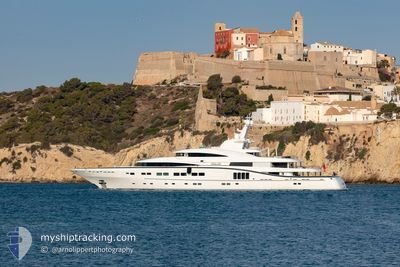
SEA PEARL
Yacht
Current Trip
| Time Travelled | 17 days |
|---|---|
| Remaining Time | --- |
| Distance Travelled | 1307.17 nm |
| Remaining Distance | --- |
| AVG Speed | 11.6 Knots |
| MAX Speed | 14.7 Knots |
| AVG Wind | 9.3 knots |
| MAX Wind | 20.8 knots |
| MIN Temp | 8.7°C / 47.66°F |
| MAX Temp | 18.4°C / 65.12°F |
| Dybgang | 3.5 m |
| Position Modtaget | 2 h, 10 m siden |
Current Position
| Longitude | 13.93172° |
|---|---|
| Latitude | 43.81046° |
| Status | Under way using engine |
| Fart | 14 Knots |
| Kurs | 135.5° |
| Område | Adriatic Sea |
| Station | T-AIS |
| Position Modtaget | 2 h, 10 m siden |
Info
Information
The current position of SEA PEARL is in Adriatic Sea with coordinates 43.81046° / 13.93172° as reported on 2024-04-24 18:54 by AIS to our vessel tracker app. The vessel's current speed is 14 Knots and is heading at the port of OLBIA. The estimated time of arrival as calculated by MyShipTracking vessel tracking app is 2024-04-27 10:30 LT
The vessel SEA PEARL (IMO: 1011795, MMSI: 319387000) is a Yacht that was built in 2013 ( 11 år gamle ). It's sailing under the flag of [KY] Cayman Is.
In this page you can find informations about the vessels current position, last detected port calls, and current voyage information. If the vessels is not in coverage by AIS you will find the latest position.
The current position of SEA PEARL is detected by our AIS receivers and we are not responsible for the reliability of the data. The last position was recorded while the vessel was in Coverage by the Ais receivers of our vessel tracking app.
The current draught of SEA PEARL as reported by AIS is 3.5 meters
Weather
| Temperature | 11.7°C / 53.06°F |
|---|---|
| Wind Speed | 7 knots |
| Direction | 197° SSW |
| Pressure | 1007 hPa |
| Humidity | 66.2 % |
| Cloud Coverage | 24 % |
Featured Company
Events
| Tid | Hændelsen | Detaljer | Position / Dest | Info |
|---|---|---|---|---|
| 2024-04-24 18:54 | Udenfor Dækning |
43.81046 / 13.93172
Adriatic Sea
OLBIA ITALY
|
Fart: 14 kn Kurs: 135.5° |
|
| 2024-04-24 17:00 | Indenfor Dækning |
44.07377 / 13.44313
Adriatic Sea
OLBIA ITALY
|
Fart: 14.3 kn Kurs: 126.4° |
|
| 2024-04-24 12:33 | Udenfor Dækning |
44.99893 / 12.77218
Adriatic Sea
OLBIA ITALY
|
Fart: 14.3 kn Kurs: 143.1° |
|
| 2024-04-24 09:52 | Destination er ændret | OLBIA ITALY VENICE ITALY |
45.42166 / 12.36998
OLBIA ITALY
|
Fart: 7.3 kn Kurs: 62.9° |
| 2024-04-24 09:52 | ETA er ændret | 2024/04/27 10:30 2024/04/11 10:00 |
45.42166 / 12.36998
OLBIA ITALY
|
Fart: 7.3 kn Kurs: 62.9° |
| 2024-04-24 09:46 | Status er ændret | Under way using engine Moored |
45.42511 / 12.35735
VENICE ITALY
|
Fart: 6.4 kn Kurs: 140.7° |
| 2024-04-24 09:41 | Indenfor Dækning |
45.42882 / 12.35317
Adriatic Sea
|
Fart: 6.1 kn Kurs: 139.4° |
|
| 2024-04-16 07:24 | Udenfor Dækning |
45.43228 / 12.34976
Adriatic Sea
|
Fart: Kurs: 51° |
|
| 2024-04-16 07:24 | Indenfor Dækning |
45.43228 / 12.34976
Adriatic Sea
|
Fart: Kurs: 51° |
|
| 2024-04-16 05:28 | Udenfor Dækning |
45.43227 / 12.34976
Adriatic Sea
|
Fart: Kurs: 177.6° |