
SC CONNECTOR
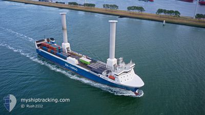
Ro-Ro Cargo
Current Trip
| Time Travelled | 1 day |
|---|---|
| Remaining Time | 5 h, 29 mins |
| Distance Travelled | 376.07 nm |
| Remaining Distance | 78.14 nm |
| AVG Speed | 11.4 Knots |
| MAX Speed | 14 Knots |
| AVG Wind | 20 knots |
| MAX Wind | 28 knots |
| MIN Temp | 3.4°C / 38.12°F |
| MAX Temp | 8°C / 46.4°F |
| Dybgang | 6.1 m |
| Position Modtaget | 1 m siden |
Current Position
| Longitude | 5.36710° |
|---|---|
| Latitude | 57.69772° |
| Status | Under way using engine |
| Fart | 13.5 Knots |
| Kurs | 354.5° |
| Område | North Sea |
| Station | T-AIS |
| Position Modtaget | 1 m siden |
Info
Information
The current position of SC CONNECTOR is in North Sea with coordinates 57.69772° / 5.36710° as reported on 2024-04-25 02:19 by AIS to our vessel tracker app. The vessel's current speed is 13.5 Knots and is heading at the port of TANANGER. The estimated time of arrival as calculated by MyShipTracking vessel tracking app is 2024-04-25 07:49 LT
The vessel SC CONNECTOR (IMO: 9131993, MMSI: 256149000) is a Ro-Ro Cargo that was built in 1997 ( 27 år gamle ). It's sailing under the flag of [MT] Malta.
In this page you can find informations about the vessels current position, last detected port calls, and current voyage information. If the vessels is not in coverage by AIS you will find the latest position.
The current position of SC CONNECTOR is detected by our AIS receivers and we are not responsible for the reliability of the data. The last position was recorded while the vessel was in Coverage by the Ais receivers of our vessel tracking app.
The current draught of SC CONNECTOR as reported by AIS is 6.1 meters
Weather
| Temperature | 3.4°C / 38.12°F |
|---|---|
| Wind Speed | 3 knots |
| Direction | 220° SW |
| Pressure | 1004.1 hPa |
| Humidity | 87.5 % |
| Cloud Coverage | 100 % |
Featured Company
Last Port Calls
| Port | Arrival | Departure | Time In Port |
|---|---|---|---|
| 2024-04-23 16:46 | 2024-04-23 19:19 | 2 h | |
| 2024-04-23 15:46 | 2024-04-23 16:37 | 50 m | |
| 2024-04-23 07:02 | 2024-04-23 14:21 | 7 h | |
| 2024-04-23 04:48 | |||
| 2024-04-22 06:20 | 2024-04-22 14:13 | 7 h | |
| 2024-04-20 02:40 | 2024-04-20 07:12 | 4 h | |
| 2024-04-19 21:25 | 2024-04-19 23:44 | 2 h | |
| 2024-04-19 18:56 | 2024-04-19 21:13 | 2 h | |
| 2024-04-19 05:17 | 2024-04-19 15:49 | 10 h | |
| 2024-04-18 18:39 | 2024-04-18 22:17 | 3 h |
Most Visited Ports (Last year)
| Port | Arrivals | |
|---|---|---|
| 90 | ||
| 55 | ||
| 51 | ||
| 50 | ||
| 49 | ||
| 48 |
Last Trips
| Origin | Departure | Destination | Arrival | Distance | |
|---|---|---|---|---|---|
| 2024-04-23 18:37 | 2024-04-23 18:46 | 0.30 nm | |||
| 2024-04-23 16:21 | 2024-04-23 17:46 | 15.67 nm | |||
| 2024-04-22 15:13 | 2024-04-23 09:02 | 200.67 nm | |||
| 2024-04-22 15:13 | 2024-04-23 06:48 | 199.88 nm | |||
| 2024-04-20 09:12 | 2024-04-22 07:20 | 486.32 nm | |||
| 2024-04-20 01:44 | 2024-04-20 04:40 | 27.78 nm | |||
| 2024-04-19 23:13 | 2024-04-19 23:25 | 1.44 nm | |||
| 2024-04-19 17:49 | 2024-04-19 20:56 | 41.64 nm | |||
| 2024-04-19 00:17 | 2024-04-19 07:17 | 51.22 nm | |||
| 2024-04-18 13:08 | 2024-04-18 20:39 | 102.95 nm |
Events
| Tid | Hændelsen | Detaljer | Position / Dest | Info |
|---|---|---|---|---|
| 2024-04-24 23:46 | Status er ændret | Under way using engine Default |
57.11834 / 5.49636
RISAVIKA
|
Fart: 13 kn Kurs: 354° |
| 2024-04-24 23:34 | Status er ændret | Default Under way using engine |
57.07667 / 5.50500
RISAVIKA
|
Fart: 13.3 kn Kurs: 353.7° |
| 2024-04-24 23:29 | Ændre havområde | Norwegian part of the North Sea Danish part of the North Sea |
57.05714 / 5.50965
North Sea
RISAVIKA
|
Fart: 13.3 kn Kurs: 353.7° |
| 2024-04-24 23:29 | Status er ændret | Under way using engine Default |
57.05714 / 5.50965
RISAVIKA
|
Fart: 13.3 kn Kurs: 354° |
| 2024-04-24 23:29 | Indenfor Dækning |
57.05714 / 5.50965
North Sea
RISAVIKA
|
Fart: 13.3 kn Kurs: 353.7° |
|
| 2024-04-24 20:22 | Status er ændret | Default Under way using engine |
56.36500 / 5.57500
RISAVIKA
|
Fart: 13.2 kn Kurs: 12.7° |
| 2024-04-24 20:16 | Udenfor Dækning |
56.34517 / 5.56589
North Sea
RISAVIKA
|
Fart: 13.2 kn Kurs: 12.7° |
|
| 2024-04-24 15:02 | Ændre havområde | Danish part of the North Sea German part of the North Sea |
55.25352 / 5.20347
North Sea
RISAVIKA
|
Fart: 11.7 kn Kurs: 346.8° |
| 2024-04-24 14:24 | Status er ændret | Under way using engine Default |
55.13198 / 5.25664
RISAVIKA
|
Fart: 12 kn Kurs: 347° |
| 2024-04-24 14:18 | Status er ændret | Default Under way using engine |
55.11333 / 5.26500
RISAVIKA
|
Fart: 11.3 kn Kurs: 345° |