
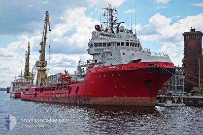
SAR LOKE
Anchor Handling Vessel
Current Trip
| Time Travelled | 2 days |
|---|---|
| Remaining Time | 1 h, 24 mins |
| Distance Travelled | 171.36 nm |
| Remaining Distance | 9.89 nm |
| AVG Speed | 6 Knots |
| MAX Speed | 9 Knots |
| AVG Wind | 7.4 knots |
| MAX Wind | 18 knots |
| MIN Temp | 4.2°C / 39.56°F |
| MAX Temp | 7.8°C / 46.04°F |
| Dybgang | 6 m |
| Position Modtaget | 2 m siden |
Current Position
| Longitude | -1.21051° |
|---|---|
| Latitude | 54.79429° |
| Status | At anchor |
| Fart | 0.6 Knots |
| Kurs | 1° |
| Område | North Sea |
| Station | T-AIS |
| Position Modtaget | 2 m siden |
Info
Information
The current position of SAR LOKE is in North Sea with coordinates 54.79429° / -1.21051° as reported on 2024-04-23 08:31 by AIS to our vessel tracker app. The vessel's current speed is 0.6 Knots and is heading at the port of TEES. The estimated time of arrival as calculated by MyShipTracking vessel tracking app is 2024-04-23 09:58 LT
The vessel SAR LOKE (IMO: 9166613, MMSI: 259495000) is a Anchor Handling Vessel that was built in 1998 ( 26 år gamle ). It's sailing under the flag of [NO] Norway.
In this page you can find informations about the vessels current position, last detected port calls, and current voyage information. If the vessels is not in coverage by AIS you will find the latest position.
The current position of SAR LOKE is detected by our AIS receivers and we are not responsible for the reliability of the data. The last position was recorded while the vessel was in Coverage by the Ais receivers of our vessel tracking app.
The current draught of SAR LOKE as reported by AIS is 6 meters
Weather
| Temperature | 6.7°C / 44.06°F |
|---|---|
| Wind Speed | 17 knots |
| Direction | 358° N |
| Pressure | 1025.5 hPa |
| Humidity | 81.1 % |
| Cloud Coverage | 100 % |
Featured Company
Last Port Calls
| Port | Arrival | Departure | Time In Port |
|---|---|---|---|
| 2024-04-18 14:52 | 2024-04-21 07:32 | 2 d | |
| 2024-04-13 11:47 | 2024-04-13 11:55 | 8 m | |
| 2024-04-13 09:01 |
Last Trips
| Origin | Departure | Destination | Arrival | Distance | |
|---|---|---|---|---|---|
| 2024-04-13 13:55 | 2024-04-18 15:52 | 714.35 nm | |||
| 2024-04-13 11:01 | 2024-04-13 13:47 | 31.25 nm |
Events
| Tid | Hændelsen | Detaljer | Position / Dest | Info |
|---|---|---|---|---|
| 2024-04-23 08:31 | STOP Sejllads | 4.69 nm, South East of SEAHAM |
54.79429 / -1.21051
TEES
|
Fart: 0.3 kn Kurs: 2° |
| 2024-04-23 07:58 | START Sejllads | 3.4 nm, North of HARTLEPOOL |
54.74241 / -1.16242
TEES
|
Fart: 3.3 kn Kurs: 336° |
| 2024-04-23 07:52 | Status er ændret | At anchor Default |
54.74188 / -1.16142
TEES
|
Fart: 0.8 kn Kurs: 6° |
| 2024-04-23 07:49 | Status er ændret | Default At anchor |
54.74126 / -1.16156
TEES
|
Fart: 0.9 kn Kurs: 26° |
| 2024-04-23 07:46 | Status er ændret | At anchor Default |
54.74087 / -1.16219
TEES
|
Fart: 0.5 kn Kurs: 59° |
| 2024-04-23 07:40 | Status er ændret | Default At anchor |
54.74107 / -1.16248
TEES
|
Fart: 0.4 kn Kurs: 65° |
| 2024-04-23 07:16 | Status er ændret | At anchor Default |
54.74178 / -1.16132
TEES
|
Fart: 0.6 kn Kurs: 46° |
| 2024-04-23 07:13 | Status er ændret | Default At anchor |
54.74181 / -1.16179
TEES
|
Fart: 0.9 kn Kurs: 331° |
| 2024-04-23 06:07 | Status er ændret | At anchor Default |
54.74334 / -1.16121
TEES
|
Fart: 0.7 kn Kurs: 40° |
| 2024-04-23 06:01 | Status er ændret | Default At anchor |
54.74368 / -1.16128
TEES
|
Fart: 0.4 kn Kurs: 344° |