
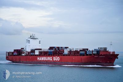
SANTA BARBARA
Container Ship
Current Trip
CAPRR>CAVNR
| Time Travelled | 6 days |
|---|---|
| Remaining Time | --- |
| Distance Travelled | 643.95 nm |
| Remaining Distance | --- |
| AVG Speed | 10.6 Knots |
| MAX Speed | 17.9 Knots |
| AVG Wind | 11.5 knots |
| MAX Wind | 29.9 knots |
| MIN Temp | 4.5°C / 40.1°F |
| MAX Temp | 11.3°C / 52.34°F |
| Dybgang | 11.2 m |
| Position Modtaget | 1 m siden |
Current Position
| Longitude | -123.21266° |
|---|---|
| Latitude | 49.31536° |
| Status | At anchor |
| Fart | 7 Knots |
| Kurs | 61.6° |
| Område | The Coastal Waters of Southeast Alaska and British Columbia |
| Station | T-AIS |
| Position Modtaget | 1 m siden |
Info
Information
The current position of SANTA BARBARA is in The Coastal Waters of Southeast Alaska and British Columbia with coordinates 49.31536° / -123.21266° as reported on 2024-04-19 00:13 by AIS to our vessel tracker app. The vessel's current speed is 7 Knots
The vessel SANTA BARBARA (IMO: 9430399, MMSI: 219068000) is a Container Ship that was built in 2012 ( 12 år gamle ). It's sailing under the flag of [DK] Denmark.
In this page you can find informations about the vessels current position, last detected port calls, and current voyage information. If the vessels is not in coverage by AIS you will find the latest position.
The current position of SANTA BARBARA is detected by our AIS receivers and we are not responsible for the reliability of the data. The last position was recorded while the vessel was in Coverage by the Ais receivers of our vessel tracking app.
The current draught of SANTA BARBARA as reported by AIS is 11.2 meters
Weather
| Temperature | 11.3°C / 52.34°F |
|---|---|
| Wind Speed | 9 knots |
| Direction | 304° NW |
| Pressure | 1024.9 hPa |
| Humidity | 52.1 % |
| Cloud Coverage | 3 % |
Featured Company
Last Port Calls
| Port | Arrival | Departure | Time In Port |
|---|---|---|---|
| 2024-04-08 12:59 | 2024-04-12 01:07 | 3 d | |
| 2024-04-08 12:00 | 2024-04-08 12:12 | 11 m | |
| 2024-03-26 02:26 | 2024-03-26 10:08 | 7 h | |
| 2024-03-23 00:39 | 2024-03-24 02:51 | 1 d | |
| 2024-03-20 06:22 | 2024-03-20 21:08 | 14 h | |
| 2024-03-14 16:09 | 2024-03-15 10:16 | 18 h | |
| 2024-03-08 22:59 | 2024-03-09 09:29 | 10 h | |
| 2024-02-21 18:52 | 2024-02-27 20:42 | 6 d | |
| 2024-02-06 13:35 | 2024-02-09 07:27 | 2 d | |
| 2024-02-06 12:49 | 2024-02-06 12:59 | 10 m |
Most Visited Ports (Last year)
| Port | Arrivals | |
|---|---|---|
| 7 | ||
| 6 | ||
| 5 | ||
| 4 | ||
| 3 | ||
| 3 |
Last Trips
| Origin | Departure | Destination | Arrival | Distance | |
|---|---|---|---|---|---|
| 2024-04-08 05:12 | 2024-04-08 05:59 | 1.56 nm | |||
| 2024-03-26 19:08 | 2024-04-08 05:00 | 3876.89 nm | |||
| 2024-03-24 11:51 | 2024-03-26 11:26 | 891.86 nm | |||
| 2024-03-21 05:08 | 2024-03-23 09:39 | 568.14 nm | |||
| 2024-03-15 18:16 | 2024-03-20 14:22 | 883.48 nm | |||
| 2024-03-09 18:29 | 2024-03-15 00:09 | 1684.96 nm | |||
| 2024-02-27 12:42 | 2024-03-09 07:59 | 4339.24 nm | |||
| 2024-02-08 23:27 | 2024-02-21 10:52 | 644.32 nm | |||
| 2024-02-06 04:59 | 2024-02-06 05:35 | 1.16 nm | |||
| 2024-01-24 17:39 | 2024-02-06 04:49 | 3881.63 nm |
Events
| Tid | Hændelsen | Detaljer | Position / Dest | Info |
|---|---|---|---|---|
| 2024-04-19 00:04 | START Sejllads | 5.19 nm, West of VANCOUVER |
49.30316 / -123.22686
CAPRR>CAVNR
|
Fart: 3.9 kn Kurs: 11° |
| 2024-04-18 19:14 | Dybgangen er ændret | 11.2 11.1 |
49.30161 / -123.22310
CAPRR>CAVNR
|
Fart: Kurs: 267° |
| 2024-04-18 19:14 | ETA er ændret | 2024/04/18 23:35 2024/04/19 08:00 |
49.30161 / -123.22310
CAPRR>CAVNR
|
Fart: Kurs: 267° |
| 2024-04-17 15:20 | Dybgangen er ændret | 11.1 11.2 |
49.30118 / -123.23031
CAPRR>CAVNR
|
Fart: Kurs: 87° |
| 2024-04-17 15:20 | ETA er ændret | 2024/04/19 08:00 2024/04/17 08:00 |
49.30118 / -123.23031
CAPRR>CAVNR
|
Fart: Kurs: 87° |
| 2024-04-17 15:13 | Status er ændret | At anchor Under way using engine |
49.30122 / -123.23029
CAPRR>CAVNR
|
Fart: Kurs: 88° |
| 2024-04-17 13:10 | STOP Sejllads | 5.24 nm, West of VANCOUVER |
49.30162 / -123.22838
CAPRR>CAVNR
|
Fart: 0.3 kn Kurs: 108° |
| 2024-04-17 11:26 | Ændre havområde | Canadian part of the The Coastal Waters of Southeast Alaska and British Columbia United States part of the The Coastal Waters of Southeast Alaska and British Columbia |
49.00524 / -123.25459
The Coastal Waters of Southeast Alaska and British Columbia
CAPRR>CAVNR
|
Fart: 16 kn Kurs: 314° |
| 2024-04-17 10:20 | Ændre havområde | United States part of the The Coastal Waters of Southeast Alaska and British Columbia Canadian part of the The Coastal Waters of Southeast Alaska and British Columbia |
48.78901 / -123.00191
The Coastal Waters of Southeast Alaska and British Columbia
CAPRR>CAVNR
|
Fart: 15.3 kn Kurs: 40° |
| 2024-04-17 10:11 | Ændre havområde | Canadian part of the The Coastal Waters of Southeast Alaska and British Columbia United States part of the The Coastal Waters of Southeast Alaska and British Columbia |
48.75922 / -123.03849
The Coastal Waters of Southeast Alaska and British Columbia
CAPRR>CAVNR
|
Fart: 15.9 kn Kurs: 48.1° |