
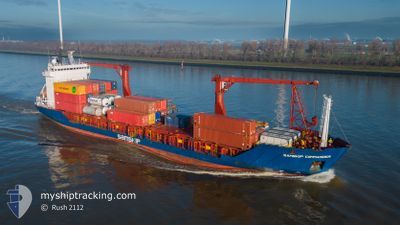
SAMSKIP COMMANDER
General Cargo
Current Trip
| Time Travelled | 12 h, 17 mins |
|---|---|
| Remaining Time | 2 days |
| Distance Travelled | 117.80 nm |
| Remaining Distance | 563.36 nm |
| AVG Speed | 9.6 Knots |
| MAX Speed | 13 Knots |
| AVG Wind | 28.1 knots |
| MAX Wind | 34 knots |
| MIN Temp | 7°C / 44.6°F |
| MAX Temp | 9.9°C / 49.82°F |
| Dybgang | 5.2 m |
| Position Modtaget | 14 m siden |
Current Position
| Longitude | 4.80785° |
|---|---|
| Latitude | 53.58310° |
| Status | Under way using engine |
| Fart | 9.1 Knots |
| Kurs | 35.7° |
| Område | North Sea |
| Station | T-AIS |
| Position Modtaget | 14 m siden |
Info
Information
The current position of SAMSKIP COMMANDER is in North Sea with coordinates 53.58310° / 4.80785° as reported on 2024-04-19 19:51 by AIS to our vessel tracker app. The vessel's current speed is 9.1 Knots and is heading at the port of ALESUND. The estimated time of arrival as calculated by MyShipTracking vessel tracking app is 2024-04-22 07:55 LT
The vessel SAMSKIP COMMANDER (IMO: 9143829, MMSI: 314292000) is a General Cargo that was built in 1997 ( 27 år gamle ). It's sailing under the flag of [BB] Barbados.
In this page you can find informations about the vessels current position, last detected port calls, and current voyage information. If the vessels is not in coverage by AIS you will find the latest position.
The current position of SAMSKIP COMMANDER is detected by our AIS receivers and we are not responsible for the reliability of the data. The last position was recorded while the vessel was in Coverage by the Ais receivers of our vessel tracking app.
The current draught of SAMSKIP COMMANDER as reported by AIS is 5.2 meters
Weather
| Temperature | 6.8°C / 44.24°F |
|---|---|
| Wind Speed | 33 knots |
| Direction | 343° NNW |
| Pressure | 1014.2 hPa |
| Humidity | 79.1 % |
| Cloud Coverage | 100 % |
Featured Company
Last Port Calls
| Port | Arrival | Departure | Time In Port |
|---|---|---|---|
| 2024-04-18 22:34 | 2024-04-19 07:49 | 9 h | |
| 2024-04-18 22:28 | |||
| 2024-04-18 16:20 | 2024-04-18 20:32 | 4 h | |
| 2024-04-17 23:08 | 2024-04-18 14:31 | 15 h | |
| 2024-04-15 12:25 | 2024-04-15 17:36 | 5 h | |
| 2024-04-13 05:12 | 2024-04-13 22:58 | 17 h | |
| 2024-04-11 16:13 | 2024-04-11 21:23 | 5 h | |
| 2024-04-11 11:08 | 2024-04-11 15:08 | 4 h | |
| 2024-04-08 12:45 | 2024-04-09 07:10 | 18 h | |
| 2024-04-07 23:10 | 2024-04-08 11:15 | 12 h |
Most Visited Ports (Last year)
| Port | Arrivals | |
|---|---|---|
| 54 | ||
| 52 | ||
| 44 | ||
| 27 | ||
| 19 | ||
| 17 |
Last Trips
| Origin | Departure | Destination | Arrival | Distance | |
|---|---|---|---|---|---|
| 2024-04-18 22:32 | 2024-04-19 00:34 | 16.72 nm | |||
| 2024-04-18 22:32 | 2024-04-19 00:28 | 16.66 nm | |||
| 2024-04-18 16:31 | 2024-04-18 18:20 | 16.39 nm | |||
| 2024-04-15 19:36 | 2024-04-18 01:08 | 698.63 nm | |||
| 2024-04-14 00:58 | 2024-04-15 14:25 | 451.76 nm | |||
| 2024-04-11 23:23 | 2024-04-13 07:12 | 450.31 nm | |||
| 2024-04-11 17:08 | 2024-04-11 18:13 | 12.51 nm | |||
| 2024-04-09 09:10 | 2024-04-11 13:08 | 691.42 nm | |||
| 2024-04-08 13:15 | 2024-04-08 14:45 | 15.17 nm | |||
| 2024-04-05 11:48 | 2024-04-08 01:10 | 700.29 nm |
Events
| Tid | Hændelsen | Detaljer | Position / Dest | Info |
|---|---|---|---|---|
| 2024-04-19 19:53 | Status er ændret | Default Under way using engine |
53.58667 / 4.81000
NOAES
|
Fart: 9.1 kn Kurs: 35.7° |
| 2024-04-19 18:41 | Status er ændret | Under way using engine Default |
53.43302 / 4.70826
NOAES
|
Fart: 9 kn Kurs: 23° |
| 2024-04-19 18:29 | Status er ændret | Default Under way using engine |
53.40667 / 4.69167
NOAES
|
Fart: 7.5 kn Kurs: 23.4° |
| 2024-04-19 17:15 | Status er ændret | Under way using engine Default |
53.25393 / 4.59787
NOAES
|
Fart: 6 kn Kurs: 20° |
| 2024-04-19 17:11 | Status er ændret | Default Under way using engine |
53.24667 / 4.59333
NOAES
|
Fart: 8.2 kn Kurs: 19.3° |
| 2024-04-19 16:52 | Status er ændret | Under way using engine Default |
53.20799 / 4.56877
NOAES
|
Fart: 8 kn Kurs: 15° |
| 2024-04-19 16:47 | Status er ændret | Default Under way using engine |
53.19667 / 4.56000
NOAES
|
Fart: 7.9 kn Kurs: 32.1° |
| 2024-04-19 16:20 | Status er ændret | Under way using engine Default |
53.14106 / 4.50300
NOAES
|
Fart: 6 kn Kurs: 38° |
| 2024-04-19 16:08 | Status er ændret | Default Under way using engine |
53.11666 / 4.47667
NOAES
|
Fart: 10.9 kn Kurs: 30.6° |
| 2024-04-19 16:01 | Status er ændret | Under way using engine Default |
53.10292 / 4.46125
NOAES
|
Fart: 9.5 kn Kurs: 38° |