
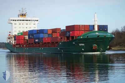
SAMSKIP AMINA
Container Ship
Current Trip
| Time Travelled | 3 days |
|---|---|
| Remaining Time | 8 h, 46 mins |
| Distance Travelled | 1440.95 nm |
| Remaining Distance | 111.25 nm |
| AVG Speed | 15.5 Knots |
| MAX Speed | 18.4 Knots |
| AVG Wind | 17.6 knots |
| MAX Wind | 39 knots |
| MIN Temp | 12.5°C / 54.5°F |
| MAX Temp | 18.6°C / 65.48°F |
| Dybgang | 7.7 m |
| Position Modtaget | 4 h, 8 m siden |
Current Position
| Longitude | --- |
|---|---|
| Latitude | --- |
| Status | Under way using engine |
| Fart | 12.9 Knots |
| Kurs | 75.5° |
| Område | English Channel |
| Station | T-AIS |
| Position Modtaget | 4 h, 8 m siden |
Info
Information
The current position of SAMSKIP AMINA is in English Channel with coordinates 50.31759° / -0.08923° as reported on 2025-12-08 22:20 by AIS to our vessel tracker app. The vessel's current speed is 12.9 Knots and is heading at the port of TILBURY. The estimated time of arrival as calculated by MyShipTracking vessel tracking app is 2025-12-09 11:15 LT
The vessel SAMSKIP AMINA (IMO: 9448683, MMSI: 255806464) is a Container Ship that was built in 2011 ( 14 år gamle ). It's sailing under the flag of [PT] Portugal.
In this page you can find informations about the vessels current position, last detected port calls, and current voyage information. If the vessels is not in coverage by AIS you will find the latest position.
The current position of SAMSKIP AMINA is detected by our AIS receivers and we are not responsible for the reliability of the data. The last position was recorded while the vessel was in Coverage by the Ais receivers of our vessel tracking app.
The current draught of SAMSKIP AMINA as reported by AIS is 7.7 meters
Weather
| Temperature | 12.4°C / 54.32°F |
|---|---|
| Wind Speed | 18 knots |
| Direction | 185° S |
| Pressure | 1010.8 hPa |
| Humidity | 86 % |
| Cloud Coverage | 100 % |
Featured Company
Last Port Calls
| Port | Arrival | Departure | Time In Port |
|---|---|---|---|
| 2025-12-04 16:54 | 2025-12-05 04:59 | 12 h | |
| 2025-12-01 14:39 | 2025-12-01 19:43 | 5 h | |
| 2025-11-27 04:03 | 2025-11-27 04:15 | 12 m | |
| 2025-11-26 12:46 | 2025-11-27 04:03 | 15 h | |
| 2025-11-26 11:57 | |||
| 2025-11-25 10:46 | 2025-11-25 23:40 | 12 h | |
| 2025-11-20 10:06 | 2025-11-21 05:38 | 19 h | |
| 2025-11-18 22:38 | 2025-11-19 06:02 | 7 h | |
| 2025-11-12 23:25 | 2025-11-12 23:35 | 10 m | |
| 2025-11-12 13:14 |
Most Visited Ports (Last year)
| Port | Arrivals | |
|---|---|---|
| 29 | ||
| 23 | ||
| 13 | ||
| 6 | ||
| 5 | ||
| 5 |
Last Trips
| Origin | Departure | Destination | Arrival | Distance | |
|---|---|---|---|---|---|
| 2025-12-01 19:43 | 2025-12-04 16:54 | 318.16 nm | |||
| 2025-11-27 04:15 | 2025-12-01 14:39 | 1451.49 nm | |||
| 2025-11-25 23:40 | 2025-11-27 04:03 | 169.77 nm | |||
| 2025-11-25 23:40 | 2025-11-26 12:46 | 169.45 nm | |||
| 2025-11-25 23:40 | 2025-11-26 11:57 | 168.97 nm | |||
| 2025-11-21 05:38 | 2025-11-25 10:46 | 1584.46 nm | |||
| 2025-11-19 06:02 | 2025-11-20 10:06 | 288.30 nm | |||
| 2025-11-12 23:35 | 2025-11-18 22:38 | 1464.46 nm | |||
| 2025-11-11 05:24 | 2025-11-12 23:25 | 166.71 nm | |||
| 2025-11-11 05:24 | 2025-11-12 13:14 | 166.26 nm |
Events
| Tid | Hændelsen | Detaljer | Position / Dest | Info |
|---|---|---|---|---|
| 2025-12-08 22:27 | Status er ændret | Default Under way using engine |
50.32367 / -.05273
GBTIL
|
Fart: 12.9 kn Kurs: 75.5° |
| 2025-12-08 22:20 | Udenfor Dækning |
50.31759 / -.08923
English Channel
GBTIL
|
Fart: 12.9 kn Kurs: 75.5° |
|
| 2025-12-08 21:58 | Fundet i havområde | United Kingdom part of the English Channel |
50.29830 / -.20935
English Channel
GBTIL
|
Fart: 12.7 kn Kurs: 75.7° |
| 2025-12-08 21:56 | Status er ændret | Under way using engine Default |
50.29729 / -.21574
GBTIL
|
Fart: 12.6 kn Kurs: 76° |
| 2025-12-08 21:43 | Indenfor Dækning |
50.29830 / -.20935
English Channel
GBTIL
|
Fart: 12.7 kn Kurs: 75.7° |
|
| 2025-12-08 09:46 | Status er ændret | Default Under way using engine |
49.44054 / -3.90818
GBTIL
|
Fart: 12.1 kn Kurs: 58.9° |
| 2025-12-08 09:41 | Udenfor Dækning |
49.43115 / -3.93199
English Channel
GBTIL
|
Fart: 12.1 kn Kurs: 58.9° |
|
| 2025-12-08 09:34 | Status er ændret | Under way using engine Default |
49.41839 / -3.96466
GBTIL
|
Fart: 12.2 kn Kurs: 61° |
| 2025-12-08 09:27 | Indenfor Dækning |
49.41839 / -3.96466
English Channel
GBTIL
|
Fart: 12.1 kn Kurs: 59.4° |
|
| 2025-12-08 08:13 | Udenfor Dækning |
49.28269 / -4.33067
English Channel
GBTIL
|
Fart: 12.3 kn Kurs: 61° |