
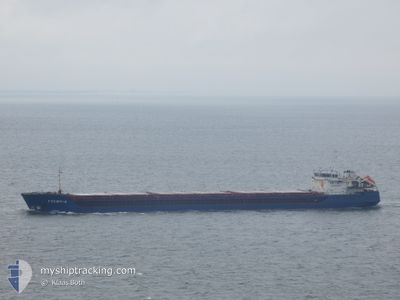
RUSICH-4
General Cargo
Current Trip
RU YEY
| Time Travelled | 1 day |
|---|---|
| Remaining Time | --- |
| Distance Travelled | 175.03 nm |
| Remaining Distance | --- |
| AVG Speed | 6.4 Knots |
| MAX Speed | 8.1 Knots |
| AVG Wind | 15.2 knots |
| MAX Wind | 19 knots |
| MIN Temp | 16°C / 60.8°F |
| MAX Temp | 19.9°C / 67.82°F |
| Dybgang | 3.2 m |
| Position Modtaget | 7 d siden |
Current Position
| Longitude | 29.44021° |
|---|---|
| Latitude | 41.40872° |
| Status | Under way using engine |
| Fart | 8.5 Knots |
| Kurs | 51.9° |
| Område | Black Sea |
| Station | T-AIS |
| Position Modtaget | 7 d siden |
Info
Information
The current position of RUSICH-4 is in Black Sea with coordinates 41.40872° / 29.44021° as reported on 2024-04-18 15:23 by AIS to our vessel tracker app. The vessel's current speed is 8.5 Knots
The vessel RUSICH-4 (IMO: 9331799, MMSI: 273316430) is a General Cargo that was built in 2004 ( 20 år gamle ). It's sailing under the flag of [RU] Russia.
In this page you can find informations about the vessels current position, last detected port calls, and current voyage information. If the vessels is not in coverage by AIS you will find the latest position.
The current position of RUSICH-4 is detected by our AIS receivers and we are not responsible for the reliability of the data. The last position was recorded while the vessel was in Coverage by the Ais receivers of our vessel tracking app.
The current draught of RUSICH-4 as reported by AIS is 3.2 meters
Weather
| Temperature | 15.8°C / 60.44°F |
|---|---|
| Wind Speed | 12 knots |
| Direction | 118° ESE |
| Pressure | 1005.9 hPa |
| Humidity | 80.3 % |
| Cloud Coverage | 100 % |
Featured Company
Last Port Calls
| Port | Arrival | Departure | Time In Port |
|---|---|---|---|
| 2024-04-22 08:40 | 2024-04-24 14:44 | 2 d | |
| 2024-04-15 06:35 | 2024-04-16 10:36 | 1 d | |
| 2024-04-02 13:21 | 2024-04-04 16:01 | 2 d | |
| 2024-03-29 04:53 | 2024-03-30 14:12 | 1 d | |
| 2024-03-20 03:48 | 2024-03-22 15:01 | 2 d | |
| 2024-03-08 04:34 | |||
| 2024-02-25 10:34 | 2024-02-27 16:11 | 2 d | |
| 2024-02-10 13:54 | 2024-02-12 14:26 | 2 d | |
| 2024-02-02 20:54 | 2024-02-04 11:42 | 1 d | |
| 2024-02-01 11:26 | 2024-02-01 20:18 | 8 h |
Last Trips
| Origin | Departure | Destination | Arrival | Distance | |
|---|---|---|---|---|---|
| 2024-04-16 13:36 | 2024-04-22 11:40 | 888.59 nm | |||
| 2024-04-04 19:01 | 2024-04-15 09:35 | 883.66 nm | |||
| 2024-03-30 17:12 | 2024-04-02 16:21 | 483.44 nm | |||
| 2024-03-22 18:01 | 2024-03-29 07:53 | 480.29 nm | |||
| 2024-03-08 07:34 | 2024-03-20 06:48 | 1261.07 nm | |||
| 2024-02-12 17:26 | 2024-02-25 13:34 | 798.71 nm | |||
| 2024-02-04 14:42 | 2024-02-10 16:54 | 444.25 nm | |||
| 2024-02-01 23:18 | 2024-02-02 23:54 | 0.72 nm | |||
| 2024-01-29 22:53 | 2024-02-01 14:26 | 377.64 nm |
Events
| Tid | Hændelsen | Detaljer | Position / Dest | Info |
|---|---|---|---|---|
| 2024-04-24 14:44 | Afsejlet fra sidste havn |
|
46.73773 / 38.25921
RU YEY
|
Fart: 4.9 kn Kurs: 313° |
| 2024-04-24 14:36 | START Sejllads |
46.73004 / 38.27092
[RU] YEYSK
|
Fart: 3.7 kn Kurs: 315° |
|
| 2024-04-22 09:06 | STOP Sejllads |
46.72837 / 38.27528
[RU] YEYSK
|
Fart: Kurs: 221° |
|
| 2024-04-22 08:40 | Skibe i havn |
|
46.72837 / 38.27528
[RU] YEYSK
|
Fart: 6.3 kn Kurs: 133° |
| 2024-04-22 08:08 | START Sejllads | 2.73 nm, North West of YEYSK |
46.75732 / 38.22076
RU YEY
|
Fart: 4.5 kn Kurs: 119° |
| 2024-04-22 07:16 | STOP Sejllads | 2.74 nm, North West of YEYSK |
46.75562 / 38.21863
RU YEY
|
Fart: 0.3 kn Kurs: 333° |
| 2024-04-21 10:37 | START Sejllads | 9.13 nm, South of TAMAN |
44.97453 / 36.70722
RU YEY
|
Fart: 4.1 kn Kurs: 245° |
| 2024-04-18 15:23 | Udenfor Dækning |
41.40872 / 29.44021
Black Sea
RU YEY
|
Fart: 8.5 kn Kurs: 51.9° |
|
| 2024-04-18 13:23 | Ændre havområde | Turkish part of the Black Sea Turkish part of the Sea of Marmara |
41.23472 / 29.15702
Black Sea
RU YEY
|
Fart: 8.3 kn Kurs: 40.9° |
| 2024-04-18 08:11 | START Sejllads | 15.16 nm, South of YESILKOY |
40.70419 / 28.86361
RU YEY
|
Fart: 3.2 kn Kurs: 21° |