
RUDYANGE
Other Type
Current Trip
| Time Travelled | 17 h, 34 mins |
|---|---|
| Remaining Time | --- |
| Distance Travelled | 5.33 nm |
| Remaining Distance | --- |
| AVG Speed | 4.9 Knots |
| MAX Speed | 5.5 Knots |
| AVG Wind | 16.9 knots |
| MAX Wind | 17.3 knots |
| MIN Temp | 9.6°C / 49.28°F |
| MAX Temp | 9.7°C / 49.46°F |
| Dybgang | 0 m |
| Position Modtaget | 1 m siden |
Current Position
| Longitude | --- |
|---|---|
| Latitude | --- |
| Status | Under way using engine |
| Fart | |
| Kurs | --- |
| Område | North Sea |
| Station | T-AIS |
| Position Modtaget | 1 m siden |
Info
info
Information
The current position of RUDYANGE is in North Sea with coordinates 50.83939° / 2.20931° as reported on 2025-12-07 00:26 by AIS to our vessel tracker app. The vessel's current speed is 0 Knots
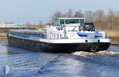
The vessel RUDYANGE (MMSI: 205345890) is a Other Type It's sailing under the flag of [BE] Belgium.
In this page you can find informations about the vessels current position, last detected port calls, and current voyage information. If the vessels is not in coverage by AIS you will find the latest position.
The current position of RUDYANGE is detected by our AIS receivers and we are not responsible for the reliability of the data. The last position was recorded while the vessel was in Coverage by the Ais receivers of our vessel tracking app.
Weather
| Temperature | 9.6°C / 49.28°F |
|---|---|
| Wind Speed | 13 knots |
| Direction | 240° WSW |
| Pressure | 1006 hPa |
| Humidity | 87.1 % |
| Cloud Coverage | 60 % |
Featured Company
Limited time offer - Install a base station receiver to your area and list your company on MyShipTracking Free forever!
Last Port Calls
| Port | Arrival | Departure | Time In Port |
|---|---|---|---|
| 2025-12-04 08:34 | 2025-12-06 07:53 | 1 d | |
| 2025-12-02 16:03 | 2025-12-04 02:23 | 1 d | |
| 2025-12-02 12:18 | 2025-12-02 12:40 | 22 m | |
| 2025-11-27 23:24 | 2025-11-29 06:05 | 1 d | |
| 2025-11-24 17:08 | 2025-11-26 14:37 | 1 d | |
| 2025-11-20 17:23 | 2025-11-22 05:11 | 1 d | |
| 2025-11-18 10:37 | 2025-11-19 09:36 | 22 h | |
| 2025-11-16 22:56 | 2025-11-18 07:17 | 1 d | |
| 2025-11-14 20:00 | 2025-11-15 11:21 | 15 h | |
| 2025-11-10 17:06 | 2025-11-13 01:50 | 2 d |
Last Trips
| Origin | Departure | Destination | Arrival | Distance | |
|---|---|---|---|---|---|
| 2025-12-04 02:23 | 2025-12-04 08:34 | 16.44 nm | |||
| 2025-12-02 12:40 | 2025-12-02 16:03 | 16.49 nm | |||
| 2025-11-29 06:05 | 2025-12-02 12:18 | 37.36 nm | |||
| 2025-11-26 14:37 | 2025-11-27 23:24 | 41.00 nm | |||
| 2025-11-22 05:11 | 2025-11-24 17:08 | 48.89 nm | |||
| 2025-11-19 09:36 | 2025-11-20 17:23 | 32.25 nm | |||
| 2025-11-18 07:17 | 2025-11-18 10:37 | 15.64 nm | |||
| 2025-11-15 11:21 | 2025-11-16 22:56 | 16.54 nm | |||
| 2025-11-13 01:50 | 2025-11-14 20:00 | 63.44 nm | |||
| 2025-11-07 17:23 | 2025-11-10 17:06 | 49.25 nm |
Events
| Tid | Hændelsen | Detaljer | Position / Dest | Info |
|---|---|---|---|---|
| 2025-12-06 08:16 | STOP Sejllads | 0.45 nm, North of WATTEN |
50.83882 / 2.20900
DUNKERQUE
|
Fart: 0.3 kn Kurs: 511° |
| 2025-12-06 07:12 | Indenfor Dækning |
50.76804 / 2.28292
North Sea
|
Fart: 5 kn Kurs: 310.4° |
|
| 2025-12-06 06:53 | Afsejlet fra sidste havn |
|
50.76804 / 2.28292
DUNKERQUE
|
Fart: 0.3 kn Kurs: 511° |
| 2025-12-04 08:33 | Udenfor Dækning |
50.74367 / 2.29499
North Sea
[FR] ARQUES
|
Fart: 0.3 kn Kurs: 88.9° |
|
| 2025-12-04 07:34 | STOP Sejllads |
50.74864 / 2.29423
[FR] ARQUES
|
Fart: 0.3 kn Kurs: 511° |
|
| 2025-12-04 07:34 | Skibe i havn |
|
50.74864 / 2.29423
[FR] ARQUES
|
Fart: 1.2 kn Kurs: 511° |
| 2025-12-04 06:18 | START Sejllads | 0.51 nm, North of WATTEN |
50.83984 / 2.20932
DUNKERQUE
|
Fart: 3.7 kn Kurs: 196.1° |
| 2025-12-04 06:06 | STOP Sejllads | 0.62 nm, North of WATTEN |
50.84179 / 2.21012
DUNKERQUE
|
Fart: 0.3 kn Kurs: 511° |
| 2025-12-04 06:01 | START Sejllads | 0.78 nm, North of WATTEN |
50.84443 / 2.21102
DUNKERQUE
|
Fart: 3.9 kn Kurs: 192.3° |
| 2025-12-04 02:48 | STOP Sejllads | 0.89 nm, North of WATTEN |
50.84617 / 2.21198
DUNKERQUE
|
Fart: 0.1 kn Kurs: 511° |