
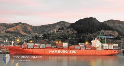
RIO MADEIRA
Container Ship
Current Trip
SG SIN>AU TOR
| Time Travelled | 1 day |
|---|---|
| Remaining Time | --- |
| Distance Travelled | 439.19 nm |
| Remaining Distance | --- |
| AVG Speed | 16 Knots |
| MAX Speed | 19.8 Knots |
| AVG Wind | 7.1 knots |
| MAX Wind | 10.6 knots |
| MIN Temp | 28.4°C / 83.12°F |
| MAX Temp | 29.9°C / 85.82°F |
| Dybgang | 11 m |
| Position Modtaget | 21 h, 13 m siden |
Current Position
| Longitude | 104.41966° |
|---|---|
| Latitude | 1.35864° |
| Status | Under way using engine |
| Fart | 18.8 Knots |
| Kurs | 55.7° |
| Område | South China Sea |
| Station | T-AIS |
| Position Modtaget | 21 h, 13 m siden |
Info
Information
The current position of RIO MADEIRA is in South China Sea with coordinates 1.35864° / 104.41966° as reported on 2024-04-24 15:09 by AIS to our vessel tracker app. The vessel's current speed is 18.8 Knots
The vessel RIO MADEIRA (IMO: 9348106, MMSI: 563051600) is a Container Ship that was built in 2009 ( 15 år gamle ). It's sailing under the flag of [SG] Singapore.
In this page you can find informations about the vessels current position, last detected port calls, and current voyage information. If the vessels is not in coverage by AIS you will find the latest position.
The current position of RIO MADEIRA is detected by our AIS receivers and we are not responsible for the reliability of the data. The last position was recorded while the vessel was in Coverage by the Ais receivers of our vessel tracking app.
The current draught of RIO MADEIRA as reported by AIS is 11 meters
Weather
| Temperature | 29.5°C / 85.1°F |
|---|---|
| Wind Speed | 4 knots |
| Direction | 216° SW |
| Pressure | 1007.2 hPa |
| Humidity | 72.6 % |
| Cloud Coverage | 63 % |
Featured Company
Last Port Calls
| Port | Arrival | Departure | Time In Port |
|---|---|---|---|
| 2024-04-23 01:02 | 2024-04-24 11:48 | 1 d | |
| 2024-04-20 19:40 | 2024-04-22 04:54 | 1 d | |
| 2024-04-02 01:28 | 2024-04-03 22:24 | 1 d | |
| 2024-03-31 09:56 | 2024-04-01 07:02 | 21 h | |
| 2024-03-27 21:00 | 2024-03-29 07:08 | 1 d | |
| 2024-03-23 02:57 | 2024-03-24 18:47 | 1 d | |
| 2024-03-16 09:41 | 2024-03-18 19:26 | 2 d | |
| 2024-03-04 10:37 | 2024-03-05 22:42 | 1 d | |
| 2024-03-02 01:36 | 2024-03-03 03:19 | 1 d | |
| 2024-02-18 06:00 | 2024-02-18 17:22 | 11 h |
Most Visited Ports (Last year)
| Port | Arrivals | |
|---|---|---|
| 8 | ||
| 8 | ||
| 8 | ||
| 8 | ||
| 7 | ||
| 6 |
Last Trips
| Origin | Departure | Destination | Arrival | Distance | |
|---|---|---|---|---|---|
| 2024-04-22 12:54 | 2024-04-23 09:02 | 48.02 nm | |||
| 2024-04-04 11:24 | 2024-04-21 03:40 | 5114.25 nm | |||
| 2024-04-01 20:02 | 2024-04-02 14:28 | 201.29 nm | |||
| 2024-03-29 20:08 | 2024-03-31 22:56 | 349.26 nm | |||
| 2024-03-25 07:47 | 2024-03-28 10:00 | 304.93 nm | |||
| 2024-03-19 06:26 | 2024-03-23 15:57 | 1386.21 nm | |||
| 2024-03-06 06:42 | 2024-03-16 20:41 | 4215.59 nm | |||
| 2024-03-03 11:19 | 2024-03-04 18:37 | 100.08 nm | |||
| 2024-02-19 04:22 | 2024-03-02 09:36 | 3976.99 nm | |||
| 2024-02-14 16:53 | 2024-02-18 17:00 | 1385.38 nm |
Events
| Tid | Hændelsen | Detaljer | Position / Dest | Info |
|---|---|---|---|---|
| 2024-04-24 15:17 | Status er ændret | Default Under way using engine |
1.37895 / 104.45197
SG SIN>AU TOR
|
Fart: 18.8 kn Kurs: 55.7° |
| 2024-04-24 15:09 | Udenfor Dækning |
1.35864 / 104.41966
South China Sea
SG SIN>AU TOR
|
Fart: 18.8 kn Kurs: 55.7° |
|
| 2024-04-24 14:55 | Ændre havområde | Malaysian part of the South China Sea Malaysian part of the Singapore Strait |
1.31808 / 104.36297
South China Sea
SG SIN>AU TOR
|
Fart: 17.8 kn Kurs: 60.3° |
| 2024-04-24 14:08 | Ændre havområde | Malaysian part of the Singapore Strait Indonesian part of the Singapore Strait |
1.26146 / 104.14514
Singapore Strait
SG SIN>AU TOR
|
Fart: 16.6 kn Kurs: 83.8° |
| 2024-04-24 12:50 | Ændre havområde | Indonesian part of the Singapore Strait Singaporean part of the Singapore Strait |
1.18846 / 103.84461
Singapore Strait
SG SIN>AU TOR
|
Fart: 10.7 kn Kurs: 70.6° |
| 2024-04-24 11:48 | Afsejlet fra sidste havn |
|
1.28030 / 103.74593
SG SIN>AU TOR
|
Fart: 5.5 kn Kurs: 185° |
| 2024-04-24 11:35 | START Sejllads |
1.28699 / 103.75861
[SG] SINGAPORE
|
Fart: 3.1 kn Kurs: 296° |
|
| 2024-04-24 11:21 | Status er ændret | Under way using engine Moored |
1.28380 / 103.76128
[SG] SINGAPORE
|
Fart: Kurs: 301° |
| 2024-04-24 04:06 | Status er ændret | Moored Default |
1.28337 / 103.76112
[SG] SINGAPORE
|
Fart: Kurs: 301° |
| 2024-04-24 04:03 | Status er ændret | Default Moored |
1.28337 / 103.76112
[SG] SINGAPORE
|
Fart: Kurs: 301° |