
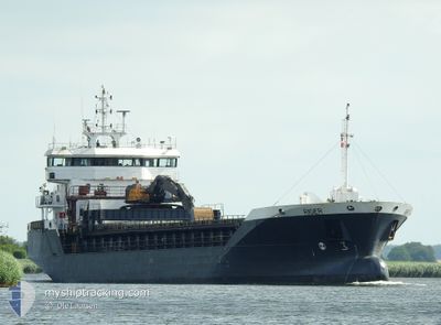
RIGER
General Cargo
Current Trip
FINNFJORDBOTN
| Time Travelled | 3 days |
|---|---|
| Remaining Time | --- |
| Distance Travelled | 952.05 nm |
| Remaining Distance | --- |
| AVG Speed | 10.3 Knots |
| MAX Speed | 12.8 Knots |
| AVG Wind | 12.4 knots |
| MAX Wind | 22 knots |
| MIN Temp | -8.3°C / 17.06°F |
| MAX Temp | 9.5°C / 49.1°F |
| Dybgang | 6.3 m |
| Position Modtaget | 2 m siden |
Current Position
| Longitude | --- |
|---|---|
| Latitude | --- |
| Status | Moored |
| Fart | |
| Kurs | 178° |
| Område | Norwegian Sea |
| Station | T-AIS |
| Position Modtaget | 2 m siden |
Info
Information
The current position of RIGER is in Norwegian Sea with coordinates 69.21885° / 18.07219° as reported on 2025-12-07 18:47 by AIS to our vessel tracker app. The vessel's current speed is 0 Knots
The vessel RIGER (IMO: 9373553, MMSI: 257203000) is a General Cargo that was built in 2008 ( 17 år gamle ). It's sailing under the flag of [NO] Norway.
In this page you can find informations about the vessels current position, last detected port calls, and current voyage information. If the vessels is not in coverage by AIS you will find the latest position.
The current position of RIGER is detected by our AIS receivers and we are not responsible for the reliability of the data. The last position was recorded while the vessel was in Coverage by the Ais receivers of our vessel tracking app.
The current draught of RIGER as reported by AIS is 6.3 meters
Weather
| Temperature | -8.3°C / 17.06°F |
|---|---|
| Wind Speed | 5 knots |
| Direction | 107° ESE |
| Pressure | 1014.2 hPa |
| Humidity | 90.5 % |
| Cloud Coverage | 100 % |
Featured Company
Last Port Calls
| Port | Arrival | Departure | Time In Port |
|---|---|---|---|
| 2025-12-03 11:24 | 2025-12-03 22:16 | 10 h | |
| 2025-12-03 00:53 | 2025-12-03 03:42 | 2 h | |
| 2025-11-29 05:11 | 2025-11-29 06:03 | 51 m | |
| 2025-11-24 15:37 | 2025-11-25 22:20 | 1 d | |
| 2025-11-21 15:39 | 2025-11-23 11:16 | 1 d | |
| 2025-11-18 08:27 | 2025-11-19 14:19 | 1 d | |
| 2025-11-16 13:35 | 2025-11-18 01:40 | 1 d | |
| 2025-11-15 04:50 | 2025-11-15 12:37 | 7 h | |
| 2025-11-14 15:44 | 2025-11-14 17:20 | 1 h | |
| 2025-11-11 08:49 | 2025-11-12 17:36 | 1 d |
Last Trips
| Origin | Departure | Destination | Arrival | Distance | |
|---|---|---|---|---|---|
| 2025-12-03 03:42 | 2025-12-03 11:24 | 69.12 nm | |||
| 2025-11-29 06:03 | 2025-12-03 00:53 | 250.65 nm | |||
| 2025-11-25 22:20 | 2025-11-29 05:11 | 463.23 nm | |||
| 2025-11-23 11:16 | 2025-11-24 15:37 | 305.48 nm | |||
| 2025-11-19 14:19 | 2025-11-21 15:39 | 579.01 nm | |||
| 2025-11-18 01:40 | 2025-11-18 08:27 | 75.55 nm | |||
| 2025-11-15 12:37 | 2025-11-16 13:35 | 263.66 nm | |||
| 2025-11-14 17:20 | 2025-11-15 04:50 | 119.74 nm | |||
| 2025-11-12 17:36 | 2025-11-14 15:44 | 469.06 nm | |||
| 2025-11-09 16:41 | 2025-11-11 08:49 | 455.75 nm |
Events
| Tid | Hændelsen | Detaljer | Position / Dest | Info |
|---|---|---|---|---|
| 2025-12-07 18:08 | Status er ændret | Moored Under way using engine |
69.21883 / 18.07222
FINNFJORDBOTN
|
Fart: Kurs: 178° |
| 2025-12-07 18:07 | STOP Sejllads | 2.4 nm, South East of FINNSNES |
69.21884 / 18.07216
FINNFJORDBOTN
|
Fart: 0.1 kn Kurs: 177° |
| 2025-12-04 23:58 | Ændre havområde | Norwegian part of the Norwegian Sea Norwegian part of the North Sea |
61.00826 / 4.44506
Norwegian Sea
FINNFJORDBOTN
|
Fart: 11 kn Kurs: 354.4° |
| 2025-12-04 04:41 | Ændre havområde | Norwegian part of the North Sea Norwegian part of the Skaggerak |
57.93725 / 7.10170
North Sea
FINNFJORDBOTN
|
Fart: 11.2 kn Kurs: 277.3° |
| 2025-12-03 21:16 | Afsejlet fra sidste havn |
|
58.50036 / 8.89414
FINNFJORDBOTN
|
Fart: 5.1 kn Kurs: 57° |
| 2025-12-03 21:10 | START Sejllads |
58.49627 / 8.88106
[NO] EYDEHAVN
|
Fart: 3.2 kn Kurs: 61° |
|
| 2025-12-03 20:59 | Status er ændret | Under way using engine Moored |
58.49438 / 8.87541
[NO] EYDEHAVN
|
Fart: Kurs: 41° |
| 2025-12-03 20:44 | Dybgangen er ændret | 6.3 6 |
58.49438 / 8.87539
[NO] EYDEHAVN
|
Fart: Kurs: 41° |
| 2025-12-03 20:06 | Dybgangen er ændret | 6 4.4 |
58.49435 / 8.87537
[NO] EYDEHAVN
|
Fart: Kurs: 41° |
| 2025-12-03 20:06 | Destination er ændret | FINNFJORDBOTN NOEYD |
58.49435 / 8.87537
[NO] EYDEHAVN
|
Fart: Kurs: 41° |