
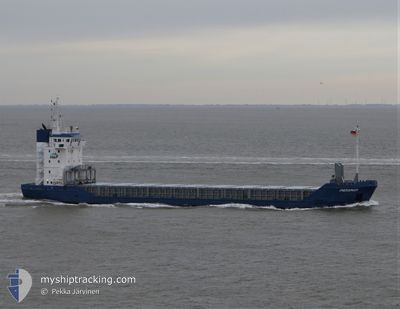
PARAMAR
General Cargo
Current Trip
| Time Travelled | 2 days |
|---|---|
| Remaining Time | 3 days |
| Distance Travelled | 466.71 nm |
| Remaining Distance | 778.21 nm |
| AVG Speed | 8.5 Knots |
| MAX Speed | 10 Knots |
| AVG Wind | 11.3 knots |
| MAX Wind | 15.4 knots |
| MIN Temp | 14.9°C / 58.82°F |
| MAX Temp | 24.3°C / 75.74°F |
| Dybgang | 6 m |
| Position Modtaget | 4 h, 52 m siden |
Current Position
| Longitude | -9.81126° |
|---|---|
| Latitude | 41.69607° |
| Status | Under way using engine |
| Fart | 9 Knots |
| Kurs | 358.8° |
| Område | North Atlantic Ocean |
| Station | T-AIS |
| Position Modtaget | 4 h, 52 m siden |
Info
Information
The current position of PARAMAR is in North Atlantic Ocean with coordinates 41.69607° / -9.81126° as reported on 2024-04-18 20:25 by AIS to our vessel tracker app. The vessel's current speed is 9 Knots and is heading at the port of BELFAST. The estimated time of arrival as calculated by MyShipTracking vessel tracking app is 2024-04-22 15:03 LT
The vessel PARAMAR (IMO: 9190262, MMSI: 275529000) is a General Cargo that was built in 1999 ( 25 år gamle ). It's sailing under the flag of [LV] Latvia.
In this page you can find informations about the vessels current position, last detected port calls, and current voyage information. If the vessels is not in coverage by AIS you will find the latest position.
The current position of PARAMAR is detected by our AIS receivers and we are not responsible for the reliability of the data. The last position was recorded while the vessel was in Coverage by the Ais receivers of our vessel tracking app.
The current draught of PARAMAR as reported by AIS is 6 meters
Weather
| Temperature | 14.4°C / 57.92°F |
|---|---|
| Wind Speed | 12 knots |
| Direction | 34° NE |
| Pressure | 1015.6 hPa |
| Humidity | 80.4 % |
| Cloud Coverage | 1 % |
Featured Company
Last Port Calls
| Port | Arrival | Departure | Time In Port |
|---|---|---|---|
| 2024-04-16 06:19 | 2024-04-16 06:51 | 32 m | |
| 2024-04-13 12:57 | 2024-04-14 17:24 | 1 d | |
| 2024-03-25 15:59 | 2024-03-25 17:40 | 1 h | |
| 2024-03-23 06:13 | 2024-03-25 13:30 | 2 d | |
| 2024-03-10 21:56 | 2024-03-12 02:40 | 1 d | |
| 2024-02-29 18:48 | 2024-03-06 13:05 | 5 d | |
| 2024-02-21 12:11 | 2024-02-22 17:12 | 1 d | |
| 2024-02-16 11:35 | 2024-02-19 22:03 | 3 d | |
| 2024-02-08 15:47 | 2024-02-09 21:39 | 1 d | |
| 2024-02-08 07:47 | 2024-02-08 14:18 | 6 h |
Last Trips
| Origin | Departure | Destination | Arrival | Distance | |
|---|---|---|---|---|---|
| 2024-04-14 18:24 | 2024-04-16 08:19 | 262.09 nm | |||
| 2024-03-25 18:40 | 2024-04-13 12:57 | 1881.89 nm | |||
| 2024-03-25 14:30 | 2024-03-25 16:59 | 24.82 nm | |||
| 2024-03-12 03:40 | 2024-03-23 07:13 | 1350.47 nm | |||
| 2024-03-06 14:05 | 2024-03-10 22:56 | 318.81 nm | |||
| 2024-02-22 18:12 | 2024-02-29 19:48 | 1539.56 nm | |||
| 2024-02-19 23:03 | 2024-02-21 13:11 | 355.21 nm | |||
| 2024-02-09 22:39 | 2024-02-16 12:35 | 1106.78 nm | |||
| 2024-02-08 15:18 | 2024-02-08 16:47 | 11.09 nm | |||
| 2024-02-05 15:42 | 2024-02-08 08:47 | 301.75 nm |
Events
| Tid | Hændelsen | Detaljer | Position / Dest | Info |
|---|---|---|---|---|
| 2024-04-18 20:40 | Status er ændret | Default Under way using engine |
41.74500 / -9.81167
GBBEL
|
Fart: 9 kn Kurs: 358.8° |
| 2024-04-18 20:25 | Udenfor Dækning |
41.69607 / -9.81126
North Atlantic Ocean
GBBEL
|
Fart: 9 kn Kurs: 358.8° |
|
| 2024-04-18 20:02 | Status er ændret | Under way using engine Default |
41.63760 / -9.81081
GBBEL
|
Fart: 9.1 kn Kurs: 2° |
| 2024-04-18 19:43 | Indenfor Dækning |
41.63760 / -9.81081
North Atlantic Ocean
GBBEL
|
Fart: 8.9 kn Kurs: 1.6° |
|
| 2024-04-18 19:13 | Status er ændret | Default Under way using engine |
41.52833 / -9.81333
GBBEL
|
Fart: 8.6 kn Kurs: 359.2° |
| 2024-04-18 18:36 | Udenfor Dækning |
41.41000 / -9.81522
North Atlantic Ocean
GBBEL
|
Fart: 8.6 kn Kurs: 359.2° |
|
| 2024-04-18 17:56 | Status er ændret | Under way using engine Default |
41.33530 / -9.81599
GBBEL
|
Fart: 9 kn Kurs: 5° |
| 2024-04-18 17:33 | Status er ændret | Default Under way using engine |
41.28167 / -9.81833
GBBEL
|
Fart: 8.8 kn Kurs: 353° |
| 2024-04-18 16:59 | Status er ændret | Under way using engine Default |
41.18652 / -9.81541
GBBEL
|
Fart: 9 kn Kurs: 352° |
| 2024-04-18 16:27 | Status er ændret | Default Under way using engine |
41.11666 / -9.81333
GBBEL
|
Fart: 8.4 kn Kurs: 2.9° |