
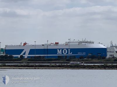
ORCA ACE
Cargo
Current Trip
| Time Travelled | 2 days |
|---|---|
| Remaining Time | --- |
| Distance Travelled | 926.08 nm |
| Remaining Distance | --- |
| AVG Speed | 14.4 Knots |
| MAX Speed | 18.3 Knots |
| AVG Wind | 9.4 knots |
| MAX Wind | 21.8 knots |
| MIN Temp | -0.2°C / 31.64°F |
| MAX Temp | 26.4°C / 79.52°F |
| Dybgang | 8.6 m |
| Position Modtaget | 1 d siden |
Current Position
| Longitude | --- |
|---|---|
| Latitude | --- |
| Status | Under way using engine |
| Fart | 15 Knots |
| Kurs | 173° |
| Område | North Atlantic Ocean |
| Station | T-AIS |
| Position Modtaget | 1 d siden |
Info
Information
The current position of ORCA ACE is in North Atlantic Ocean with coordinates 35.32565° / -74.99661° as reported on 2025-12-07 07:01 by AIS to our vessel tracker app. The vessel's current speed is 15 Knots and is heading at the port of CRISTOBAL. The estimated time of arrival as calculated by MyShipTracking vessel tracking app is 2025-12-14 01:00 LT
The vessel ORCA ACE (IMO: 9777814, MMSI: 371563000) is a Cargo It's sailing under the flag of [PA] Panama.
In this page you can find informations about the vessels current position, last detected port calls, and current voyage information. If the vessels is not in coverage by AIS you will find the latest position.
The current position of ORCA ACE is detected by our AIS receivers and we are not responsible for the reliability of the data. The last position was recorded while the vessel was in Coverage by the Ais receivers of our vessel tracking app.
The current draught of ORCA ACE as reported by AIS is 8.6 meters
Weather
| Temperature | 25.8°C / 78.44°F |
|---|---|
| Wind Speed | 7 knots |
| Direction | 260° W |
| Pressure | 1013.9 hPa |
| Humidity | 80.4 % |
| Cloud Coverage | 69 % |
Featured Company
Last Port Calls
| Port | Arrival | Departure | Time In Port |
|---|---|---|---|
| 2025-12-05 05:27 | 2025-12-06 08:31 | 1 d | |
| 2025-11-21 07:03 | 2025-11-21 20:34 | 13 h | |
| 2025-11-01 08:56 | 2025-11-01 18:36 | 9 h | |
| 2025-10-29 06:00 | 2025-11-01 01:40 | 2 d | |
| 2025-10-27 07:29 | 2025-10-27 17:14 | 9 h | |
| 2025-10-20 07:20 | 2025-10-21 18:59 | 1 d | |
| 2025-10-14 17:11 | 2025-10-15 12:22 | 19 h | |
| 2025-10-12 05:01 | 2025-10-12 19:55 | 14 h | |
| 2025-10-06 21:18 | 2025-10-08 09:46 | 1 d | |
| 2025-10-01 15:50 | 2025-10-02 12:20 | 20 h |
Most Visited Ports (Last year)
| Port | Arrivals | |
|---|---|---|
| 7 | ||
| 6 | ||
| 4 | ||
| 4 | ||
| 3 | ||
| 3 |
Last Trips
| Origin | Departure | Destination | Arrival | Distance | |
|---|---|---|---|---|---|
| 2025-11-21 20:34 | 2025-12-05 05:27 | 3917.65 nm | |||
| 2025-11-01 18:36 | 2025-11-21 07:03 | 6802.05 nm | |||
| 2025-10-27 17:14 | 2025-10-29 06:00 | 563.47 nm | |||
| 2025-10-21 18:59 | 2025-10-27 07:29 | 1869.19 nm | |||
| 2025-10-15 12:22 | 2025-10-20 07:20 | 1488.60 nm | |||
| 2025-10-12 19:55 | 2025-10-14 17:11 | 831.02 nm | |||
| 2025-10-08 09:46 | 2025-10-12 05:01 | 1483.11 nm | |||
| 2025-10-02 12:20 | 2025-10-06 21:18 | 1467.50 nm | |||
| 2025-09-29 00:30 | 2025-10-01 15:50 | 427.22 nm |
Events
| Tid | Hændelsen | Detaljer | Position / Dest | Info |
|---|---|---|---|---|
| 2025-12-07 07:06 | Status er ændret | Default Under way using engine |
35.30333 / -74.99500
PA CTB
|
Fart: 15 kn Kurs: 173° |
| 2025-12-07 07:01 | Udenfor Dækning |
35.32565 / -74.99661
North Atlantic Ocean
PA CTB
|
Fart: 15 kn Kurs: 173° |
|
| 2025-12-07 06:48 | Status er ændret | Under way using engine Default |
35.38276 / -75.00171
PA CTB
|
Fart: 15 kn Kurs: 175° |
| 2025-12-07 06:48 | Indenfor Dækning |
35.38276 / -75.00171
North Atlantic Ocean
PA CTB
|
Fart: 15 kn Kurs: 176° |
|
| 2025-12-06 23:51 | Status er ændret | Default Under way using engine |
36.84539 / -75.83735
PA CTB
|
Fart: 9.7 kn Kurs: 122.6° |
| 2025-12-06 23:45 | Udenfor Dækning |
36.85329 / -75.85297
North Atlantic Ocean
PA CTB
|
Fart: 9.7 kn Kurs: 122.6° |
|
| 2025-12-06 23:45 | Status er ændret | Under way using engine Default |
36.85431 / -75.85492
PA CTB
|
Fart: 9.4 kn Kurs: 123° |
| 2025-12-06 23:43 | Status er ændret | Default Under way using engine |
36.85695 / -75.86003
PA CTB
|
Fart: 9.4 kn Kurs: 122.8° |
| 2025-12-06 23:43 | Status er ændret | Under way using engine Default |
36.85716 / -75.86044
PA CTB
|
Fart: 9.2 kn Kurs: 122° |
| 2025-12-06 23:35 | Status er ændret | Default Under way using engine |
36.86902 / -75.88042
PA CTB
|
Fart: 9.6 kn Kurs: 140° |