
ORANGE STRAIT
Cargo
Current Trip
| Time Travelled | 15 days |
|---|---|
| Remaining Time | --- |
| Distance Travelled | 1308.20 nm |
| Remaining Distance | --- |
| AVG Speed | 11.2 Knots |
| MAX Speed | 16.8 Knots |
| AVG Wind | 6.3 knots |
| MAX Wind | 13.3 knots |
| MIN Temp | 23.4°C / 74.12°F |
| MAX Temp | 34.8°C / 94.64°F |
| Dybgang | 6 m |
| Position Modtaget | 2024-03-03 02:40 |
Current Position
| Longitude | -15.29012° |
|---|---|
| Latitude | 27.61950° |
| Status | Under way using engine |
| Fart | 11.9 Knots |
| Kurs | 175.1° |
| Område | North Atlantic Ocean |
| Station | T-AIS |
| Position Modtaget | 2024-03-03 02:40 |
Info
Information
The current position of ORANGE STRAIT is in North Atlantic Ocean with coordinates 27.61950° / -15.29012° as reported on 2024-03-03 02:40 by AIS to our vessel tracker app. The vessel's current speed is 11.9 Knots and is heading at the port of NOUADHIBOU.
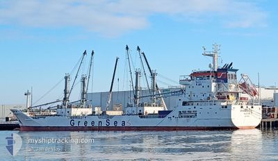
The vessel ORANGE STRAIT (IMO: 9795995, MMSI: 306124000) is a Cargo It's sailing under the flag of [CW] Curacao.
In this page you can find informations about the vessels current position, last detected port calls, and current voyage information. If the vessels is not in coverage by AIS you will find the latest position.
The current position of ORANGE STRAIT is detected by our AIS receivers and we are not responsible for the reliability of the data. The last position was recorded while the vessel was in Coverage by the Ais receivers of our vessel tracking app.
The current draught of ORANGE STRAIT as reported by AIS is 6 meters
Weather
| Temperature | 28.2°C / 82.76°F |
|---|---|
| Wind Speed | 9 knots |
| Direction | 139° SE |
| Pressure | 1008.8 hPa |
| Humidity | 79 % |
| Cloud Coverage | 82 % |
Featured Company
Last Port Calls
| Port | Arrival | Departure | Time In Port |
|---|---|---|---|
| 2024-04-06 04:33 | 2024-04-09 17:21 | 3 d | |
| 2024-03-23 15:47 | 2024-03-27 12:59 | 3 d | |
| 2024-03-20 09:05 | 2024-03-21 13:02 | 1 d | |
| 2024-03-02 16:12 | 2024-03-02 23:53 | 7 h | |
| 2024-02-02 10:42 | 2024-02-02 22:41 | 11 h | |
| 2024-02-01 04:07 | 2024-02-01 21:57 | 17 h |
Last Trips
| Origin | Departure | Destination | Arrival | Distance | |
|---|---|---|---|---|---|
| 2024-03-27 12:59 | 2024-04-06 05:33 | 1169.58 nm | |||
| 2024-03-21 13:02 | 2024-03-23 15:47 | 479.15 nm | |||
| 2024-03-02 23:53 | 2024-03-20 09:05 | 1619.46 nm | |||
| 2024-02-02 22:41 | 2024-03-02 16:12 | 1773.62 nm | |||
| 2024-02-01 22:57 | 2024-02-02 10:42 | 140.96 nm | |||
| 2024-01-14 09:36 | 2024-02-01 05:07 | 4116.17 nm |
Events
| Tid | Hændelsen | Detaljer | Position / Dest | Info |
|---|---|---|---|---|
| 2024-04-23 13:10 | START Sejllads | 2.42 nm, West of BOMA |
-5.85667 / 13.00833
NOUADHIBOU
|
Fart: 4 kn Kurs: -1° |
| 2024-04-17 12:47 | STOP Sejllads | 1.82 nm, West of BOMA |
-5.85833 / 13.01833
NOUADHIBOU
|
Fart: Kurs: -1° |
| 2024-04-17 12:35 | START Sejllads | 0.83 nm, West of BOMA |
-5.86167 / 13.03500
NOUADHIBOU
|
Fart: 8 kn Kurs: 299° |
| 2024-04-16 13:49 | STOP Sejllads | 1.04 nm, South West of BOMA |
-5.87167 / 13.03667
NOUADHIBOU
|
Fart: Kurs: -1° |
| 2024-04-16 07:24 | START Sejllads | 3.28 nm, South West of BANANA |
-6.03500 / 12.35833
NOUADHIBOU
|
Fart: 5 kn Kurs: 158° |