
DAY BLUE
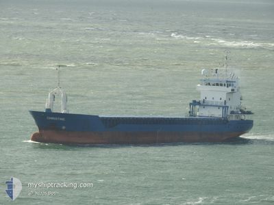
General Cargo
Current Trip
| Trip Time | 7 days |
|---|---|
| Trip Distance | 1758.42 nm |
| AVG Speed | 10.2 Knots |
| MAX Speed | 13.9 Knots |
| Dybgang | 6.4 m |
| AVG Wind | 10.7 knots |
| MAX Wind | 29 knots |
| MIN Temp | 9.1°C / 48.38°F |
| MAX Temp | 21.5°C / 70.7°F |
| Position Modtaget | 22 h, 21 m siden |
Current Position
| Longitude | -2.60705° |
|---|---|
| Latitude | 48.95224° |
| Status | Under way using engine |
| Fart | 12.4 Knots |
| Kurs | 88.4° |
| Område | English Channel |
| Station | T-AIS |
| Position Modtaget | 22 h, 21 m siden |
Info
Information
The current position of DAY BLUE is in English Channel with coordinates 48.95224° / -2.60705° as reported on 2024-04-22 14:03 by AIS to our vessel tracker app. The vessel's current speed is 12.4 Knots and is currently inside the port of SAINT MALO.
The vessel DAY BLUE (IMO: 9184811, MMSI: 312012000) is a General Cargo that was built in 1998 ( 26 år gamle ). It's sailing under the flag of [BZ] Belize.
In this page you can find informations about the vessels current position, last detected port calls, and current voyage information. If the vessels is not in coverage by AIS you will find the latest position.
The current position of DAY BLUE is detected by our AIS receivers and we are not responsible for the reliability of the data. The last position was recorded while the vessel was in Coverage by the Ais receivers of our vessel tracking app.
The current draught of DAY BLUE as reported by AIS is 6.4 meters
Weather
| Temperature | 9.5°C / 49.1°F |
|---|---|
| Wind Speed | 9 knots |
| Direction | 2° N |
| Pressure | 1023.7 hPa |
| Humidity | 70.7 % |
| Cloud Coverage | 76 % |
Featured Company
Last Port Calls
| Port | Arrival | Departure | Time In Port |
|---|---|---|---|
| 2024-04-22 16:38 | |||
| 2024-04-14 06:54 | 2024-04-15 10:28 | 1 d | |
| 2024-04-09 04:12 | 2024-04-09 18:43 | 14 h | |
| 2024-04-05 08:31 | 2024-04-06 18:06 | 1 d | |
| 2024-04-04 18:03 | |||
| 2024-03-17 19:26 | 2024-03-22 19:48 | 5 d | |
| 2024-03-14 08:57 | 2024-03-15 21:35 | 1 d | |
| 2024-03-01 09:39 | 2024-03-06 13:27 | 5 d | |
| 2024-03-01 05:11 | 2024-03-01 05:19 | 8 m | |
| 2024-02-23 06:19 | 2024-02-27 06:04 | 3 d |
Most Visited Ports (Last year)
| Port | Arrivals | |
|---|---|---|
| 2 | ||
| 1 | ||
| 1 | ||
| 1 | ||
| 1 | ||
| 1 |
Last Trips
| Origin | Departure | Destination | Arrival | Distance | |
|---|---|---|---|---|---|
| 2024-04-15 11:28 | 2024-04-22 18:38 | 1758.42 nm | |||
| 2024-04-09 20:43 | 2024-04-14 07:54 | 454.47 nm | |||
| 2024-04-06 20:06 | 2024-04-09 06:12 | 558.19 nm | |||
| 2024-04-04 20:03 | 2024-04-05 10:31 | 45.53 nm | |||
| 2024-03-15 22:35 | 2024-03-17 20:26 | 380.87 nm | |||
| 2024-03-06 14:27 | 2024-03-14 09:57 | 1716.08 nm | |||
| 2024-03-01 06:19 | 2024-03-01 10:39 | 2.07 nm | |||
| 2024-02-27 07:04 | 2024-03-01 06:11 | 317.54 nm | |||
| 2023-12-26 07:17 | 2024-02-23 07:19 | 841.18 nm |
Events
| Tid | Hændelsen | Detaljer | Position / Dest | Info |
|---|---|---|---|---|
| 2024-04-22 16:50 | STOP Sejllads |
48.64327 / -2.02402
[FR] SAINT MALO
|
Fart: Kurs: 70° |
|
| 2024-04-22 16:38 | Skibe i havn |
|
48.64153 / -2.03057
[FR] SAINT MALO
|
Fart: 5.7 kn Kurs: 135° |
| 2024-04-22 14:10 | Status er ændret | Default Under way using engine |
48.94196 / -2.57644
FRSML
|
Fart: 12.4 kn Kurs: 88.4° |
| 2024-04-22 14:03 | Udenfor Dækning |
48.95224 / -2.60705
English Channel
|
Fart: 12.4 kn Kurs: 88.4° |
|
| 2024-04-22 14:02 | Ændre havområde | Jersey part of the English Channel French part of the English Channel |
48.95211 / -2.61406
English Channel
|
Fart: 12.4 kn Kurs: 88.1° |
| 2024-04-22 12:33 | Status er ændret | Under way using engine Default |
48.94484 / -3.06925
FRSML
|
Fart: 11.6 kn Kurs: 82° |
| 2024-04-22 11:46 | Status er ændret | Default Under way using engine |
48.93427 / -3.28374
FRSML
|
Fart: 10.2 kn Kurs: 88.9° |
| 2024-04-22 05:59 | Ændre havområde | French part of the English Channel French part of the Celtic Sea |
48.74242 / -4.64982
English Channel
FRSML
|
Fart: 10.9 kn Kurs: 72.9° |
| 2024-04-22 05:39 | Dybgangen er ændret | 6.4 6 |
48.72356 / -4.74559
FRSML
|
Fart: 11.6 kn Kurs: 76° |
| 2024-04-22 05:39 | ETA er ændret | 2024/04/22 07:00 |
48.72356 / -4.74559
FRSML
|
Fart: 11.6 kn Kurs: 76° |