
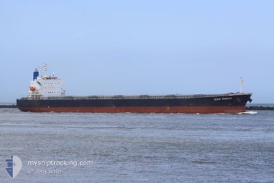
ALEXANDROS PETRAKIS
Bulk Carrier
Current Trip
INNML
| Time Travelled | 7 days |
|---|---|
| Remaining Time | --- |
| Distance Travelled | 1191.43 nm |
| Remaining Distance | --- |
| AVG Speed | 13 Knots |
| MAX Speed | 14.8 Knots |
| AVG Wind | 7.6 knots |
| MAX Wind | 14 knots |
| MIN Temp | 27.6°C / 81.68°F |
| MAX Temp | 29.6°C / 85.28°F |
| Dybgang | 14 m |
| Position Modtaget | 10 d siden |
Current Position
| Longitude | 76.51020° |
|---|---|
| Latitude | 8.36374° |
| Status | Under way using engine |
| Fart | 10.9 Knots |
| Kurs | 306.7° |
| Område | Laccadive Sea |
| Station | T-AIS |
| Position Modtaget | 10 d siden |
Info
Information
The current position of ALEXANDROS PETRAKIS is in Laccadive Sea with coordinates 8.36374° / 76.51020° as reported on 2024-04-09 01:51 by AIS to our vessel tracker app. The vessel's current speed is 10.9 Knots
The vessel ALEXANDROS PETRAKIS (IMO: 9442938, MMSI: 538009094) is a Bulk Carrier that was built in 2008 ( 16 år gamle ). It's sailing under the flag of [MH] Marshall Is.
In this page you can find informations about the vessels current position, last detected port calls, and current voyage information. If the vessels is not in coverage by AIS you will find the latest position.
The current position of ALEXANDROS PETRAKIS is detected by our AIS receivers and we are not responsible for the reliability of the data. The last position was recorded while the vessel was in Coverage by the Ais receivers of our vessel tracking app.
The current draught of ALEXANDROS PETRAKIS as reported by AIS is 14 meters
Weather
| Temperature | 27.2°C / 80.96°F |
|---|---|
| Wind Speed | 4 knots |
| Direction | 302° WNW |
| Pressure | 1009.5 hPa |
| Humidity | 79.2 % |
| Cloud Coverage | --- |
Featured Company
Events
| Tid | Hændelsen | Detaljer | Position / Dest | Info |
|---|---|---|---|---|
| 2024-04-16 22:09 | STOP Sejllads | 2.14 nm, South East of SALALAH |
16.92315 / 54.04454
INNML
|
Fart: 0.3 kn Kurs: 202° |
| 2024-04-12 15:22 | Afsejlet fra sidste havn |
|
12.92393 / 74.79151
INNML
|
Fart: 3.3 kn Kurs: 260° |
| 2024-04-12 15:13 | START Sejllads |
12.92742 / 74.81029
[IN] PANAMBUR
|
Fart: 3.3 kn Kurs: 260° |
|
| 2024-04-10 05:37 | STOP Sejllads |
12.92989 / 74.81279
[IN] PANAMBUR
|
Fart: 0.2 kn Kurs: 347° |
|
| 2024-04-10 05:05 | Skibe i havn |
|
12.92574 / 74.80277
[IN] PANAMBUR
|
Fart: 4.4 kn Kurs: 83° |