
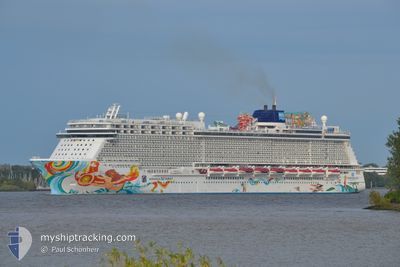
NORWEGIAN GETAWAY
Passengers Ship
Current Trip
| Trip Time | 3 days |
|---|---|
| Trip Distance | 1425.36 nm |
| AVG Speed | 17 Knots |
| MAX Speed | 21.6 Knots |
| Dybgang | 8.4 m |
| AVG Wind | 13.2 knots |
| MAX Wind | 26 knots |
| MIN Temp | 7.7°C / 45.86°F |
| MAX Temp | 26.7°C / 80.06°F |
| Position Modtaget | Nu |
Current Position
| Longitude | -73.99833° |
|---|---|
| Latitude | 40.76637° |
| Status | Under way using engine |
| Fart | |
| Kurs | 119° |
| Område | North Atlantic Ocean |
| Station | T-AIS |
| Position Modtaget | Nu |
Info
Information
The current position of NORWEGIAN GETAWAY is in North Atlantic Ocean with coordinates 40.76637° / -73.99833° as reported on 2024-04-19 08:47 by AIS to our vessel tracker app. The vessel's current speed is 0 Knots and is currently inside the port of NEW YORK.
The vessel NORWEGIAN GETAWAY (IMO: 9606924, MMSI: 311050900) is a Passengers Ship that was built in 2014 ( 10 år gamle ). It's sailing under the flag of [BS] Bahamas.
In this page you can find informations about the vessels current position, last detected port calls, and current voyage information. If the vessels is not in coverage by AIS you will find the latest position.
The current position of NORWEGIAN GETAWAY is detected by our AIS receivers and we are not responsible for the reliability of the data. The last position was recorded while the vessel was in Coverage by the Ais receivers of our vessel tracking app.
The current draught of NORWEGIAN GETAWAY as reported by AIS is 8.4 meters
Weather
| Temperature | 8.1°C / 46.58°F |
|---|---|
| Wind Speed | 5 knots |
| Direction | 87° E |
| Pressure | 1021.1 hPa |
| Humidity | 75.9 % |
| Cloud Coverage | 93 % |
Featured Company
Last Port Calls
| Port | Arrival | Departure | Time In Port |
|---|---|---|---|
| 2024-04-19 07:09 | |||
| 2024-04-15 10:15 | 2024-04-16 01:16 | 15 h | |
| 2024-04-14 10:09 | 2024-04-14 21:02 | 10 h | |
| 2024-04-13 11:08 | 2024-04-13 21:12 | 10 h | |
| 2024-04-12 11:22 | 2024-04-12 20:54 | 9 h | |
| 2024-04-11 17:29 | 2024-04-11 23:47 | 6 h | |
| 2024-04-10 12:58 | 2024-04-10 21:16 | 8 h | |
| 2024-04-07 07:45 | 2024-04-07 20:54 | 13 h | |
| 2024-04-04 14:54 | 2024-04-05 00:48 | 9 h | |
| 2024-03-31 07:17 | 2024-03-31 20:51 | 13 h |
Most Visited Ports (Last year)
| Port | Arrivals | |
|---|---|---|
| 19 | ||
| 17 | ||
| 15 | ||
| 13 | ||
| 10 | ||
| 8 |
Last Trips
| Origin | Departure | Destination | Arrival | Distance | |
|---|---|---|---|---|---|
| 2024-04-15 21:16 | 2024-04-19 03:09 | 1425.36 nm | |||
| 2024-04-14 17:02 | 2024-04-15 06:15 | 108.67 nm | |||
| 2024-04-13 17:12 | 2024-04-14 06:09 | 192.83 nm | |||
| 2024-04-12 16:54 | 2024-04-13 07:08 | 93.46 nm | |||
| 2024-04-11 19:47 | 2024-04-12 07:22 | 100.29 nm | |||
| 2024-04-10 17:16 | 2024-04-11 13:29 | 374.00 nm | |||
| 2024-04-07 16:54 | 2024-04-10 08:58 | 1275.68 nm | |||
| 2024-04-04 20:48 | 2024-04-07 03:45 | 1012.97 nm | |||
| 2024-03-31 16:51 | 2024-04-04 10:54 | 1522.30 nm | |||
| 2024-03-24 19:44 | 2024-03-31 03:17 | 1680.79 nm |
Events
| Tid | Hændelsen | Detaljer | Position / Dest | Info |
|---|---|---|---|---|
| 2024-04-19 08:15 | STOP Sejllads |
40.76646 / -73.99846
[US] NEW YORK
|
Fart: 0.3 kn Kurs: 121° |
|
| 2024-04-19 07:09 | Skibe i havn |
|
40.57942 / -74.03651
[US] NEW YORK
|
Fart: 17.5 kn Kurs: 349.5° |
| 2024-04-19 02:51 | ETA er ændret | 2024/04/19 06:00 2024/04/19 05:30 |
39.92648 / -73.71470
NEW YORK, USA
|
Fart: 10.6 kn Kurs: 352.4° |
| 2024-04-19 02:43 | Fundet i havområde | United States part of the North Atlantic Ocean |
39.90411 / -73.71177
North Atlantic Ocean
NEW YORK, USA
|
Fart: 10.3 kn Kurs: 354.4° |
| 2024-04-19 02:43 | Status er ændret | Under way using engine Default |
39.90216 / -73.71152
NEW YORK, USA
|
Fart: 15.4 kn Kurs: 3° |
| 2024-04-19 02:43 | Indenfor Dækning |
39.90411 / -73.71177
North Atlantic Ocean
NEW YORK, USA
|
Fart: 10.3 kn Kurs: 354.4° |
|
| 2024-04-16 03:51 | Status er ændret | Default Under way using engine |
19.21567 / -66.42004
NEW YORK, USA
|
Fart: 20.8 kn Kurs: 337.2° |
| 2024-04-16 03:46 | Udenfor Dækning |
19.18676 / -66.40741
North Atlantic Ocean
NEW YORK, USA
|
Fart: 20.8 kn Kurs: 337.2° |
|
| 2024-04-16 03:00 | Status er ændret | Under way using engine Default |
18.94070 / -66.29994
NEW YORK, USA
|
Fart: 18.7 kn Kurs: 337° |
| 2024-04-16 02:56 | Status er ændret | Default Under way using engine |
18.92402 / -66.29237
NEW YORK, USA
|
Fart: 18.8 kn Kurs: 338.8° |