
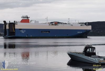
NORDIC RAY
Vehicles Carrier
Current Trip
| Time Travelled | 2 h, 3 mins |
|---|---|
| Remaining Time | 1 day |
| Distance Travelled | 32.80 nm |
| Remaining Distance | 567.66 nm |
| AVG Speed | 15.9 Knots |
| MAX Speed | 17.5 Knots |
| AVG Wind | 19.8 knots |
| MAX Wind | 21 knots |
| MIN Temp | 8°C / 46.4°F |
| MAX Temp | 8.3°C / 46.94°F |
| Dybgang | 7.7 m |
| Position Modtaget | Nu |
Current Position
| Longitude | 2.68744° |
|---|---|
| Latitude | 51.69020° |
| Status | Under way using engine |
| Fart | 16.7 Knots |
| Kurs | 347.3° |
| Område | North Sea |
| Station | T-AIS |
| Position Modtaget | Nu |
Info
Information
The current position of NORDIC RAY is in North Sea with coordinates 51.69020° / 2.68744° as reported on 2024-04-24 18:01 by AIS to our vessel tracker app. The vessel's current speed is 16.7 Knots and is heading at the port of DRAMMEN. The estimated time of arrival as calculated by MyShipTracking vessel tracking app is 2024-04-26 03:02 LT
The vessel NORDIC RAY (IMO: 9386225, MMSI: 309586000) is a Vehicles Carrier that was built in 2007 ( 17 år gamle ). It's sailing under the flag of [BS] Bahamas.
In this page you can find informations about the vessels current position, last detected port calls, and current voyage information. If the vessels is not in coverage by AIS you will find the latest position.
The current position of NORDIC RAY is detected by our AIS receivers and we are not responsible for the reliability of the data. The last position was recorded while the vessel was in Coverage by the Ais receivers of our vessel tracking app.
The current draught of NORDIC RAY as reported by AIS is 7.7 meters
Weather
| Temperature | 8°C / 46.4°F |
|---|---|
| Wind Speed | 20 knots |
| Direction | 339° NNW |
| Pressure | 1011.7 hPa |
| Humidity | 66.1 % |
| Cloud Coverage | 62 % |
Featured Company
Last Port Calls
| Port | Arrival | Departure | Time In Port |
|---|---|---|---|
| 2024-04-23 14:19 | 2024-04-24 15:59 | 1 d | |
| 2024-04-21 03:24 | 2024-04-21 14:21 | 10 h | |
| 2024-04-20 08:08 | 2024-04-20 13:59 | 5 h | |
| 2024-04-19 06:58 | 2024-04-19 14:18 | 7 h | |
| 2024-04-16 11:21 | 2024-04-17 20:40 | 1 d | |
| 2024-04-14 01:45 | 2024-04-14 13:34 | 11 h | |
| 2024-04-13 09:37 | 2024-04-13 14:22 | 4 h | |
| 2024-04-11 22:46 | 2024-04-12 14:01 | 15 h | |
| 2024-04-10 22:55 | 2024-04-11 14:16 | 15 h | |
| 2024-04-09 02:08 | 2024-04-10 03:56 | 1 d |
Last Trips
| Origin | Departure | Destination | Arrival | Distance | |
|---|---|---|---|---|---|
| 2024-04-21 16:21 | 2024-04-23 16:19 | 569.74 nm | |||
| 2024-04-20 15:59 | 2024-04-21 05:24 | 136.59 nm | |||
| 2024-04-19 16:18 | 2024-04-20 10:08 | 267.50 nm | |||
| 2024-04-17 22:40 | 2024-04-19 08:58 | 606.88 nm | |||
| 2024-04-14 15:34 | 2024-04-16 13:21 | 574.20 nm | |||
| 2024-04-13 16:22 | 2024-04-14 03:45 | 148.37 nm | |||
| 2024-04-12 16:01 | 2024-04-13 11:37 | 328.27 nm | |||
| 2024-04-11 16:16 | 2024-04-12 00:46 | 143.41 nm | |||
| 2024-04-10 05:56 | 2024-04-11 00:55 | 313.61 nm | |||
| 2024-04-07 16:14 | 2024-04-09 04:08 | 559.27 nm |
Events
| Tid | Hændelsen | Detaljer | Position / Dest | Info |
|---|---|---|---|---|
| 2024-04-24 17:09 | START Sejllads | 15.45 nm, North West of OOSTENDE |
51.45048 / 2.74352
NO DRM
|
Fart: 17.2 kn Kurs: 327.7° |
| 2024-04-24 17:09 | STOP Sejllads | 15.31 nm, North West of OOSTENDE |
51.44844 / 2.74559
NO DRM
|
Fart: Kurs: 0° |
| 2024-04-24 16:53 | START Sejllads | 11.63 nm, North West of OOSTENDE |
51.39774 / 2.80173
NO DRM
|
Fart: 10.7 kn Kurs: 267.6° |
| 2024-04-24 16:53 | STOP Sejllads | 11.58 nm, North West of OOSTENDE |
51.39779 / 2.80477
NO DRM
|
Fart: Kurs: 0° |
| 2024-04-24 16:48 | START Sejllads | 11.35 nm, North of OOSTENDE |
51.40140 / 2.83334
NO DRM
|
Fart: 17.1 kn Kurs: 254.5° |
| 2024-04-24 16:48 | STOP Sejllads | 11.33 nm, North of OOSTENDE |
51.40208 / 2.83727
NO DRM
|
Fart: Kurs: 0° |
| 2024-04-24 16:47 | START Sejllads | 11.32 nm, North of OOSTENDE |
51.40286 / 2.84173
NO DRM
|
Fart: 17.3 kn Kurs: 254.1° |
| 2024-04-24 16:47 | STOP Sejllads | 11.31 nm, North of OOSTENDE |
51.40340 / 2.84496
NO DRM
|
Fart: Kurs: 0° |
| 2024-04-24 16:46 | START Sejllads | 11.31 nm, North of OOSTENDE |
51.40412 / 2.84915
NO DRM
|
Fart: 17.3 kn Kurs: 255.3° |
| 2024-04-24 16:46 | STOP Sejllads | 11.3 nm, North of OOSTENDE |
51.40468 / 2.85262
NO DRM
|
Fart: Kurs: 0° |