
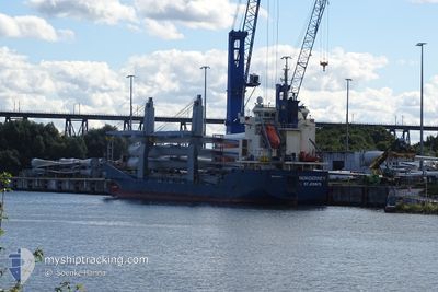
NORDERNEY
General Cargo
Current Trip
| Time Travelled | 4 days |
|---|---|
| Remaining Time | 2 days |
| Distance Travelled | 127.52 nm |
| Remaining Distance | 556.94 nm |
| AVG Speed | 8 Knots |
| MAX Speed | 10.4 Knots |
| AVG Wind | 10.7 knots |
| MAX Wind | 17.9 knots |
| MIN Temp | 25.1°C / 77.18°F |
| MAX Temp | 28.3°C / 82.94°F |
| Dybgang | 5.8 m |
| Position Modtaget | 6 m siden |
Current Position
| Longitude | 38.13480° |
|---|---|
| Latitude | 22.17561° |
| Status | Under way using engine |
| Fart | 7.8 Knots |
| Kurs | 359.1° |
| Område | Red Sea |
| Station | T-AIS |
| Position Modtaget | 6 m siden |
Info
Information
The current position of NORDERNEY is in Red Sea with coordinates 22.17561° / 38.13480° as reported on 2024-04-18 22:17 by AIS to our vessel tracker app. The vessel's current speed is 7.8 Knots and is heading at the port of AL ADABIYAH. The estimated time of arrival as calculated by MyShipTracking vessel tracking app is 2024-04-21 19:41 LT
The vessel NORDERNEY (IMO: 9506124, MMSI: 305901000) is a General Cargo that was built in 2012 ( 12 år gamle ). It's sailing under the flag of [AG] Antigua Barbuda.
In this page you can find informations about the vessels current position, last detected port calls, and current voyage information. If the vessels is not in coverage by AIS you will find the latest position.
The current position of NORDERNEY is detected by our AIS receivers and we are not responsible for the reliability of the data. The last position was recorded while the vessel was in Coverage by the Ais receivers of our vessel tracking app.
The current draught of NORDERNEY as reported by AIS is 5.8 meters
Weather
| Temperature | 26.6°C / 79.88°F |
|---|---|
| Wind Speed | 6 knots |
| Direction | 337° NNW |
| Pressure | 1008.2 hPa |
| Humidity | 74.4 % |
| Cloud Coverage | 1 % |
Featured Company
Last Port Calls
| Port | Arrival | Departure | Time In Port |
|---|---|---|---|
| 2024-04-13 07:47 | 2024-04-14 05:05 | 21 h | |
| 2024-04-10 04:01 | 2024-04-10 13:19 | 9 h | |
| 2024-04-02 08:54 | 2024-04-02 20:19 | 11 h | |
| 2024-03-25 17:40 | 2024-03-28 00:03 | 2 d | |
| 2024-03-18 09:01 | 2024-03-18 19:56 | 10 h | |
| 2024-03-10 22:35 | 2024-03-13 18:47 | 2 d | |
| 2024-02-13 18:46 | 2024-02-16 12:58 | 2 d | |
| 2024-02-03 21:16 | 2024-02-06 03:57 | 2 d |
Last Trips
| Origin | Departure | Destination | Arrival | Distance | |
|---|---|---|---|---|---|
| 2024-04-02 22:19 | 2024-04-13 10:47 | 2347.59 nm | |||
| 2024-04-02 22:19 | 2024-04-10 06:01 | 1618.23 nm | |||
| 2024-03-28 01:03 | 2024-04-02 10:54 | 532.68 nm | |||
| 2024-03-18 20:56 | 2024-03-25 18:40 | 1276.74 nm | |||
| 2024-03-13 19:47 | 2024-03-18 10:01 | 797.62 nm | |||
| 2024-02-16 07:58 | 2024-03-10 23:35 | 3760.21 nm | |||
| 2024-02-05 22:57 | 2024-02-13 13:46 | 1896.84 nm | |||
| 2024-01-02 13:14 | 2024-02-03 16:16 | 6500.07 nm |
Events
| Tid | Hændelsen | Detaljer | Position / Dest | Info |
|---|---|---|---|---|
| 2024-04-18 13:10 | Indenfor Dækning |
21.54538 / 38.81772
Red Sea
ADABIYAH
|
Fart: 7.4 kn Kurs: 282° |
|
| 2024-04-18 12:34 | Destination er ændret | ADABIYAH JEDDAH,KSA |
21.51167 / 38.95167
ADABIYAH
|
Fart: 7 kn Kurs: 287° |
| 2024-04-18 09:42 | ETA er ændret | 2024/04/21 12:00 2024/04/13 04:00 |
21.45795 / 39.08892
JEDDAH,KSA
|
Fart: Kurs: 322° |
| 2024-04-18 09:35 | Udenfor Dækning |
21.45795 / 39.08892
Red Sea
JEDDAH,KSA
|
Fart: Kurs: 261.2° |
|
| 2024-04-18 08:13 | Status er ændret | At anchor Default |
21.45787 / 39.08871
JEDDAH,KSA
|
Fart: Kurs: 327° |
| 2024-04-18 07:34 | Status er ændret | Default At anchor |
21.45788 / 39.08864
JEDDAH,KSA
|
Fart: Kurs: 328° |
| 2024-04-18 07:02 | Status er ændret | At anchor Default |
21.45787 / 39.08866
JEDDAH,KSA
|
Fart: Kurs: -1° |
| 2024-04-18 06:43 | Status er ændret | Default At anchor |
21.45667 / 39.08833
JEDDAH,KSA
|
Fart: Kurs: 325° |
| 2024-04-18 06:22 | Indenfor Dækning |
21.45788 / 39.08875
Red Sea
|
Fart: Kurs: 261.2° |
|
| 2024-04-18 04:19 | Udenfor Dækning |
21.45793 / 39.08882
Red Sea
|
Fart: Kurs: 261.2° |