
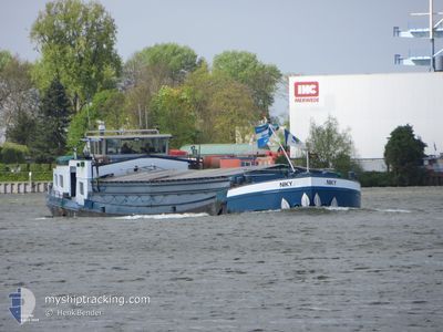
NIKY
Cargo
Current Trip
ROTTERDAM
Unknown Port
ETA*
2024-11-18 09:15 UTC
| Time Travelled | 58 days |
|---|---|
| Remaining Time | --- |
| Distance Travelled | 801.06 nm |
| Remaining Distance | --- |
| AVG Speed | 5.4 Knots |
| MAX Speed | 8.6 Knots |
| AVG Wind | 10.6 knots |
| MAX Wind | 25.8 knots |
| MIN Temp | 3.3°C / 37.94°F |
| MAX Temp | 24.4°C / 75.92°F |
| Dybgang | 0 m |
| Position Modtaget | Nu |
Current Position
| Longitude | 5.75760° |
|---|---|
| Latitude | 51.27754° |
| Status | Under way using engine |
| Fart | 6.5 Knots |
| Kurs | 149.6° |
| Område | North Sea |
| Station | T-AIS |
| Position Modtaget | Nu |
Info
info
Information
The current position of NIKY is in North Sea with coordinates 51.27754° / 5.75760° as reported on 2024-04-19 13:02 by AIS to our vessel tracker app. The vessel's current speed is 6.5 Knots
The vessel NIKY (MMSI: 244060545) is a Cargo It's sailing under the flag of [NL] Netherlands.
In this page you can find informations about the vessels current position, last detected port calls, and current voyage information. If the vessels is not in coverage by AIS you will find the latest position.
The current position of NIKY is detected by our AIS receivers and we are not responsible for the reliability of the data. The last position was recorded while the vessel was in Coverage by the Ais receivers of our vessel tracking app.
Weather
| Temperature | 10.8°C / 51.44°F |
|---|---|
| Wind Speed | 19 knots |
| Direction | 308° NW |
| Pressure | 1008.2 hPa |
| Humidity | 75.2 % |
| Cloud Coverage | 100 % |
Featured Company
Limited time offer - Install a base station receiver to your area and list your company on MyShipTracking Free forever!
Last Port Calls
| Port | Arrival | Departure | Time In Port |
|---|---|---|---|
| 2024-02-20 13:25 | 2024-02-20 14:28 | 1 h |
Most Visited Ports (Last year)
| Port | Arrivals | |
|---|---|---|
| 18 | ||
| 13 | ||
| 3 | ||
| 2 | ||
| 1 |
Last Trips
| Origin | Departure | Destination | Arrival | Distance | |
|---|---|---|---|---|---|
| 2024-01-29 15:05 | 2024-02-20 14:25 | 287.96 nm |
Events
| Tid | Hændelsen | Detaljer | Position / Dest | Info |
|---|---|---|---|---|
| 2024-04-19 12:02 | START Sejllads | 8.27 nm, South East of HELMOND |
51.34835 / 5.74359
ROTTERDAM
|
Fart: 4.6 kn Kurs: 175.2° |
| 2024-04-19 11:52 | STOP Sejllads | 8.16 nm, South East of HELMOND |
51.35031 / 5.74329
ROTTERDAM
|
Fart: 0.1 kn Kurs: 511° |
| 2024-04-19 11:51 | Indenfor Dækning |
51.35032 / 5.74328
North Sea
|
Fart: 0.1 kn Kurs: 291.3° |
|
| 2024-04-18 14:36 | Udenfor Dækning |
51.44512 / 5.69227
North Sea
|
Fart: 5.3 kn Kurs: 0° |
|
| 2024-04-18 14:33 | Indenfor Dækning |
51.44386 / 5.69233
North Sea
|
Fart: 5.3 kn Kurs: 357.9° |
|
| 2024-04-18 12:48 | Udenfor Dækning |
51.35425 / 5.74276
North Sea
|
Fart: 3.7 kn Kurs: 352.8° |
|
| 2024-04-18 10:24 | Indenfor Dækning |
51.22415 / 5.80794
North Sea
|
Fart: 4.6 kn Kurs: 329.1° |
|
| 2024-04-18 06:16 | Udenfor Dækning |
51.10576 / 5.84855
North Sea
|
Fart: 6.2 kn Kurs: 28.6° |
|
| 2024-04-18 05:34 | Indenfor Dækning |
51.04633 / 5.80227
North Sea
|
Fart: 5.4 kn Kurs: 142.5° |
|
| 2024-04-17 16:57 | Udenfor Dækning |
51.04729 / 5.80158
North Sea
|
Fart: 6.3 kn Kurs: 339.9° |