
NATO WARSHIP
Other Type
Current Trip
Unknown
| Time Travelled | --- |
|---|---|
| Remaining Time | --- |
| Distance Travelled | --- |
| Remaining Distance | --- |
| AVG Speed | --- |
| MAX Speed | --- |
| AVG Wind | --- |
| MAX Wind | --- |
| MIN Temp | --- |
| MAX Temp | --- |
| Dybgang | 0 m |
| Position Modtaget | 10 h, 19 m siden |
Current Position
| Longitude | 4.92955° |
|---|---|
| Latitude | 59.55327° |
| Status | Under way using engine |
| Fart | 6.5 Knots |
| Kurs | 43.9° |
| Område | North Sea |
| Station | T-AIS |
| Position Modtaget | 10 h, 19 m siden |
Info
Information
The current position of NATO WARSHIP is in North Sea with coordinates 59.55327° / 4.92955° as reported on 2024-04-18 03:28 by AIS to our vessel tracker app. The vessel's current speed is 6.5 Knots
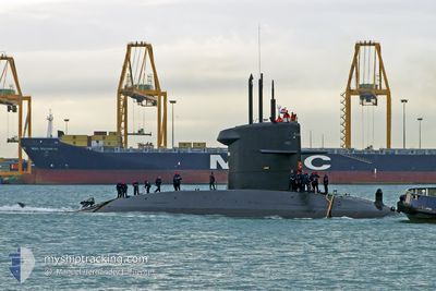
The vessel NATO WARSHIP (MMSI: 245375000) is a Other Type It's sailing under the flag of [NL] Netherlands.
In this page you can find informations about the vessels current position, last detected port calls, and current voyage information. If the vessels is not in coverage by AIS you will find the latest position.
The current position of NATO WARSHIP is detected by our AIS receivers and we are not responsible for the reliability of the data. The last position was recorded while the vessel was in Coverage by the Ais receivers of our vessel tracking app.
Weather
| Temperature | 5.6°C / 42.08°F |
|---|---|
| Wind Speed | 10 knots |
| Direction | 338° NNW |
| Pressure | 1014.7 hPa |
| Humidity | 79.7 % |
| Cloud Coverage | 17 % |
Featured Company
Last Port Calls
Most Visited Ports (Last year)
| Port | Arrivals |
|---|
Last Trips
| Origin | Departure | Destination | Arrival | Distance |
|---|
Events
| Tid | Hændelsen | Detaljer | Position / Dest | Info |
|---|---|---|---|---|
| 2024-04-18 03:28 | Udenfor Dækning |
59.55327 / 4.92955
North Sea
|
Fart: 6.5 kn Kurs: 43.9° |
|
| 2024-04-18 03:28 | Indenfor Dækning |
59.55327 / 4.92955
North Sea
|
Fart: 6.5 kn Kurs: 43.9° |
|
| 2024-04-10 16:47 | Udenfor Dækning |
60.17076 / 4.76787
North Sea
|
Fart: 5.8 kn Kurs: 205.2° |
|
| 2024-04-10 04:15 | Dybgangen er ændret | 0 10 |
58.97648 / 4.77498
|
Fart: 10.4 kn Kurs: 333.5° |
| 2024-04-10 01:34 | Ændre havområde | Norwegian part of the North Sea Norwegian part of the Skaggerak |
58.51660 / 5.12393
North Sea
|
Fart: 11 kn Kurs: 339.3° |
| 2024-04-10 01:32 | Indenfor Dækning |
58.51660 / 5.12393
North Sea
|
Fart: 11 kn Kurs: 339.3° |