
MSC VIRGO
Cargo A
Current Trip
| Time Travelled | 2 days |
|---|---|
| Remaining Time | 14 h, 31 mins |
| Distance Travelled | 892.43 nm |
| Remaining Distance | 265.88 nm |
| AVG Speed | 16.1 Knots |
| MAX Speed | 19.4 Knots |
| AVG Wind | 9 knots |
| MAX Wind | 26.6 knots |
| MIN Temp | 0.7°C / 33.26°F |
| MAX Temp | 8.5°C / 47.3°F |
| Dybgang | 11.6 m |
| Position Modtaget | Nu |
Current Position
| Longitude | 13.84675° |
|---|---|
| Latitude | 54.95703° |
| Status | Under way using engine |
| Fart | 18 Knots |
| Kurs | 72.8° |
| Område | Baltic Sea |
| Station | T-AIS |
| Position Modtaget | Nu |
Info
Information
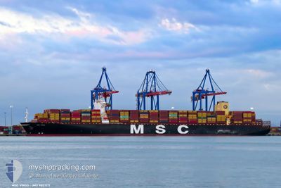
The current position of MSC VIRGO is in Baltic Sea with coordinates 54.95703° / 13.84675° as reported on 2024-04-25 10:16 by AIS to our vessel tracker app. The vessel's current speed is 18 Knots and is heading at the port of KLAIPEDA. The estimated time of arrival as calculated by MyShipTracking vessel tracking app is 2024-04-26 00:48 LT
The vessel MSC VIRGO (IMO: 9857171, MMSI: 255806340) is a Cargo A It's sailing under the flag of [PT] Portugal.
In this page you can find informations about the vessels current position, last detected port calls, and current voyage information. If the vessels is not in coverage by AIS you will find the latest position.
The current position of MSC VIRGO is detected by our AIS receivers and we are not responsible for the reliability of the data. The last position was recorded while the vessel was in Coverage by the Ais receivers of our vessel tracking app.
The current draught of MSC VIRGO as reported by AIS is 11.6 meters
Weather
| Temperature | 5.3°C / 41.54°F |
|---|---|
| Wind Speed | 15 knots |
| Direction | 109° ESE |
| Pressure | 1005.1 hPa |
| Humidity | 78.3 % |
| Cloud Coverage | 83 % |
Featured Company
Last Port Calls
| Port | Arrival | Departure | Time In Port |
|---|---|---|---|
| 2024-04-20 20:24 | 2024-04-23 05:07 | 2 d | |
| 2024-04-18 01:33 | 2024-04-20 03:26 | 2 d | |
| 2024-04-06 12:43 | 2024-04-07 13:23 | 1 d | |
| 2024-03-25 03:25 | 2024-03-26 05:25 | 1 d | |
| 2024-02-27 07:35 | 2024-02-28 08:12 | 1 d | |
| 2024-02-23 11:15 | 2024-02-26 01:11 | 2 d | |
| 2024-02-16 01:15 | 2024-02-18 05:43 | 2 d |
Most Visited Ports (Last year)
| Port | Arrivals | |
|---|---|---|
| 4 | ||
| 4 | ||
| 3 | ||
| 3 | ||
| 3 | ||
| 3 |
Last Trips
| Origin | Departure | Destination | Arrival | Distance | |
|---|---|---|---|---|---|
| 2024-04-20 05:26 | 2024-04-20 22:24 | 145.88 nm | |||
| 2024-04-07 13:23 | 2024-04-18 03:33 | 3865.63 nm | |||
| 2024-03-26 05:25 | 2024-04-06 12:43 | 464.23 nm | |||
| 2024-02-28 13:42 | 2024-03-25 03:25 | 7814.17 nm | |||
| 2024-02-26 06:41 | 2024-02-27 13:05 | 404.81 nm | |||
| 2024-02-18 11:13 | 2024-02-23 16:45 | 1186.67 nm | |||
| 2024-01-17 15:20 | 2024-02-16 06:45 | 10621.96 nm |
Events
| Tid | Hændelsen | Detaljer | Position / Dest | Info |
|---|---|---|---|---|
| 2024-04-25 10:03 | ETA er ændret | 2024/04/26 03:00 2024/04/25 23:05 |
54.93637 / 13.73654
BEANR - LTKLJ
|
Fart: 17.9 kn Kurs: 71° |
| 2024-04-25 07:14 | Ændre havområde | German part of the Baltic Sea Danish part of the Baltic Sea |
54.64545 / 12.39469
Baltic Sea
BEANR - LTKLJ
|
Fart: 16.4 kn Kurs: 48.2° |
| 2024-04-25 06:32 | Ændre havområde | Danish part of the Baltic Sea German part of the Baltic Sea |
54.52782 / 12.24740
Baltic Sea
BEANR - LTKLJ
|
Fart: 8.8 kn Kurs: 15.2° |
| 2024-04-25 05:53 | Ændre havområde | German part of the Baltic Sea Danish part of the Baltic Sea |
54.41184 / 12.12183
Baltic Sea
BEANR - LTKLJ
|
Fart: 16.4 kn Kurs: 87° |
| 2024-04-25 04:35 | Ændre havområde | Danish part of the Baltic Sea German part of the Baltic Sea |
54.48516 / 11.48018
Baltic Sea
BEANR - LTKLJ
|
Fart: 18.9 kn Kurs: 112.2° |
| 2024-04-25 03:20 | Ændre havområde | German part of the Baltic Sea Danish part of the Baltic Sea |
54.62827 / 10.90288
Baltic Sea
BEANR - LTKLJ
|
Fart: 14.4 kn Kurs: 122.8° |
| 2024-04-25 02:50 | Ændre havområde | Danish part of the Baltic Sea Danish part of the Kattegat |
54.72668 / 10.77869
Baltic Sea
BEANR - LTKLJ
|
Fart: 18.5 kn Kurs: 184.1° |
| 2024-04-24 21:44 | ETA er ændret | 2024/04/25 23:05 2024/04/25 23:10 |
56.05505 / 11.09118
BEANR - LTKLJ
|
Fart: 12.6 kn Kurs: 202.3° |
| 2024-04-24 21:38 | ETA er ændret | 2024/04/25 23:10 2024/04/25 23:05 |
56.07283 / 11.10550
BEANR - LTKLJ
|
Fart: 10.6 kn Kurs: 210° |
| 2024-04-24 20:23 | ETA er ændret | 2024/04/25 23:05 2024/04/25 23:00 |
56.33535 / 11.43078
BEANR - LTKLJ
|
Fart: 18.6 kn Kurs: 207.8° |