
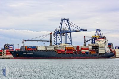
MSC REET II
Container Ship
Current Trip
| Trip Time | 2 days |
|---|---|
| Trip Distance | 276.29 nm |
| AVG Speed | 14.1 Knots |
| MAX Speed | 14.1 Knots |
| Dybgang | 9.2 m |
| AVG Wind | 8.7 knots |
| MAX Wind | 16.9 knots |
| MIN Temp | 16°C / 60.8°F |
| MAX Temp | 25.2°C / 77.36°F |
| Position Modtaget | 19 h, 51 m siden |
Current Position
| Longitude | 29.78344° |
|---|---|
| Latitude | 31.21158° |
| Status | At anchor |
| Fart | 6.4 Knots |
| Kurs | 148.5° |
| Område | Mediterranean Sea - Eastern Basin |
| Station | T-AIS |
| Position Modtaget | 19 h, 51 m siden |
Info
Information
The current position of MSC REET II is in Mediterranean Sea - Eastern Basin with coordinates 31.21158° / 29.78344° as reported on 2024-04-17 09:48 by AIS to our vessel tracker app. The vessel's current speed is 6.4 Knots and is currently inside the port of ALEXANDRIA.
The vessel MSC REET II (IMO: 9236224, MMSI: 636021153) is a Container Ship that was built in 2002 ( 22 år gamle ). It's sailing under the flag of [LR] Liberia.
In this page you can find informations about the vessels current position, last detected port calls, and current voyage information. If the vessels is not in coverage by AIS you will find the latest position.
The current position of MSC REET II is detected by our AIS receivers and we are not responsible for the reliability of the data. The last position was recorded while the vessel was in Coverage by the Ais receivers of our vessel tracking app.
The current draught of MSC REET II as reported by AIS is 9.2 meters
Weather
| Temperature | 19.2°C / 66.56°F |
|---|---|
| Wind Speed | 11 knots |
| Direction | 291° WNW |
| Pressure | 1011.6 hPa |
| Humidity | 83.5 % |
| Cloud Coverage | --- |
Featured Company
Last Port Calls
| Port | Arrival | Departure | Time In Port |
|---|---|---|---|
| 2024-04-17 10:36 | |||
| 2024-04-14 07:13 | 2024-04-15 02:35 | 19 h | |
| 2024-04-13 05:42 | |||
| 2024-04-10 20:06 | 2024-04-11 20:35 | 1 d | |
| 2024-04-07 04:26 | 2024-04-08 19:56 | 1 d | |
| 2024-04-04 11:16 | 2024-04-05 09:29 | 22 h | |
| 2024-04-01 15:01 | 2024-04-02 00:17 | 9 h | |
| 2024-03-25 14:38 | 2024-03-26 22:43 | 1 d | |
| 2024-03-24 00:58 | 2024-03-24 19:05 | 18 h | |
| 2024-03-24 00:45 | 2024-03-24 00:46 | 1 m |
Last Trips
| Origin | Departure | Destination | Arrival | Distance | |
|---|---|---|---|---|---|
| 2024-04-15 05:35 | 2024-04-17 12:36 | 276.29 nm | |||
| 2024-04-11 23:35 | 2024-04-13 08:42 | 213.74 nm | |||
| 2024-04-08 22:56 | 2024-04-10 23:06 | 572.47 nm | |||
| 2024-04-05 11:29 | 2024-04-07 07:26 | 522.98 nm | |||
| 2024-04-02 02:17 | 2024-04-04 13:16 | 25.53 nm | |||
| 2024-03-27 00:43 | 2024-04-01 17:01 | 225.19 nm | |||
| 2024-03-24 21:05 | 2024-03-25 16:38 | 161.40 nm | |||
| 2024-03-24 02:46 | 2024-03-24 02:58 | 16.65 nm | |||
| 2024-03-24 02:43 | 2024-03-24 02:45 | 5.01 nm | |||
| 2024-03-24 02:43 | 2024-03-23 09:41 | 2.44 nm |
Events
| Tid | Hændelsen | Detaljer | Position / Dest | Info |
|---|---|---|---|---|
| 2024-04-17 11:08 | STOP Sejllads |
31.18905 / 29.87490
[EG] ALEXANDRIA
|
Fart: 0.2 kn Kurs: 128° |
|
| 2024-04-17 10:36 | Skibe i havn |
|
31.16475 / 29.84798
[EG] ALEXANDRIA
|
Fart: 6.4 kn Kurs: 71° |
| 2024-04-17 09:52 | Status er ændret | Default At anchor |
31.20637 / 29.78674
EGALY
|
Fart: 6.4 kn Kurs: 148.5° |
| 2024-04-17 09:48 | Udenfor Dækning |
31.21158 / 29.78344
Mediterranean Sea - Eastern Basin
[EG] ALEXANDRIA
|
Fart: 6.4 kn Kurs: 148.5° |
|
| 2024-04-17 09:43 | START Sejllads | 4.62 nm, North of EL DEKHEILA |
31.21938 / 29.77708
EGALY
|
Fart: 4.3 kn Kurs: 139° |
| 2024-04-17 09:41 | ETA er ændret | 2024/04/17 09:00 2024/04/15 21:00 |
31.21998 / 29.77482
EGALY
|
Fart: 0.4 kn Kurs: 125° |
| 2024-04-17 09:33 | Status er ændret | At anchor Default |
31.21935 / 29.77420
EGALY
|
Fart: Kurs: 152° |
| 2024-04-17 09:25 | Indenfor Dækning |
31.21935 / 29.77420
Mediterranean Sea - Eastern Basin
|
Fart: 0.1 kn Kurs: 139° |
|
| 2024-04-17 08:09 | Status er ændret | Default At anchor |
31.21936 / 29.77378
EGALY
|
Fart: 0.1 kn Kurs: 164° |
| 2024-04-17 08:03 | Udenfor Dækning |
31.21942 / 29.77384
Mediterranean Sea - Eastern Basin
|
Fart: 0.1 kn Kurs: 61° |