
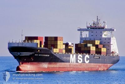
MSC MEDITERRANEAN
Container Ship
Current Trip
| Time Travelled | 8 days |
|---|---|
| Remaining Time | 1 day |
| Distance Travelled | 2362.68 nm |
| Remaining Distance | 368.20 nm |
| AVG Speed | 11.7 Knots |
| MAX Speed | 15.4 Knots |
| AVG Wind | 13 knots |
| MAX Wind | 21.3 knots |
| MIN Temp | 22.2°C / 71.96°F |
| MAX Temp | 28.6°C / 83.48°F |
| Dybgang | 9.9 m |
| Position Modtaget | 6 d siden |
Current Position
| Longitude | -62.00106° |
|---|---|
| Latitude | 11.62366° |
| Status | Under way using engine |
| Fart | 12.6 Knots |
| Kurs | 96.9° |
| Område | Caribbean Sea |
| Station | T-AIS |
| Position Modtaget | 6 d siden |
Info
Information
The current position of MSC MEDITERRANEAN is in Caribbean Sea with coordinates 11.62366° / -62.00106° as reported on 2024-04-17 06:30 by AIS to our vessel tracker app. The vessel's current speed is 12.6 Knots and is heading at the port of SUAPE. The estimated time of arrival as calculated by MyShipTracking vessel tracking app is 2024-04-24 23:11 LT
The vessel MSC MEDITERRANEAN (IMO: 9102710, MMSI: 357444000) is a Container Ship that was built in 1995 ( 29 år gamle ). It's sailing under the flag of [PA] Panama.
In this page you can find informations about the vessels current position, last detected port calls, and current voyage information. If the vessels is not in coverage by AIS you will find the latest position.
The current position of MSC MEDITERRANEAN is detected by our AIS receivers and we are not responsible for the reliability of the data. The last position was recorded while the vessel was in Coverage by the Ais receivers of our vessel tracking app.
The current draught of MSC MEDITERRANEAN as reported by AIS is 9.9 meters
Weather
| Temperature | 28.5°C / 83.3°F |
|---|---|
| Wind Speed | 9 knots |
| Direction | 127° SE |
| Pressure | 1011.3 hPa |
| Humidity | 77.8 % |
| Cloud Coverage | 100 % |
Featured Company
Last Port Calls
| Port | Arrival | Departure | Time In Port |
|---|---|---|---|
| 2024-04-13 18:55 | 2024-04-15 08:32 | 1 d | |
| 2024-04-08 08:41 | 2024-04-11 00:24 | 2 d | |
| 2024-03-25 01:08 | 2024-03-26 14:58 | 1 d | |
| 2024-03-16 08:37 | 2024-03-21 18:48 | 5 d | |
| 2024-03-12 22:01 | 2024-03-13 19:31 | 21 h | |
| 2024-03-05 20:01 | 2024-03-06 23:22 | 1 d | |
| 2024-02-26 08:09 | 2024-02-27 01:33 | 17 h | |
| 2024-02-23 06:01 | 2024-02-23 20:02 | 14 h | |
| 2024-02-21 02:14 | 2024-02-21 15:06 | 12 h | |
| 2024-02-10 14:24 | 2024-02-12 08:32 | 1 d |
Most Visited Ports (Last year)
| Port | Arrivals | |
|---|---|---|
| 16 | ||
| 8 | ||
| 8 | ||
| 8 | ||
| 8 | ||
| 8 |
Last Trips
| Origin | Departure | Destination | Arrival | Distance | |
|---|---|---|---|---|---|
| 2024-04-10 20:24 | 2024-04-13 14:55 | 935.49 nm | |||
| 2024-03-26 11:58 | 2024-04-08 04:41 | 1783.18 nm | |||
| 2024-03-21 16:18 | 2024-03-24 22:08 | 782.65 nm | |||
| 2024-03-13 15:31 | 2024-03-16 06:07 | 742.42 nm | |||
| 2024-03-06 18:22 | 2024-03-12 18:01 | 1569.27 nm | |||
| 2024-02-26 20:33 | 2024-03-05 15:01 | 1239.83 nm | |||
| 2024-02-23 14:02 | 2024-02-26 03:09 | 721.60 nm | |||
| 2024-02-21 09:06 | 2024-02-23 00:01 | 467.81 nm | |||
| 2024-02-12 03:32 | 2024-02-20 20:14 | 1593.09 nm | |||
| 2024-02-04 04:42 | 2024-02-10 09:24 | 1373.21 nm |
Events
| Tid | Hændelsen | Detaljer | Position / Dest | Info |
|---|---|---|---|---|
| 2024-04-17 06:42 | Status er ændret | Default Under way using engine |
11.61868 / -61.95787
BR SUA
|
Fart: 12.6 kn Kurs: 96.9° |
| 2024-04-17 06:30 | Udenfor Dækning |
11.62366 / -62.00106
Caribbean Sea
BR SUA
|
Fart: 12.6 kn Kurs: 96.9° |
|
| 2024-04-17 06:21 | Status er ændret | Under way using engine Default |
11.62638 / -62.03070
BR SUA
|
Fart: 12.6 kn Kurs: 101° |
| 2024-04-17 06:11 | Status er ændret | Default Under way using engine |
11.63177 / -62.06519
BR SUA
|
Fart: 12.5 kn Kurs: 99.6° |
| 2024-04-17 06:06 | Ændre havområde | Grenadian part of the Caribbean Sea Domican Republic part of the Caribbean Sea |
11.63451 / -62.08327
Caribbean Sea
BR SUA
|
Fart: 12.5 kn Kurs: 99.6° |
| 2024-04-17 06:06 | Status er ændret | Under way using engine Default |
11.63451 / -62.08327
BR SUA
|
Fart: 12.6 kn Kurs: 99° |
| 2024-04-17 05:53 | Indenfor Dækning |
11.63451 / -62.08327
Caribbean Sea
BR SUA
|
Fart: 12.5 kn Kurs: 99.6° |
|
| 2024-04-15 08:59 | Status er ændret | Default Under way using engine |
18.36005 / -69.55409
BR SUA
|
Fart: 13.4 kn Kurs: 131.2° |
| 2024-04-15 08:54 | Udenfor Dækning |
18.37346 / -69.57005
Caribbean Sea
BR SUA
|
Fart: 13.4 kn Kurs: 131.2° |
|
| 2024-04-15 08:48 | Status er ændret | Under way using engine Moored |
18.38713 / -69.58592
BR SUA
|
Fart: 12.5 kn Kurs: 159.7° |