
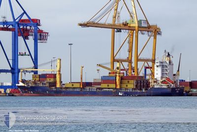
MSC MANON
Container Ship
Current Trip
LYTIP
| Time Travelled | 9 h, 21 mins |
|---|---|
| Remaining Time | --- |
| Distance Travelled | 93.71 nm |
| Remaining Distance | --- |
| AVG Speed | 10.8 Knots |
| MAX Speed | 11.6 Knots |
| AVG Wind | 22.4 knots |
| MAX Wind | 25 knots |
| MIN Temp | 15.6°C / 60.08°F |
| MAX Temp | 17.2°C / 62.96°F |
| Dybgang | 8.9 m |
| Position Modtaget | 4 d siden |
Current Position
| Longitude | 15.42896° |
|---|---|
| Latitude | 36.49797° |
| Status | Under way using engine |
| Fart | 15.2 Knots |
| Kurs | 217.2° |
| Område | Mediterranean Sea - Eastern Basin |
| Station | T-AIS |
| Position Modtaget | 4 d siden |
Info
Information
The current position of MSC MANON is in Mediterranean Sea - Eastern Basin with coordinates 36.49797° / 15.42896° as reported on 2024-04-19 01:35 by AIS to our vessel tracker app. The vessel's current speed is 15.2 Knots
The vessel MSC MANON (IMO: 9435820, MMSI: 255806063) is a Container Ship that was built in 2007 ( 17 år gamle ). It's sailing under the flag of [PT] Portugal.
In this page you can find informations about the vessels current position, last detected port calls, and current voyage information. If the vessels is not in coverage by AIS you will find the latest position.
The current position of MSC MANON is detected by our AIS receivers and we are not responsible for the reliability of the data. The last position was recorded while the vessel was in Coverage by the Ais receivers of our vessel tracking app.
The current draught of MSC MANON as reported by AIS is 8.9 meters
Weather
| Temperature | 15.6°C / 60.08°F |
|---|---|
| Wind Speed | 23 knots |
| Direction | 338° NNW |
| Pressure | 1009.8 hPa |
| Humidity | 77.9 % |
| Cloud Coverage | 23 % |
Featured Company
Last Port Calls
| Port | Arrival | Departure | Time In Port |
|---|---|---|---|
| 2024-04-20 08:48 | 2024-04-22 20:09 | 2 d | |
| 2024-04-16 17:24 | 2024-04-18 16:45 | 1 d | |
| 2024-04-15 07:33 | |||
| 2024-04-06 16:10 | 2024-04-07 19:51 | 1 d | |
| 2024-04-01 08:59 | 2024-04-03 02:10 | 1 d | |
| 2024-03-30 09:08 | 2024-03-31 01:02 | 15 h | |
| 2024-03-27 09:34 | 2024-03-29 14:23 | 2 d | |
| 2024-03-24 06:39 | 2024-03-25 19:44 | 1 d | |
| 2024-03-21 00:45 | 2024-03-21 10:13 | 9 h | |
| 2024-03-18 03:08 | 2024-03-18 09:41 | 6 h |
Most Visited Ports (Last year)
| Port | Arrivals | |
|---|---|---|
| 17 | ||
| 17 | ||
| 17 | ||
| 10 | ||
| 6 | ||
| 6 |
Last Trips
| Origin | Departure | Destination | Arrival | Distance | |
|---|---|---|---|---|---|
| 2024-04-18 18:45 | 2024-04-20 10:48 | 405.61 nm | |||
| 2024-04-15 09:33 | 2024-04-16 19:24 | 378.08 nm | |||
| 2024-04-03 04:10 | 2024-04-06 18:10 | 445.11 nm | |||
| 2024-03-31 03:02 | 2024-04-01 10:59 | 373.56 nm | |||
| 2024-03-29 15:23 | 2024-03-30 10:08 | 173.60 nm | |||
| 2024-03-25 21:44 | 2024-03-27 10:34 | 528.99 nm | |||
| 2024-03-21 13:13 | 2024-03-24 08:39 | 828.32 nm | |||
| 2024-03-18 12:41 | 2024-03-21 03:45 | 818.33 nm | |||
| 2024-03-08 05:00 | 2024-03-18 06:08 | 1211.69 nm | |||
| 2024-03-03 15:04 | 2024-03-05 10:55 | 181.55 nm |
Events
| Tid | Hændelsen | Detaljer | Position / Dest | Info |
|---|---|---|---|---|
| 2024-04-22 20:26 | START Sejllads | 1.79 nm, North East of TRIPOLI |
32.93126 / 13.22467
LYTIP
|
Fart: 7.9 kn Kurs: 348° |
| 2024-04-22 20:09 | Afsejlet fra sidste havn |
|
32.93126 / 13.22467
LYTIP
|
Fart: Kurs: -1° |
| 2024-04-20 10:03 | STOP Sejllads |
32.90500 / 13.19333
[LY] TRIPOLI
|
Fart: Kurs: -1° |
|
| 2024-04-20 08:48 | Skibe i havn |
|
32.91667 / 13.21333
[LY] TRIPOLI
|
Fart: 3 kn Kurs: -1° |
| 2024-04-20 04:50 | START Sejllads | 20.37 nm, North of TRIPOLI |
33.24506 / 13.25186
LYTIP
|
Fart: 5.9 kn Kurs: 205° |
| 2024-04-19 20:09 | STOP Sejllads | 14.82 nm, North of TRIPOLI |
33.15333 / 13.23667
LYTIP
|
Fart: Kurs: -1° |
| 2024-04-19 01:35 | Udenfor Dækning |
36.49797 / 15.42896
Mediterranean Sea - Eastern Basin
LYTIP
|
Fart: 15.2 kn Kurs: 217.2° |
|
| 2024-04-19 00:59 | Ændre havområde | Italian part of the Mediterranean Sea - Eastern Basin Italian part of the Ionian Sea |
36.62366 / 15.53204
Mediterranean Sea - Eastern Basin
LYTIP
|
Fart: 15.3 kn Kurs: 206° |
| 2024-04-18 17:59 | Ændre havområde | Italian part of the Ionian Sea Italian part of the Tyrrhenian Sea |
38.25785 / 15.65315
Ionian Sea
LYTIP
|
Fart: 15.7 kn Kurs: 249.7° |
| 2024-04-18 17:42 | Dybgangen er ændret | 8.9 9 |
38.31878 / 15.69834
LYTIP
|
Fart: 14.7 kn Kurs: 227.8° |