
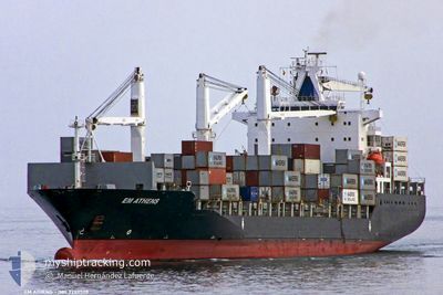
MSC MALENA
Container Ship
Current Trip
| Time Travelled | 3 days |
|---|---|
| Remaining Time | 5 h, 51 mins |
| Distance Travelled | 1037.59 nm |
| Remaining Distance | 90.85 nm |
| AVG Speed | 13.6 Knots |
| MAX Speed | 15.7 Knots |
| AVG Wind | 10.8 knots |
| MAX Wind | 17.9 knots |
| MIN Temp | 24.2°C / 75.56°F |
| MAX Temp | 27.3°C / 81.14°F |
| Dybgang | 11.7 m |
| Position Modtaget | 2 d siden |
Current Position
| Longitude | -80.99818° |
|---|---|
| Latitude | 23.97209° |
| Status | Under way using engine |
| Fart | 14 Knots |
| Kurs | 239.7° |
| Område | North Atlantic Ocean |
| Station | T-AIS |
| Position Modtaget | 2 d siden |
Info
Information
The current position of MSC MALENA is in North Atlantic Ocean with coordinates 23.97209° / -80.99818° as reported on 2024-04-22 15:59 by AIS to our vessel tracker app. The vessel's current speed is 14 Knots and is heading at the port of VERACRUZ. The estimated time of arrival as calculated by MyShipTracking vessel tracking app is 2024-04-25 09:28 LT
The vessel MSC MALENA (IMO: 9203538, MMSI: 636020360) is a Container Ship that was built in 2000 ( 24 år gamle ). It's sailing under the flag of [LR] Liberia.
In this page you can find informations about the vessels current position, last detected port calls, and current voyage information. If the vessels is not in coverage by AIS you will find the latest position.
The current position of MSC MALENA is detected by our AIS receivers and we are not responsible for the reliability of the data. The last position was recorded while the vessel was in Coverage by the Ais receivers of our vessel tracking app.
The current draught of MSC MALENA as reported by AIS is 11.7 meters
Weather
| Temperature | 26.6°C / 79.88°F |
|---|---|
| Wind Speed | 12 knots |
| Direction | 54° NE |
| Pressure | 1014.9 hPa |
| Humidity | 88.1 % |
| Cloud Coverage | --- |
Featured Company
Last Port Calls
| Port | Arrival | Departure | Time In Port |
|---|---|---|---|
| 2024-04-20 00:45 | 2024-04-22 00:28 | 1 d | |
| 2024-04-03 08:45 | 2024-04-03 21:46 | 13 h | |
| 2024-03-29 16:01 | 2024-03-31 00:50 | 1 d | |
| 2024-03-25 08:49 | 2024-03-26 22:20 | 1 d | |
| 2024-03-18 07:23 | 2024-03-19 05:54 | 22 h | |
| 2024-03-13 02:00 | 2024-03-14 12:33 | 1 d | |
| 2024-03-08 09:10 | 2024-03-09 01:42 | 16 h | |
| 2024-03-06 07:21 | 2024-03-06 19:01 | 11 h | |
| 2024-02-28 07:30 | 2024-03-01 07:19 | 1 d | |
| 2024-02-22 12:22 | 2024-02-23 01:39 | 13 h |
Most Visited Ports (Last year)
| Port | Arrivals | |
|---|---|---|
| 16 | ||
| 9 | ||
| 8 | ||
| 8 | ||
| 7 | ||
| 7 |
Last Trips
| Origin | Departure | Destination | Arrival | Distance | |
|---|---|---|---|---|---|
| 2024-04-03 18:46 | 2024-04-19 20:45 | 1945.95 nm | |||
| 2024-03-30 22:20 | 2024-04-03 05:45 | 731.89 nm | |||
| 2024-03-26 18:20 | 2024-03-29 13:31 | 729.42 nm | |||
| 2024-03-19 01:54 | 2024-03-25 04:49 | 1548.29 nm | |||
| 2024-03-14 08:33 | 2024-03-18 03:23 | 1008.04 nm | |||
| 2024-03-08 19:42 | 2024-03-12 22:00 | 754.40 nm | |||
| 2024-03-06 13:01 | 2024-03-08 03:10 | 464.79 nm | |||
| 2024-03-01 02:19 | 2024-03-06 01:21 | 1276.85 nm | |||
| 2024-02-22 21:39 | 2024-02-28 02:30 | 1458.29 nm | |||
| 2024-02-19 07:48 | 2024-02-22 08:22 | 730.49 nm |
Events
| Tid | Hændelsen | Detaljer | Position / Dest | Info |
|---|---|---|---|---|
| 2024-04-22 16:18 | Status er ændret | Default Under way using engine |
23.93389 / -81.06844
VERACRUZ
|
Fart: 14 kn Kurs: 239.7° |
| 2024-04-22 15:59 | Udenfor Dækning |
23.97209 / -80.99818
North Atlantic Ocean
VERACRUZ
|
Fart: 14 kn Kurs: 239.7° |
|
| 2024-04-22 15:40 | Status er ændret | Under way using engine Default |
24.00987 / -80.92902
VERACRUZ
|
Fart: 13.9 kn Kurs: 239° |
| 2024-04-22 15:17 | Status er ændret | Default Under way using engine |
24.05747 / -80.84425
VERACRUZ
|
Fart: 13.9 kn Kurs: 239.2° |
| 2024-04-22 15:14 | Status er ændret | Under way using engine Default |
24.06383 / -80.83270
VERACRUZ
|
Fart: 13.8 kn Kurs: 239° |
| 2024-04-22 15:14 | Indenfor Dækning |
24.06383 / -80.83270
North Atlantic Ocean
VERACRUZ
|
Fart: 14 kn Kurs: 239.2° |
|
| 2024-04-22 08:46 | Status er ændret | Default Under way using engine |
24.95860 / -79.67381
VERACRUZ
|
Fart: 13.4 kn Kurs: 195.3° |
| 2024-04-22 08:34 | Status er ændret | Under way using engine Default |
25.00277 / -79.66107
VERACRUZ
|
Fart: 13.4 kn Kurs: 195° |
| 2024-04-22 08:34 | Udenfor Dækning |
25.00277 / -79.66107
North Atlantic Ocean
VERACRUZ
|
Fart: 13.4 kn Kurs: 195.3° |
|
| 2024-04-22 08:09 | Status er ændret | Default Under way using engine |
25.09185 / -79.63541
VERACRUZ
|
Fart: 13.4 kn Kurs: 189.2° |