
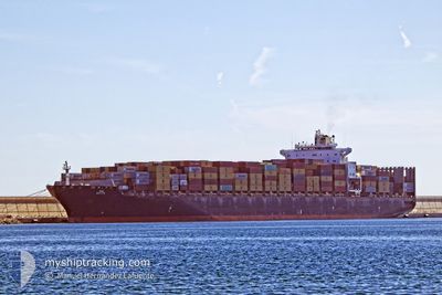
MSC DARIEN
Container Ship
Current Trip
| Time Travelled | 18 h, 4 mins |
|---|---|
| Remaining Time | 5 h, 38 mins |
| Distance Travelled | 247.67 nm |
| Remaining Distance | 70.92 nm |
| AVG Speed | 13.2 Knots |
| MAX Speed | 15 Knots |
| AVG Wind | 17.1 knots |
| MAX Wind | 20.8 knots |
| MIN Temp | 11.2°C / 52.16°F |
| MAX Temp | 19.1°C / 66.38°F |
| Dybgang | 9.6 m |
| Position Modtaget | 1 m siden |
Current Position
| Longitude | --- |
|---|---|
| Latitude | --- |
| Status | Under way using engine |
| Fart | 12.8 Knots |
| Kurs | 196° |
| Område | Mediterranean Sea - Eastern Basin |
| Station | T-AIS |
| Position Modtaget | 1 m siden |
Info
Information
The current position of MSC DARIEN is in Mediterranean Sea - Eastern Basin with coordinates 32.92242° / 34.82788° as reported on 2025-12-09 18:56 by AIS to our vessel tracker app. The vessel's current speed is 12.8 Knots and is heading at the port of ASHDOD. The estimated time of arrival as calculated by MyShipTracking vessel tracking app is 2025-12-10 02:35 LT
The vessel MSC DARIEN (IMO: 9243394, MMSI: 255803780) is a Container Ship that was built in 2003 ( 22 år gamle ). It's sailing under the flag of [PT] Portugal.
In this page you can find informations about the vessels current position, last detected port calls, and current voyage information. If the vessels is not in coverage by AIS you will find the latest position.
The current position of MSC DARIEN is detected by our AIS receivers and we are not responsible for the reliability of the data. The last position was recorded while the vessel was in Coverage by the Ais receivers of our vessel tracking app.
The current draught of MSC DARIEN as reported by AIS is 9.6 meters
Weather
| Temperature | 17.5°C / 63.5°F |
|---|---|
| Wind Speed | 18 knots |
| Direction | 190° S |
| Pressure | 1013 hPa |
| Humidity | 78.6 % |
| Cloud Coverage | 100 % |
Featured Company
Last Port Calls
| Port | Arrival | Departure | Time In Port |
|---|---|---|---|
| 2025-12-08 04:25 | 2025-12-09 03:53 | 23 h | |
| 2025-12-06 18:51 | 2025-12-07 21:17 | 1 d | |
| 2025-12-02 12:38 | 2025-12-04 00:03 | 1 d | |
| 2025-11-27 15:40 | 2025-11-28 23:57 | 1 d | |
| 2025-11-15 01:54 | 2025-11-15 16:38 | 14 h | |
| 2025-11-13 16:33 | 2025-11-14 13:26 | 20 h | |
| 2025-11-11 15:51 | 2025-11-12 10:21 | 18 h | |
| 2025-11-09 14:54 | 2025-11-11 02:35 | 1 d | |
| 2025-11-07 01:07 | 2025-11-07 13:02 | 11 h | |
| 2025-11-03 14:14 | 2025-11-04 23:04 | 1 d |
Most Visited Ports (Last year)
| Port | Arrivals | |
|---|---|---|
| 12 | ||
| 7 | ||
| 7 | ||
| 5 | ||
| 4 | ||
| 4 |
Last Trips
| Origin | Departure | Destination | Arrival | Distance | |
|---|---|---|---|---|---|
| 2025-12-07 21:17 | 2025-12-08 04:25 | 99.05 nm | |||
| 2025-12-04 00:03 | 2025-12-06 18:51 | 1033.24 nm | |||
| 2025-11-28 23:57 | 2025-12-02 12:38 | 788.32 nm | |||
| 2025-11-15 16:38 | 2025-11-27 15:40 | 4162.68 nm | |||
| 2025-11-14 13:26 | 2025-11-15 01:54 | 173.38 nm | |||
| 2025-11-12 10:21 | 2025-11-13 16:33 | 467.39 nm | |||
| 2025-11-11 02:35 | 2025-11-11 15:51 | 129.74 nm | |||
| 2025-11-07 13:02 | 2025-11-09 14:54 | 704.45 nm | |||
| 2025-11-04 23:04 | 2025-11-07 01:07 | 345.38 nm | |||
| 2025-10-25 23:34 | 2025-11-03 14:14 | 3420.31 nm |
Events
| Tid | Hændelsen | Detaljer | Position / Dest | Info |
|---|---|---|---|---|
| 2025-12-09 17:47 | Ændre havområde | Israeli part of the Mediterranean Sea - Eastern Basin Lebanese part of the Mediterranean Sea - Eastern Basin |
33.15987 / 34.83467
Mediterranean Sea - Eastern Basin
ILASH
|
Fart: 12.5 kn Kurs: 178° |
| 2025-12-09 10:15 | Ændre havområde | Lebanese part of the Mediterranean Sea - Eastern Basin Syrian part of the Mediterranean Sea - Eastern Basin |
34.78040 / 35.21105
Mediterranean Sea - Eastern Basin
ILASH
|
Fart: 13.6 kn Kurs: 188° |
| 2025-12-09 10:11 | Ændre havområde | Syrian part of the Mediterranean Sea - Eastern Basin Turkish part of the Mediterranean Sea - Eastern Basin |
34.79638 / 35.21433
Mediterranean Sea - Eastern Basin
ILASH
|
Fart: 13.5 kn Kurs: 186° |
| 2025-12-09 10:11 | Status er ændret | Under way using engine Default |
34.79638 / 35.21433
ILASH
|
Fart: 13.9 kn Kurs: 188° |
| 2025-12-09 09:53 | Indenfor Dækning |
34.79638 / 35.21433
Mediterranean Sea - Eastern Basin
ILASH
|
Fart: 13.5 kn Kurs: 186° |
|
| 2025-12-09 03:37 | Status er ændret | Default Under way using engine |
36.28517 / 35.58297
ILASH
|
Fart: 14.1 kn Kurs: 192° |
| 2025-12-09 03:29 | Udenfor Dækning |
36.31763 / 35.58847
Mediterranean Sea - Eastern Basin
ILASH
|
Fart: 14.1 kn Kurs: 192° |
|
| 2025-12-09 02:14 | Dybgangen er ændret | 9.6 9.9 |
36.55162 / 35.83240
ILASH
|
Fart: 14.8 kn Kurs: 228° |
| 2025-12-09 02:14 | Destination er ændret | ILASH TRISK |
36.55162 / 35.83240
ILASH
|
Fart: 14.8 kn Kurs: 228° |
| 2025-12-09 02:14 | ETA er ændret | 2025/12/10 01:00 2025/12/08 00:30 |
36.55162 / 35.83240
ILASH
|
Fart: 14.8 kn Kurs: 228° |