
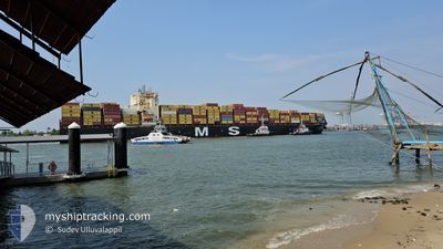
MSC BRITTANY
Cargo A
Current Trip
| Time Travelled | 12 days |
|---|---|
| Remaining Time | 1 h, 45 mins |
| Distance Travelled | 2139.83 nm |
| Remaining Distance | 25.74 nm |
| AVG Speed | 7.6 Knots |
| MAX Speed | 15 Knots |
| AVG Wind | 15.9 knots |
| MAX Wind | 30 knots |
| MIN Temp | 17.5°C / 63.5°F |
| MAX Temp | 26.4°C / 79.52°F |
| Dybgang | 11.3 m |
| Position Modtaget | 1 m siden |
Current Position
| Longitude | 31.47294° |
|---|---|
| Latitude | -29.82436° |
| Status | Under way using engine |
| Fart | 0.9 Knots |
| Kurs | 306° |
| Område | Indian Ocean |
| Station | T-AIS |
| Position Modtaget | 1 m siden |
Info
Information
The current position of MSC BRITTANY is in Indian Ocean with coordinates -29.82436° / 31.47294° as reported on 2024-04-18 22:48 by AIS to our vessel tracker app. The vessel's current speed is 0.9 Knots and is heading at the port of DURBAN. The estimated time of arrival as calculated by MyShipTracking vessel tracking app is 2024-04-19 00:34 LT
The vessel MSC BRITTANY (IMO: 9724049, MMSI: 255806430) is a Cargo A It's sailing under the flag of [PT] Portugal.
In this page you can find informations about the vessels current position, last detected port calls, and current voyage information. If the vessels is not in coverage by AIS you will find the latest position.
The current position of MSC BRITTANY is detected by our AIS receivers and we are not responsible for the reliability of the data. The last position was recorded while the vessel was in Coverage by the Ais receivers of our vessel tracking app.
The current draught of MSC BRITTANY as reported by AIS is 11.3 meters
Weather
| Temperature | 23.6°C / 74.48°F |
|---|---|
| Wind Speed | 5 knots |
| Direction | 21° NNE |
| Pressure | 1018.9 hPa |
| Humidity | 82.6 % |
| Cloud Coverage | --- |
Featured Company
Last Port Calls
| Port | Arrival | Departure | Time In Port |
|---|---|---|---|
| 2024-04-01 18:36 | 2024-04-06 06:59 | 4 d | |
| 2024-03-18 08:35 | |||
| 2024-03-09 15:27 | 2024-03-10 09:35 | 18 h | |
| 2024-03-08 08:21 | |||
| 2024-02-26 04:33 | 2024-02-27 07:16 | 1 d | |
| 2024-02-22 07:24 | 2024-02-22 19:48 | 12 h | |
| 2024-02-12 18:18 | 2024-02-13 09:26 | 15 h |
Last Trips
| Origin | Departure | Destination | Arrival | Distance | |
|---|---|---|---|---|---|
| 2024-03-18 12:35 | 2024-04-01 20:36 | 3889.12 nm | |||
| 2024-03-08 13:51 | 2024-03-09 20:57 | 333.32 nm | |||
| 2024-02-23 03:48 | 2024-02-26 12:33 | 69.07 nm | |||
| 2024-02-13 17:26 | 2024-02-22 15:24 | 2334.91 nm | |||
| 2024-01-31 14:33 | 2024-02-13 02:18 | 1580.62 nm |
Events
| Tid | Hændelsen | Detaljer | Position / Dest | Info |
|---|---|---|---|---|
| 2024-04-18 20:25 | Status er ændret | Under way using engine Default |
-29.81662 / 31.53583
DURBAN
|
Fart: 2 kn Kurs: -1° |
| 2024-04-18 20:18 | Indenfor Dækning |
-29.81645 / 31.53492
Indian Ocean
DURBAN
|
Fart: 1.9 kn Kurs: 282.8° |
|
| 2024-04-18 19:49 | START Sejllads |
-29.83984 / 31.49958
DURBAN
|
Fart: 4 kn Kurs: 64° |
|
| 2024-04-18 19:15 | STOP Sejllads |
-29.83333 / 31.49500
DURBAN
|
Fart: Kurs: -1° |
|
| 2024-04-18 17:54 | Status er ændret | Default Under way using engine |
-29.81788 / 31.49054
DURBAN
|
Fart: 3.8 kn Kurs: 149° |
| 2024-04-18 17:38 | Udenfor Dækning |
-29.80838 / 31.48480
Indian Ocean
DURBAN
|
Fart: 3.8 kn Kurs: 168.5° |
|
| 2024-04-18 17:18 | Status er ændret | Under way using engine Default |
-29.77763 / 31.48298
DURBAN
|
Fart: 2 kn Kurs: -1° |
| 2024-04-18 17:18 | START Sejllads |
-29.77763 / 31.48298
DURBAN
|
Fart: 4.6 kn Kurs: 170° |
|
| 2024-04-18 17:18 | Indenfor Dækning |
-29.77763 / 31.48298
Indian Ocean
DURBAN
|
Fart: 4.6 kn Kurs: 175.6° |
|
| 2024-04-18 16:39 | STOP Sejllads |
-29.76667 / 31.48667
DURBAN
|
Fart: Kurs: -1° |