
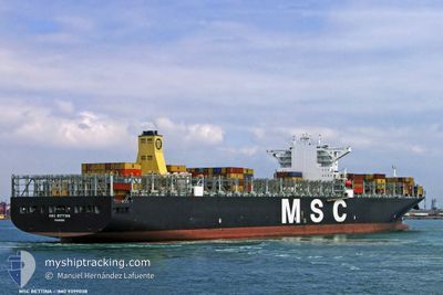
MSC BETTINA
Container Ship
Current Trip
COLOMBO
| Time Travelled | 2 h, 8 mins |
|---|---|
| Remaining Time | --- |
| Distance Travelled | 31.69 nm |
| Remaining Distance | --- |
| AVG Speed | 17.6 Knots |
| MAX Speed | 19.2 Knots |
| AVG Wind | 7.3 knots |
| MAX Wind | 7.9 knots |
| MIN Temp | 28.9°C / 84.02°F |
| MAX Temp | 29.4°C / 84.92°F |
| Dybgang | 14.7 m |
| Position Modtaget | 14 d siden |
Current Position
| Longitude | 19.20235° |
|---|---|
| Latitude | -34.78493° |
| Status | Under way using engine |
| Fart | 16 Knots |
| Kurs | 99.8° |
| Område | South Atlantic Ocean |
| Station | T-AIS |
| Position Modtaget | 14 d siden |
Info
Information
The current position of MSC BETTINA is in South Atlantic Ocean with coordinates -34.78493° / 19.20235° as reported on 2024-04-05 22:13 by AIS to our vessel tracker app. The vessel's current speed is 16 Knots
The vessel MSC BETTINA (IMO: 9399038, MMSI: 352361000) is a Container Ship that was built in 2010 ( 14 år gamle ). It's sailing under the flag of [PA] Panama.
In this page you can find informations about the vessels current position, last detected port calls, and current voyage information. If the vessels is not in coverage by AIS you will find the latest position.
The current position of MSC BETTINA is detected by our AIS receivers and we are not responsible for the reliability of the data. The last position was recorded while the vessel was in Coverage by the Ais receivers of our vessel tracking app.
The current draught of MSC BETTINA as reported by AIS is 14.7 meters
Weather
| Temperature | 28.9°C / 84.02°F |
|---|---|
| Wind Speed | 7 knots |
| Direction | 281° W |
| Pressure | 1007.7 hPa |
| Humidity | 74.5 % |
| Cloud Coverage | 100 % |
Featured Company
Last Port Calls
| Port | Arrival | Departure | Time In Port |
|---|---|---|---|
| 2024-04-19 23:04 | |||
| 2024-03-29 00:20 | 2024-03-30 10:37 | 1 d | |
| 2024-03-25 04:26 | 2024-03-27 15:54 | 2 d | |
| 2024-03-22 08:01 | 2024-03-23 19:09 | 1 d | |
| 2024-02-24 20:54 | 2024-02-26 04:14 | 1 d | |
| 2024-02-18 03:47 | 2024-02-18 23:46 | 19 h | |
| 2024-02-03 23:29 | 2024-02-04 10:46 | 11 h |
Last Trips
| Origin | Departure | Destination | Arrival | Distance | |
|---|---|---|---|---|---|
| 2024-03-27 15:54 | 2024-03-29 00:20 | 396.90 nm | |||
| 2024-03-23 19:09 | 2024-03-25 04:26 | 402.49 nm | |||
| 2024-02-26 12:14 | 2024-03-22 08:01 | 8346.20 nm | |||
| 2024-02-19 07:46 | 2024-02-25 04:54 | 1522.65 nm | |||
| 2024-02-04 19:46 | 2024-02-18 11:47 | 1851.70 nm | |||
| 2024-01-31 05:17 | 2024-02-04 08:29 | 856.03 nm |
Events
| Tid | Hændelsen | Detaljer | Position / Dest | Info |
|---|---|---|---|---|
| 2024-04-19 23:04 | Afsejlet fra sidste havn |
|
6.96877 / 79.83392
COLOMBO
|
Fart: 5.2 kn Kurs: 355° |
| 2024-04-17 16:59 | STOP Sejllads | 20.74 nm, West of COLOMBO |
6.86500 / 79.50166
COLOMBO
|
Fart: Kurs: -1° |
| 2024-04-17 14:41 | START Sejllads | 13.08 nm, North West of COLOMBO |
7.05662 / 79.64201
COLOMBO
|
Fart: 4 kn Kurs: 248° |
| 2024-04-17 01:11 | STOP Sejllads | 19.04 nm, West of COLOMBO |
6.93833 / 79.51833
COLOMBO
|
Fart: Kurs: -1° |
| 2024-04-16 22:51 | START Sejllads | 21.46 nm, North West of COLOMBO |
7.17820 / 79.55383
COLOMBO
|
Fart: 3.3 kn Kurs: 174° |
| 2024-04-16 18:11 | STOP Sejllads | 19.02 nm, West of COLOMBO |
7.07667 / 79.54166
COLOMBO
|
Fart: Kurs: -1° |