
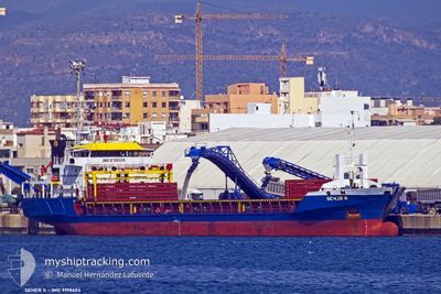
SEHER S
General Cargo
Current Trip
ILHFA
| Time Travelled | --- |
|---|---|
| Remaining Time | --- |
| Distance Travelled | --- |
| Remaining Distance | --- |
| AVG Speed | --- |
| MAX Speed | --- |
| AVG Wind | --- |
| MAX Wind | --- |
| MIN Temp | --- |
| MAX Temp | --- |
| Dybgang | 5.3 m |
| Position Modtaget | 1 m siden |
Current Position
| Longitude | 35.49079° |
|---|---|
| Latitude | 33.81826° |
| Status | Moored |
| Fart | |
| Kurs | 177° |
| Område | Mediterranean Sea - Eastern Basin |
| Station | T-AIS |
| Position Modtaget | 1 m siden |
Info
Information
The current position of SEHER S is in Mediterranean Sea - Eastern Basin with coordinates 33.81826° / 35.49079° as reported on 2024-04-20 15:30 by AIS to our vessel tracker app. The vessel's current speed is 0 Knots
The vessel SEHER S (IMO: 9198604, MMSI: 375115000) is a General Cargo that was built in 2001 ( 23 år gamle ). It's sailing under the flag of [VC] St Vincent Grenadines.
In this page you can find informations about the vessels current position, last detected port calls, and current voyage information. If the vessels is not in coverage by AIS you will find the latest position.
The current position of SEHER S is detected by our AIS receivers and we are not responsible for the reliability of the data. The last position was recorded while the vessel was in Coverage by the Ais receivers of our vessel tracking app.
The current draught of SEHER S as reported by AIS is 5.3 meters
Weather
| Temperature | 19.3°C / 66.74°F |
|---|---|
| Wind Speed | 3 knots |
| Direction | 331° NNW |
| Pressure | 1011.6 hPa |
| Humidity | 64 % |
| Cloud Coverage | 87 % |
Featured Company
Last Port Calls
| Port | Arrival | Departure | Time In Port |
|---|---|---|---|
| 2024-04-19 19:09 | |||
| 2024-04-19 16:00 | 2024-04-19 16:02 | 1 m | |
| 2024-04-19 15:58 | 2024-04-19 15:59 | 1 m | |
| 2024-04-01 18:00 | 2024-04-05 17:47 | 3 d | |
| 2024-03-20 21:52 | 2024-03-23 15:11 | 2 d | |
| 2024-03-02 01:52 | 2024-03-04 23:02 | 2 d | |
| 2024-02-23 20:31 | 2024-02-28 15:10 | 4 d | |
| 2024-02-18 00:26 | 2024-02-20 20:41 | 2 d | |
| 2024-02-10 16:14 | 2024-02-13 15:31 | 2 d |
Last Trips
| Origin | Departure | Destination | Arrival | Distance | |
|---|---|---|---|---|---|
| 2024-04-19 19:02 | 2024-04-19 22:09 | 116.97 nm | |||
| 2024-04-19 18:59 | 2024-04-19 19:00 | 3.22 nm | |||
| 2024-04-05 19:47 | 2024-04-19 18:58 | 3049.82 nm | |||
| 2024-03-23 15:11 | 2024-04-01 20:00 | 754.44 nm | |||
| 2024-03-05 02:02 | 2024-03-20 21:52 | 3211.88 nm | |||
| 2024-02-28 17:10 | 2024-03-02 04:52 | 366.07 nm | |||
| 2024-02-20 22:41 | 2024-02-23 22:31 | 701.10 nm | |||
| 2024-02-13 17:31 | 2024-02-18 02:26 | 136.90 nm | |||
| 2024-01-26 00:48 | 2024-02-10 18:14 | 3525.64 nm |
Events
| Tid | Hændelsen | Detaljer | Position / Dest | Info |
|---|---|---|---|---|
| 2024-04-20 14:58 | STOP Sejllads | 6.14 nm, South of BEIRUT |
33.81827 / 35.49078
ILHFA
|
Fart: Kurs: 177° |
| 2024-04-20 13:58 | START Sejllads | 6.81 nm, North West of BEIRUT |
33.96392 / 35.41328
ILHFA
|
Fart: 102.2 kn Kurs: 47.1° |
| 2024-04-20 09:11 | STOP Sejllads | 6.26 nm, South of BEIRUT |
33.81621 / 35.49053
ILHFA
|
Fart: 0.2 kn Kurs: 177° |
| 2024-04-20 09:10 | START Sejllads | 6.97 nm, South of BEIRUT |
33.80082 / 35.50171
ILHFA
|
Fart: 102.2 kn Kurs: 141.6° |
| 2024-04-20 07:24 | STOP Sejllads | 6.15 nm, South of BEIRUT |
33.81793 / 35.49119
ILHFA
|
Fart: 0.1 kn Kurs: 177° |
| 2024-04-20 07:23 | START Sejllads | 6.18 nm, South of BEIRUT |
33.81708 / 35.49238
ILHFA
|
Fart: 32.3 kn Kurs: 146.5° |
| 2024-04-20 07:16 | STOP Sejllads | 6.5 nm, South of BEIRUT |
33.81288 / 35.48731
ILHFA
|
Fart: 0.3 kn Kurs: 177° |
| 2024-04-20 05:58 | START Sejllads | 3.87 nm, South of BEIRUT |
33.85029 / 35.55045
ILHFA
|
Fart: 102.2 kn Kurs: 82.9° |
| 2024-04-20 05:57 | STOP Sejllads | 3.96 nm, South of BEIRUT |
33.84768 / 35.53086
ILHFA
|
Fart: 0.2 kn Kurs: 177° |
| 2024-04-20 03:25 | START Sejllads | 1.18 nm, South West of DBAIYEH |
33.92206 / 35.56385
ILHFA
|
Fart: 4.2 kn Kurs: 177° |