
MIRROR
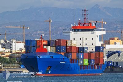
Container Ship
Current Trip
| Time Travelled | 4 days |
|---|---|
| Remaining Time | -1 mins |
| Distance Travelled | 1469.00 nm |
| Remaining Distance | 5.14 nm |
| AVG Speed | 14.7 Knots |
| MAX Speed | 17 Knots |
| AVG Wind | 11.6 knots |
| MAX Wind | 42.8 knots |
| MIN Temp | 12.9°C / 55.22°F |
| MAX Temp | 21.7°C / 71.06°F |
| Dybgang | 7.3 m |
| Position Modtaget | Nu |
Current Position
| Longitude | 28.68082° |
|---|---|
| Latitude | 40.93493° |
| Status | Under way using engine |
| Fart | 5.6 Knots |
| Kurs | 7.9° |
| Område | Sea of Marmara |
| Station | T-AIS |
| Position Modtaget | Nu |
Info
Information
The current position of MIRROR is in Sea of Marmara with coordinates 40.93493° / 28.68082° as reported on 2024-04-24 19:42 by AIS to our vessel tracker app. The vessel's current speed is 5.6 Knots and is heading at the port of AMBARLI. The estimated time of arrival as calculated by MyShipTracking vessel tracking app is 2024-04-24 19:42 LT
The vessel MIRROR (IMO: 9328041, MMSI: 255805842) is a Container Ship that was built in 2007 ( 17 år gamle ). It's sailing under the flag of [PT] Portugal.
In this page you can find informations about the vessels current position, last detected port calls, and current voyage information. If the vessels is not in coverage by AIS you will find the latest position.
The current position of MIRROR is detected by our AIS receivers and we are not responsible for the reliability of the data. The last position was recorded while the vessel was in Coverage by the Ais receivers of our vessel tracking app.
The current draught of MIRROR as reported by AIS is 7.3 meters
Weather
| Temperature | 18.5°C / 65.3°F |
|---|---|
| Wind Speed | 3 knots |
| Direction | 319° NW |
| Pressure | 1005.5 hPa |
| Humidity | 75.8 % |
| Cloud Coverage | 99 % |
Featured Company
Last Port Calls
| Port | Arrival | Departure | Time In Port |
|---|---|---|---|
| 2024-04-20 00:55 | 2024-04-20 12:36 | 11 h | |
| 2024-04-18 21:43 | 2024-04-19 14:36 | 16 h | |
| 2024-04-13 13:19 | 2024-04-13 16:31 | 3 h | |
| 2024-04-12 13:47 | 2024-04-12 20:44 | 6 h | |
| 2024-04-12 01:29 | 2024-04-12 10:15 | 8 h | |
| 2024-04-11 04:55 | 2024-04-11 12:07 | 7 h | |
| 2024-04-06 05:08 | 2024-04-06 22:07 | 16 h | |
| 2024-04-05 00:39 | 2024-04-05 18:44 | 18 h | |
| 2024-04-04 13:58 | 2024-04-04 19:08 | 5 h | |
| 2024-03-31 01:27 | 2024-03-31 14:19 | 12 h |
Last Trips
| Origin | Departure | Destination | Arrival | Distance | |
|---|---|---|---|---|---|
| 2024-04-19 16:36 | 2024-04-20 02:55 | 162.53 nm | |||
| 2024-04-13 19:31 | 2024-04-18 23:43 | 1399.09 nm | |||
| 2024-04-12 23:44 | 2024-04-13 16:19 | 252.44 nm | |||
| 2024-04-12 13:15 | 2024-04-12 16:47 | 45.60 nm | |||
| 2024-04-11 15:07 | 2024-04-12 04:29 | 55.62 nm | |||
| 2024-04-07 00:07 | 2024-04-11 07:55 | 1464.87 nm | |||
| 2024-04-05 20:44 | 2024-04-06 07:08 | 162.53 nm | |||
| 2024-04-04 21:08 | 2024-04-05 02:39 | 24.08 nm | |||
| 2024-03-31 17:19 | 2024-04-04 15:58 | 1544.16 nm | |||
| 2024-03-30 00:28 | 2024-03-31 04:27 | 13.25 nm |
Events
| Tid | Hændelsen | Detaljer | Position / Dest | Info |
|---|---|---|---|---|
| 2024-04-24 18:58 | START Sejllads | 11.07 nm, South of AMBARLI |
40.77949 / 28.62144
AMBARLI
|
Fart: 9.1 kn Kurs: 45.3° |
| 2024-04-24 18:23 | STOP Sejllads | 11.13 nm, South of AMBARLI |
40.77892 / 28.61891
AMBARLI
|
Fart: 0.3 kn Kurs: 234° |
| 2024-04-24 13:38 | Status er ændret | Under way using engine Default |
40.59163 / 27.23096
AMBARLI
|
Fart: 16 kn Kurs: 64° |
| 2024-04-24 13:35 | Status er ændret | Default Under way using engine |
40.58429 / 27.21070
AMBARLI
|
Fart: 16.3 kn Kurs: 64.5° |
| 2024-04-24 13:10 | Status er ændret | Under way using engine Default |
40.53692 / 27.08179
AMBARLI
|
Fart: 16.6 kn Kurs: 69° |
| 2024-04-24 13:10 | Indenfor Dækning |
40.53692 / 27.08179
Sea of Marmara
AMBARLI
|
Fart: 16.2 kn Kurs: 66.4° |
|
| 2024-04-24 11:43 | Status er ændret | Default Under way using engine |
40.36420 / 26.66034
AMBARLI
|
Fart: 15.2 kn Kurs: 46.4° |
| 2024-04-24 11:24 | Udenfor Dækning |
40.30505 / 26.59150
Sea of Marmara
AMBARLI
|
Fart: 15.2 kn Kurs: 46.4° |
|
| 2024-04-24 09:32 | Ændre havområde | Turkish part of the Sea of Marmara Turkish part of the Aegean Sea |
40.02025 / 26.19036
Sea of Marmara
AMBARLI
|
Fart: 9.6 kn Kurs: 75.8° |
| 2024-04-24 09:03 | Status er ændret | Under way using engine Default |
39.99122 / 26.04519
AMBARLI
|
Fart: 15.2 kn Kurs: 60° |