
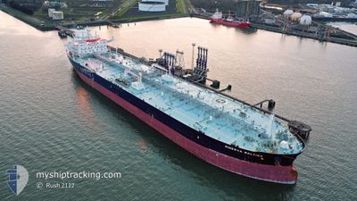
MINERVA BALTICA
Tanker
Current Trip
PT SIE
| Time Travelled | 3 days |
|---|---|
| Remaining Time | --- |
| Distance Travelled | 7.00 nm |
| Remaining Distance | --- |
| AVG Speed | 3.6 Knots |
| MAX Speed | 5.5 Knots |
| AVG Wind | 9.3 knots |
| MAX Wind | 16.8 knots |
| MIN Temp | 14.9°C / 58.82°F |
| MAX Temp | 17.5°C / 63.5°F |
| Dybgang | 11.9 m |
| Position Modtaget | 3 m siden |
Current Position
| Longitude | -8.88246° |
|---|---|
| Latitude | 37.87888° |
| Status | At anchor |
| Fart | |
| Kurs | 296° |
| Område | North Atlantic Ocean |
| Station | T-AIS |
| Position Modtaget | 3 m siden |
Info
Information
The current position of MINERVA BALTICA is in North Atlantic Ocean with coordinates 37.87888° / -8.88246° as reported on 2024-04-19 02:12 by AIS to our vessel tracker app. The vessel's current speed is 0 Knots
The vessel MINERVA BALTICA (IMO: 9728241, MMSI: 248292000) is a Tanker It's sailing under the flag of [MT] Malta.
In this page you can find informations about the vessels current position, last detected port calls, and current voyage information. If the vessels is not in coverage by AIS you will find the latest position.
The current position of MINERVA BALTICA is detected by our AIS receivers and we are not responsible for the reliability of the data. The last position was recorded while the vessel was in Coverage by the Ais receivers of our vessel tracking app.
The current draught of MINERVA BALTICA as reported by AIS is 11.9 meters
Weather
| Temperature | 16.1°C / 60.98°F |
|---|---|
| Wind Speed | 4 knots |
| Direction | 185° S |
| Pressure | 1014.8 hPa |
| Humidity | 91.2 % |
| Cloud Coverage | 66 % |
Featured Company
Last Port Calls
| Port | Arrival | Departure | Time In Port |
|---|---|---|---|
| 2024-04-14 05:57 | 2024-04-15 15:37 | 1 d | |
| 2024-04-02 06:15 | 2024-04-02 15:25 | 9 h | |
| 2024-03-03 04:55 | 2024-03-03 13:49 | 8 h | |
| 2024-02-26 22:46 | 2024-02-28 23:57 | 2 d | |
| 2024-02-16 23:27 | 2024-02-18 16:43 | 1 d | |
| 2024-02-06 23:12 | 2024-02-08 05:30 | 1 d |
Last Trips
| Origin | Departure | Destination | Arrival | Distance | |
|---|---|---|---|---|---|
| 2024-02-29 01:57 | 2024-04-14 06:57 | 5159.50 nm | |||
| 2024-02-29 01:57 | 2024-04-02 08:15 | 2841.09 nm | |||
| 2024-02-29 01:57 | 2024-03-03 06:55 | 653.95 nm | |||
| 2024-02-18 17:43 | 2024-02-27 00:46 | 542.37 nm | |||
| 2024-02-08 06:30 | 2024-02-17 00:27 | 812.86 nm | |||
| 2024-01-29 12:27 | 2024-02-07 00:12 | 1149.88 nm |
Events
| Tid | Hændelsen | Detaljer | Position / Dest | Info |
|---|---|---|---|---|
| 2024-04-18 04:41 | Status er ændret | At anchor Default |
37.87827 / -8.88336
PT SIE
|
Fart: Kurs: 299° |
| 2024-04-18 04:38 | Status er ændret | Default At anchor |
37.87827 / -8.88337
PT SIE
|
Fart: Kurs: 297° |
| 2024-04-17 08:35 | Status er ændret | At anchor Default |
37.87746 / -8.88434
PT SIE
|
Fart: Kurs: 350° |
| 2024-04-17 08:32 | Status er ændret | Default At anchor |
37.87748 / -8.88439
PT SIE
|
Fart: 0.1 kn Kurs: 353° |
| 2024-04-16 20:38 | Status er ændret | At anchor Default |
37.87762 / -8.88432
PT SIE
|
Fart: Kurs: 344° |
| 2024-04-16 20:35 | Status er ændret | Default At anchor |
37.87759 / -8.88426
PT SIE
|
Fart: Kurs: 343° |
| 2024-04-16 19:50 | Status er ændret | At anchor Default |
37.87742 / -8.88426
PT SIE
|
Fart: Kurs: -1° |
| 2024-04-16 19:47 | Status er ændret | Default At anchor |
37.87667 / -8.88333
PT SIE
|
Fart: Kurs: 351° |
| 2024-04-16 11:59 | Status er ændret | At anchor Default |
37.87766 / -8.88381
PT SIE
|
Fart: Kurs: 334° |
| 2024-04-16 11:56 | Status er ændret | Default At anchor |
37.87770 / -8.88380
PT SIE
|
Fart: Kurs: 333° |