
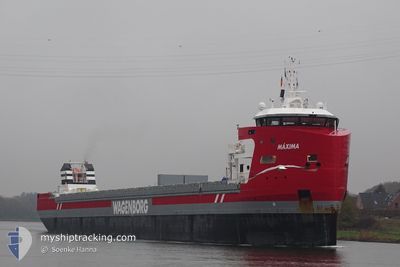
MAXIMA
Cargo
Current Trip
ESSCI
| Time Travelled | 1 day |
|---|---|
| Remaining Time | --- |
| Distance Travelled | 302.07 nm |
| Remaining Distance | --- |
| AVG Speed | 9.9 Knots |
| MAX Speed | 10.6 Knots |
| AVG Wind | 10.8 knots |
| MAX Wind | 17.6 knots |
| MIN Temp | 10.6°C / 51.08°F |
| MAX Temp | 13.1°C / 55.58°F |
| Dybgang | 4.7 m |
| Position Modtaget | 3 h, 49 m siden |
Current Position
| Longitude | -6.87771° |
|---|---|
| Latitude | 48.42786° |
| Status | Under way using engine |
| Fart | 9.9 Knots |
| Kurs | 4.7° |
| Område | Celtic Sea |
| Station | T-AIS |
| Position Modtaget | 3 h, 49 m siden |
Info
Information
The current position of MAXIMA is in Celtic Sea with coordinates 48.42786° / -6.87771° as reported on 2024-04-19 07:54 by AIS to our vessel tracker app. The vessel's current speed is 9.9 Knots
The vessel MAXIMA (IMO: 9882061, MMSI: 246539000) is a Cargo It's sailing under the flag of [NL] Netherlands.
In this page you can find informations about the vessels current position, last detected port calls, and current voyage information. If the vessels is not in coverage by AIS you will find the latest position.
The current position of MAXIMA is detected by our AIS receivers and we are not responsible for the reliability of the data. The last position was recorded while the vessel was in Coverage by the Ais receivers of our vessel tracking app.
The current draught of MAXIMA as reported by AIS is 4.7 meters
Weather
| Temperature | 10.7°C / 51.26°F |
|---|---|
| Wind Speed | 10 knots |
| Direction | 346° NNW |
| Pressure | 1024.8 hPa |
| Humidity | 84 % |
| Cloud Coverage | 25 % |
Featured Company
Last Port Calls
| Port | Arrival | Departure | Time In Port |
|---|---|---|---|
| 2024-04-16 09:58 | 2024-04-18 03:10 | 1 d | |
| 2024-04-01 18:44 | 2024-04-05 15:09 | 3 d | |
| 2024-03-22 07:57 | 2024-03-24 13:21 | 2 d | |
| 2024-03-14 15:15 | 2024-03-20 19:20 | 6 d | |
| 2024-02-18 20:24 |
Most Visited Ports (Last year)
| Port | Arrivals | |
|---|---|---|
| 4 | ||
| 4 | ||
| 4 | ||
| 2 | ||
| 2 | ||
| 2 |
Last Trips
| Origin | Departure | Destination | Arrival | Distance | |
|---|---|---|---|---|---|
| 2024-04-05 17:09 | 2024-04-16 11:58 | 670.84 nm | |||
| 2024-03-24 15:21 | 2024-04-01 20:44 | 1947.70 nm | |||
| 2024-03-20 20:20 | 2024-03-22 09:57 | 399.73 nm | |||
| 2024-01-23 08:35 | 2024-02-18 21:24 | 4600.56 nm |
Events
| Tid | Hændelsen | Detaljer | Position / Dest | Info |
|---|---|---|---|---|
| 2024-04-19 07:54 | Udenfor Dækning |
48.42786 / -6.87771
Celtic Sea
|
Fart: 9.9 kn Kurs: 4.7° |
|
| 2024-04-19 07:37 | Fundet i havområde | French part of the Celtic Sea |
48.38298 / -6.88375
Celtic Sea
|
Fart: 10.1 kn Kurs: 4.9° |
| 2024-04-19 07:37 | Indenfor Dækning |
48.38298 / -6.88375
Celtic Sea
|
Fart: 10.1 kn Kurs: 4.9° |
|
| 2024-04-18 08:53 | Status er ændret | Default Under way using engine |
44.63562 / -7.33885
ESSCI
|
Fart: 9.5 kn Kurs: 5.9° |
| 2024-04-18 08:04 | Udenfor Dækning |
44.50395 / -7.35327
North Atlantic Ocean
|
Fart: 9.5 kn Kurs: 5.9° |
|
| 2024-04-18 07:04 | Fundet i havområde | Spanish part of the North Atlantic Ocean |
44.34443 / -7.36504
North Atlantic Ocean
|
Fart: 9.7 kn Kurs: 1.6° |
| 2024-04-18 05:18 | Status er ændret | Under way using engine Default |
44.05920 / -7.40736
ESSCI
|
Fart: 10 kn Kurs: 6° |
| 2024-04-18 05:02 | Indenfor Dækning |
44.05920 / -7.40736
Bay of Biscay
|
Fart: 10.3 kn Kurs: 4.7° |
|
| 2024-04-18 03:16 | START Sejllads | 0.79 nm, North East of SAN CIPRIAN |
43.72352 / -7.45247
ESSCI
|
Fart: 8.3 kn Kurs: 19° |
| 2024-04-18 03:10 | Afsejlet fra sidste havn |
|
43.72352 / -7.45247
ESSCI
|
Fart: 2 kn Kurs: 70° |