
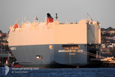
MARGUERITE ACE
Vehicles Carrier
Current Trip
| Time Travelled | 7 days |
|---|---|
| Remaining Time | --- |
| Distance Travelled | 2359.92 nm |
| Remaining Distance | --- |
| AVG Speed | 16.1 Knots |
| MAX Speed | 20 Knots |
| AVG Wind | 16.6 knots |
| MAX Wind | 31.5 knots |
| MIN Temp | 11.8°C / 53.24°F |
| MAX Temp | 21.9°C / 71.42°F |
| Dybgang | 8.8 m |
| Position Modtaget | 4 d siden |
Current Position
| Longitude | -54.69118° |
|---|---|
| Latitude | -35.12846° |
| Status | Under way using engine |
| Fart | 15.6 Knots |
| Kurs | 96.5° |
| Område | South Atlantic Ocean |
| Station | T-AIS |
| Position Modtaget | 4 d siden |
Info
Information
The current position of MARGUERITE ACE is in South Atlantic Ocean with coordinates -35.12846° / -54.69118° as reported on 2024-04-15 04:41 by AIS to our vessel tracker app. The vessel's current speed is 15.6 Knots and is heading at the port of DURBAN. The estimated time of arrival as calculated by MyShipTracking vessel tracking app is 2024-04-23 23:50 LT
The vessel MARGUERITE ACE (IMO: 9426386, MMSI: 372158000) is a Vehicles Carrier that was built in 2009 ( 15 år gamle ). It's sailing under the flag of [PA] Panama.
In this page you can find informations about the vessels current position, last detected port calls, and current voyage information. If the vessels is not in coverage by AIS you will find the latest position.
The current position of MARGUERITE ACE is detected by our AIS receivers and we are not responsible for the reliability of the data. The last position was recorded while the vessel was in Coverage by the Ais receivers of our vessel tracking app.
The current draught of MARGUERITE ACE as reported by AIS is 8.8 meters
Weather
| Temperature | 11.9°C / 53.42°F |
|---|---|
| Wind Speed | 17 knots |
| Direction | 125° SE |
| Pressure | 1021.8 hPa |
| Humidity | 67.4 % |
| Cloud Coverage | 100 % |
Featured Company
Last Port Calls
| Port | Arrival | Departure | Time In Port |
|---|---|---|---|
| 2024-04-12 11:02 | 2024-04-12 21:17 | 10 h | |
| 2024-04-08 08:45 | 2024-04-08 21:22 | 12 h | |
| 2024-04-06 13:54 | 2024-04-07 03:58 | 14 h | |
| 2024-03-28 07:05 | 2024-03-28 17:48 | 10 h | |
| 2024-03-23 00:41 | 2024-03-24 00:07 | 23 h | |
| 2024-03-20 22:50 | 2024-03-22 01:17 | 1 d | |
| 2024-03-17 13:03 | 2024-03-18 21:07 | 1 d | |
| 2024-03-16 09:29 | 2024-03-17 12:36 | 1 d | |
| 2024-03-02 18:15 | 2024-03-03 06:49 | 12 h | |
| 2024-02-14 15:26 | 2024-02-15 09:03 | 17 h |
Last Trips
| Origin | Departure | Destination | Arrival | Distance | |
|---|---|---|---|---|---|
| 2024-04-08 18:22 | 2024-04-12 08:02 | 1098.95 nm | |||
| 2024-04-07 00:58 | 2024-04-08 05:45 | 493.09 nm | |||
| 2024-03-28 12:48 | 2024-04-06 10:54 | 3859.67 nm | |||
| 2024-03-23 20:07 | 2024-03-28 02:05 | 1424.28 nm | |||
| 2024-03-21 21:17 | 2024-03-22 20:41 | 169.73 nm | |||
| 2024-03-18 17:07 | 2024-03-20 18:50 | 602.35 nm | |||
| 2024-03-17 08:36 | 2024-03-17 09:03 | 0.91 nm | |||
| 2024-03-03 00:49 | 2024-03-16 05:29 | 3929.90 nm | |||
| 2024-02-15 18:03 | 2024-03-02 12:15 | 6779.61 nm | |||
| 2024-02-14 17:00 | 2024-02-15 00:26 | 96.00 nm |
Events
| Tid | Hændelsen | Detaljer | Position / Dest | Info |
|---|---|---|---|---|
| 2024-04-15 04:45 | Status er ændret | Default Under way using engine |
-35.13050 / -54.67176
ZA DUR
|
Fart: 15.6 kn Kurs: 96.5° |
| 2024-04-15 04:41 | Udenfor Dækning |
-35.12846 / -54.69118
South Atlantic Ocean
ZA DUR
|
Fart: 15.6 kn Kurs: 96.5° |
|
| 2024-04-15 03:23 | Ændre havområde | Uruguayan part of the South Atlantic Ocean Uruguayan part of the Rio de La Plata |
-35.08259 / -55.10235
South Atlantic Ocean
ZA DUR
|
Fart: 15.7 kn Kurs: 106.1° |
| 2024-04-15 02:14 | Dybgangen er ændret | 8.8 8.6 |
-35.07926 / -55.47432
ZA DUR
|
Fart: 16.7 kn Kurs: 91° |
| 2024-04-15 02:14 | ETA er ændret | 2024/04/23 23:50 2024/04/23 23:00 |
-35.07926 / -55.47432
ZA DUR
|
Fart: 16.7 kn Kurs: 91° |
| 2024-04-15 02:01 | Ændre havområde | Uruguayan part of the Rio de La Plata Argentinean part of the Rio de La Plata |
-35.07876 / -55.54360
Rio de La Plata
ZA DUR
|
Fart: 15.9 kn Kurs: 88.2° |
| 2024-04-15 02:00 | Status er ændret | Under way using engine Default |
-35.07894 / -55.55123
ZA DUR
|
Fart: 15.6 kn Kurs: 88° |
| 2024-04-15 02:00 | Indenfor Dækning |
-35.07876 / -55.54360
Rio de La Plata
ZA DUR
|
Fart: 15.9 kn Kurs: 88.2° |
|
| 2024-04-14 16:21 | START Sejllads | 8.18 nm, North of LA PLATA |
-34.71417 / -57.86418
ZA DUR
|
Fart: 4.3 kn Kurs: 57° |
| 2024-04-13 04:13 | STOP Sejllads | 8 nm, North of LA PLATA |
-34.71667 / -57.86833
ZA DUR
|
Fart: Kurs: -1° |