
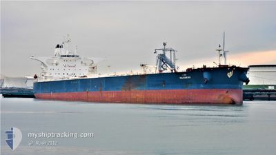
MAHARAH
Tanker
Current Trip
| Time Travelled | --- |
|---|---|
| Remaining Time | --- |
| Distance Travelled | 1014.95 nm |
| Remaining Distance | --- |
| AVG Speed | 6.6 Knots |
| MAX Speed | 12.6 Knots |
| AVG Wind | 16.1 knots |
| MAX Wind | 33.8 knots |
| MIN Temp | 2.1°C / 35.78°F |
| MAX Temp | 22.6°C / 72.68°F |
| Dybgang | 10.6 m |
| Position Modtaget | 5 d siden |
Current Position
| Longitude | 101.94746° |
|---|---|
| Latitude | 2.20854° |
| Status | Under way using engine |
| Fart | 12.5 Knots |
| Kurs | 310.3° |
| Område | Malacca Strait |
| Station | T-AIS |
| Position Modtaget | 5 d siden |
Info
Information
The current position of MAHARAH is in Malacca Strait with coordinates 2.20854° / 101.94746° as reported on 2024-04-20 17:42 by AIS to our vessel tracker app. The vessel's current speed is 12.5 Knots and is heading at the port of FUJAIRAH. The estimated time of arrival as calculated by MyShipTracking vessel tracking app is 2024-05-02 02:00 LT
The vessel MAHARAH (IMO: 9779812, MMSI: 403532000) is a Tanker It's sailing under the flag of [SA] Saudi Arabia.
In this page you can find informations about the vessels current position, last detected port calls, and current voyage information. If the vessels is not in coverage by AIS you will find the latest position.
The current position of MAHARAH is detected by our AIS receivers and we are not responsible for the reliability of the data. The last position was recorded while the vessel was in Coverage by the Ais receivers of our vessel tracking app.
The current draught of MAHARAH as reported by AIS is 10.6 meters
Weather
| Temperature | 29.4°C / 84.92°F |
|---|---|
| Wind Speed | 3 knots |
| Direction | 180° S |
| Pressure | 1006.5 hPa |
| Humidity | 71.5 % |
| Cloud Coverage | 82 % |
Featured Company
Last Port Calls
Most Visited Ports (Last year)
| Port | Arrivals | |
|---|---|---|
| 1 | ||
| 1 | ||
| 1 |
Last Trips
| Origin | Departure | Destination | Arrival | Distance |
|---|
Events
| Tid | Hændelsen | Detaljer | Position / Dest | Info |
|---|---|---|---|---|
| 2024-04-20 17:48 | Status er ændret | Default Under way using engine |
2.22206 / 101.93152
AEFJR
|
Fart: 12.5 kn Kurs: 310.3° |
| 2024-04-20 17:42 | Status er ændret | Under way using engine Default |
2.20854 / 101.94746
AEFJR
|
Fart: 12.5 kn Kurs: 310° |
| 2024-04-20 17:42 | Udenfor Dækning |
2.20854 / 101.94746
Malacca Strait
AEFJR
|
Fart: 12.5 kn Kurs: 310.3° |
|
| 2024-04-20 17:37 | Status er ændret | Default Under way using engine |
2.19568 / 101.96251
AEFJR
|
Fart: 12.4 kn Kurs: 312.3° |
| 2024-04-20 08:49 | Ændre havområde | Malaysian part of the Malacca Strait Malaysian part of the Singapore Strait |
1.22388 / 103.46120
Malacca Strait
AEFJR
|
Fart: 12.7 kn Kurs: 283.6° |
| 2024-04-20 08:14 | Ændre havområde | Malaysian part of the Singapore Strait Indonesian part of the Singapore Strait |
1.19582 / 103.58061
Singapore Strait
AEFJR
|
Fart: 12.3 kn Kurs: 283.9° |
| 2024-04-20 07:29 | Ændre havområde | Indonesian part of the Singapore Strait Singaporean part of the Singapore Strait |
1.13355 / 103.72889
Singapore Strait
AEFJR
|
Fart: 13.1 kn Kurs: 268.9° |
| 2024-04-20 05:56 | Ændre havområde | Singaporean part of the Singapore Strait Indonesian part of the Singapore Strait |
1.25106 / 103.98783
Singapore Strait
AEFJR
|
Fart: 10.8 kn Kurs: 253.7° |
| 2024-04-20 05:38 | Ændre havområde | Indonesian part of the Singapore Strait Singaporean part of the Singapore Strait |
1.26635 / 104.03617
Singapore Strait
AEFJR
|
Fart: 8.2 kn Kurs: 235.7° |
| 2024-04-20 05:05 | Ændre havområde | Singaporean part of the Singapore Strait Malaysian part of the Singapore Strait |
1.30262 / 104.05849
Singapore Strait
AEFJR
|
Fart: 6.2 kn Kurs: 258.7° |