
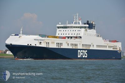
MAGNOLIA SEAWAYS
Ro-Ro Cargo
Current Trip
| Time Travelled | 16 h, 3 mins |
|---|---|
| Remaining Time | 39 mins |
| Distance Travelled | 309.89 nm |
| Remaining Distance | 15.14 nm |
| AVG Speed | 18.5 Knots |
| MAX Speed | 20.9 Knots |
| AVG Wind | 20.7 knots |
| MAX Wind | 27.6 knots |
| MIN Temp | 6.6°C / 43.88°F |
| MAX Temp | 9°C / 48.2°F |
| Dybgang | 7.4 m |
| Position Modtaget | Nu |
Current Position
| Longitude | 0.17356° |
|---|---|
| Latitude | 53.55002° |
| Status | Under way using engine |
| Fart | 18.4 Knots |
| Kurs | 277.1° |
| Område | North Sea |
| Station | T-AIS |
| Position Modtaget | Nu |
Info
Information
The current position of MAGNOLIA SEAWAYS is in North Sea with coordinates 53.55002° / 0.17356° as reported on 2024-04-19 09:56 by AIS to our vessel tracker app. The vessel's current speed is 18.4 Knots and is heading at the port of IMMINGHAM. The estimated time of arrival as calculated by MyShipTracking vessel tracking app is 2024-04-19 10:36 LT
The vessel MAGNOLIA SEAWAYS (IMO: 9259496, MMSI: 219455000) is a Ro-Ro Cargo that was built in 2003 ( 21 år gamle ). It's sailing under the flag of [DK] Denmark.
In this page you can find informations about the vessels current position, last detected port calls, and current voyage information. If the vessels is not in coverage by AIS you will find the latest position.
The current position of MAGNOLIA SEAWAYS is detected by our AIS receivers and we are not responsible for the reliability of the data. The last position was recorded while the vessel was in Coverage by the Ais receivers of our vessel tracking app.
The current draught of MAGNOLIA SEAWAYS as reported by AIS is 7.4 meters
Weather
| Temperature | 7.8°C / 46.04°F |
|---|---|
| Wind Speed | 22 knots |
| Direction | 339° NNW |
| Pressure | 1013.4 hPa |
| Humidity | 87.3 % |
| Cloud Coverage | 50 % |
Featured Company
Last Port Calls
| Port | Arrival | Departure | Time In Port |
|---|---|---|---|
| 2024-04-18 09:24 | 2024-04-18 17:54 | 8 h | |
| 2024-04-16 21:12 | 2024-04-17 12:18 | 15 h | |
| 2024-04-16 11:24 | 2024-04-16 11:45 | 20 m | |
| 2024-04-15 03:37 | 2024-04-15 14:15 | 10 h | |
| 2024-04-13 14:31 | 2024-04-14 02:02 | 11 h | |
| 2024-04-12 05:45 | 2024-04-12 14:46 | 9 h | |
| 2024-04-10 19:34 | 2024-04-11 08:29 | 12 h | |
| 2024-04-09 13:36 | 2024-04-09 22:17 | 8 h | |
| 2024-04-08 01:29 | 2024-04-08 15:38 | 14 h | |
| 2024-04-06 12:39 | 2024-04-07 03:07 | 14 h |
Most Visited Ports (Last year)
| Port | Arrivals | |
|---|---|---|
| 174 | ||
| 168 | ||
| 14 | ||
| 11 | ||
| 8 | ||
| 4 |
Last Trips
| Origin | Departure | Destination | Arrival | Distance | |
|---|---|---|---|---|---|
| 2024-04-17 13:18 | 2024-04-18 11:24 | 329.58 nm | |||
| 2024-04-16 12:45 | 2024-04-16 22:12 | 77.97 nm | |||
| 2024-04-15 16:15 | 2024-04-16 12:24 | 328.27 nm | |||
| 2024-04-14 03:02 | 2024-04-15 05:37 | 330.83 nm | |||
| 2024-04-12 16:46 | 2024-04-13 15:31 | 329.28 nm | |||
| 2024-04-11 09:29 | 2024-04-12 07:45 | 330.29 nm | |||
| 2024-04-10 00:17 | 2024-04-10 20:34 | 328.96 nm | |||
| 2024-04-08 16:38 | 2024-04-09 15:36 | 329.65 nm | |||
| 2024-04-07 05:07 | 2024-04-08 02:29 | 330.40 nm | |||
| 2024-04-05 14:17 | 2024-04-06 14:39 | 328.91 nm |
Events
| Tid | Hændelsen | Detaljer | Position / Dest | Info |
|---|---|---|---|---|
| 2024-04-19 09:42 | Indenfor Dækning |
53.55568 / .29076
North Sea
DECUX <=> GBIMM
|
Fart: 17.6 kn Kurs: 266.6° |
|
| 2024-04-19 08:36 | Udenfor Dækning |
53.59257 / .90074
North Sea
DECUX <=> GBIMM
|
Fart: 20.5 kn Kurs: 266.8° |
|
| 2024-04-19 07:07 | Fundet i havområde | United Kingdom part of the North Sea |
53.63093 / 1.72116
North Sea
DECUX <=> GBIMM
|
Fart: 20 kn Kurs: 273° |
| 2024-04-19 07:07 | Indenfor Dækning |
53.63093 / 1.72116
North Sea
DECUX <=> GBIMM
|
Fart: 20 kn Kurs: 273° |
|
| 2024-04-19 01:23 | Udenfor Dækning |
53.65152 / 4.92763
North Sea
DECUX <=> GBIMM
|
Fart: 19.2 kn Kurs: 255.9° |
|
| 2024-04-18 22:56 | Ændre havområde | Dutch part of the North Sea German part of the North Sea |
53.81822 / 6.24662
North Sea
DECUX <=> GBIMM
|
Fart: 20.1 kn Kurs: 255.5° |
| 2024-04-18 17:54 | Afsejlet fra sidste havn |
|
53.86410 / 8.72795
DECUX <=> GBIMM
|
Fart: 6.1 kn Kurs: 349° |
| 2024-04-18 17:53 | START Sejllads |
53.86255 / 8.72802
[DE] CUXHAVEN
|
Fart: 3.4 kn Kurs: 336° |
|
| 2024-04-18 17:42 | Dybgangen er ændret | 7.4 6.6 |
53.86229 / 8.72435
[DE] CUXHAVEN
|
Fart: Kurs: 135° |
| 2024-04-18 17:37 | Status er ændret | Under way using engine Moored |
53.86229 / 8.72434
[DE] CUXHAVEN
|
Fart: Kurs: 136° |