
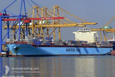
MAERSK STRALSUND
Container Ship
Current Trip
| Time Travelled | 1 day |
|---|---|
| Remaining Time | --- |
| Distance Travelled | 732.74 nm |
| Remaining Distance | --- |
| AVG Speed | 17.6 Knots |
| MAX Speed | 19.7 Knots |
| AVG Wind | 14 knots |
| MAX Wind | 23 knots |
| MIN Temp | 17.1°C / 62.78°F |
| MAX Temp | 20.6°C / 69.08°F |
| Dybgang | 15.1 m |
| Position Modtaget | 1 h, 8 m siden |
Current Position
| Longitude | -14.14334° |
|---|---|
| Latitude | 27.09615° |
| Status | Under way using engine |
| Fart | 18.9 Knots |
| Kurs | 213.5° |
| Område | North Atlantic Ocean |
| Station | T-AIS |
| Position Modtaget | 1 h, 8 m siden |
Info
Information
The current position of MAERSK STRALSUND is in North Atlantic Ocean with coordinates 27.09615° / -14.14334° as reported on 2024-04-24 23:44 by AIS to our vessel tracker app. The vessel's current speed is 18.9 Knots and is heading at the port of SALALAH. The estimated time of arrival as calculated by MyShipTracking vessel tracking app is 2024-05-13 12:30 LT
The vessel MAERSK STRALSUND (IMO: 9303522, MMSI: 563032800) is a Container Ship that was built in 2005 ( 19 år gamle ). It's sailing under the flag of [SG] Singapore.
In this page you can find informations about the vessels current position, last detected port calls, and current voyage information. If the vessels is not in coverage by AIS you will find the latest position.
The current position of MAERSK STRALSUND is detected by our AIS receivers and we are not responsible for the reliability of the data. The last position was recorded while the vessel was in Coverage by the Ais receivers of our vessel tracking app.
The current draught of MAERSK STRALSUND as reported by AIS is 15.1 meters
Weather
| Temperature | 19.6°C / 67.28°F |
|---|---|
| Wind Speed | 15 knots |
| Direction | 29° NNE |
| Pressure | 1015.4 hPa |
| Humidity | 81.2 % |
| Cloud Coverage | 4 % |
Featured Company
Last Port Calls
| Port | Arrival | Departure | Time In Port |
|---|---|---|---|
| 2024-04-22 20:55 | 2024-04-23 10:03 | 13 h | |
| 2024-04-21 10:57 | 2024-04-22 03:55 | 16 h | |
| 2024-03-25 13:00 | 2024-03-26 15:57 | 1 d | |
| 2024-03-19 05:18 | 2024-03-21 03:40 | 1 d | |
| 2024-02-20 11:52 | 2024-02-21 11:50 | 23 h | |
| 2024-02-13 14:50 | 2024-02-15 05:24 | 1 d | |
| 2024-02-08 15:25 | 2024-02-09 10:58 | 19 h | |
| 2024-02-06 11:21 | 2024-02-07 03:53 | 16 h | |
| 2024-02-05 00:25 | 2024-02-05 11:25 | 10 h | |
| 2024-02-03 02:29 | 2024-02-03 13:41 | 11 h |
Most Visited Ports (Last year)
| Port | Arrivals | |
|---|---|---|
| 11 | ||
| 8 | ||
| 8 | ||
| 4 | ||
| 4 | ||
| 4 |
Last Trips
| Origin | Departure | Destination | Arrival | Distance | |
|---|---|---|---|---|---|
| 2024-04-22 05:55 | 2024-04-22 22:55 | 9.71 nm | |||
| 2024-03-26 21:27 | 2024-04-21 12:57 | 9868.23 nm | |||
| 2024-02-21 12:50 | 2024-03-19 09:18 | 10247.07 nm | |||
| 2024-02-09 11:58 | 2024-02-20 12:52 | 3498.77 nm | |||
| 2024-02-09 11:58 | 2024-02-13 16:50 | 1548.76 nm | |||
| 2024-02-07 04:53 | 2024-02-08 16:25 | 515.93 nm | |||
| 2024-02-05 12:25 | 2024-02-06 12:21 | 418.70 nm | |||
| 2024-02-03 14:41 | 2024-02-05 01:25 | 115.61 nm | |||
| 2024-01-10 15:37 | 2024-02-03 03:29 | 9551.38 nm |
Events
| Tid | Hændelsen | Detaljer | Position / Dest | Info |
|---|---|---|---|---|
| 2024-04-24 23:50 | Status er ændret | Default Under way using engine |
27.06800 / -14.16405
OMSLV
|
Fart: 18.9 kn Kurs: 213.5° |
| 2024-04-24 23:44 | Status er ændret | Under way using engine Default |
27.09615 / -14.14334
OMSLV
|
Fart: 18.9 kn Kurs: 214° |
| 2024-04-24 23:44 | Udenfor Dækning |
27.09615 / -14.14334
North Atlantic Ocean
OMSLV
|
Fart: 18.9 kn Kurs: 213.5° |
|
| 2024-04-24 22:54 | Status er ændret | Default Under way using engine |
27.31304 / -13.98639
OMSLV
|
Fart: 18.7 kn Kurs: 215.8° |
| 2024-04-24 22:22 | Status er ændret | Under way using engine Default |
27.45233 / -13.87769
OMSLV
|
Fart: 18.8 kn Kurs: 210° |
| 2024-04-24 22:10 | Status er ændret | Default Under way using engine |
27.50410 / -13.84431
OMSLV
|
Fart: 18.9 kn Kurs: 213.3° |
| 2024-04-24 22:02 | Status er ændret | Under way using engine Default |
27.54342 / -13.81675
OMSLV
|
Fart: 19 kn Kurs: 213° |
| 2024-04-24 21:53 | Status er ændret | Default Under way using engine |
27.58169 / -13.78911
OMSLV
|
Fart: 18.9 kn Kurs: 213° |
| 2024-04-24 21:34 | Ændre havområde | Western Saharan part of the North Atlantic Ocean Moroccan part of the North Atlantic Ocean |
27.66561 / -13.72791
North Atlantic Ocean
OMSLV
|
Fart: 19 kn Kurs: 213.3° |
| 2024-04-24 20:11 | Status er ændret | Under way using engine Default |
28.04067 / -13.45530
OMSLV
|
Fart: 19.2 kn Kurs: 214° |