
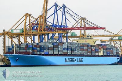
MAERSK SOFIA
Container Ship
Current Trip
| Time Travelled | 18 h, 36 mins |
|---|---|
| Remaining Time | 4 days |
| Distance Travelled | 69.39 nm |
| Remaining Distance | 2408.18 nm |
| AVG Speed | 15.6 Knots |
| MAX Speed | 19.7 Knots |
| AVG Wind | 5 knots |
| MAX Wind | 6.9 knots |
| MIN Temp | 27.9°C / 82.22°F |
| MAX Temp | 29.2°C / 84.56°F |
| Dybgang | 10.7 m |
| Position Modtaget | 14 h, 33 m siden |
Current Position
| Longitude | 104.72239° |
|---|---|
| Latitude | 1.60771° |
| Status | Under way using engine |
| Fart | 18.2 Knots |
| Kurs | 48.9° |
| Område | South China Sea |
| Station | T-AIS |
| Position Modtaget | 14 h, 33 m siden |
Info
Information
The current position of MAERSK SOFIA is in South China Sea with coordinates 1.60771° / 104.72239° as reported on 2024-04-18 06:18 by AIS to our vessel tracker app. The vessel's current speed is 18.2 Knots and is heading at the port of QINGDAO. The estimated time of arrival as calculated by MyShipTracking vessel tracking app is 2024-04-23 12:08 LT
The vessel MAERSK SOFIA (IMO: 9308637, MMSI: 563001200) is a Container Ship that was built in 2007 ( 17 år gamle ). It's sailing under the flag of [SG] Singapore.
In this page you can find informations about the vessels current position, last detected port calls, and current voyage information. If the vessels is not in coverage by AIS you will find the latest position.
The current position of MAERSK SOFIA is detected by our AIS receivers and we are not responsible for the reliability of the data. The last position was recorded while the vessel was in Coverage by the Ais receivers of our vessel tracking app.
The current draught of MAERSK SOFIA as reported by AIS is 10.7 meters
Weather
| Temperature | 29.2°C / 84.56°F |
|---|---|
| Wind Speed | 2 knots |
| Direction | 159° SSE |
| Pressure | 1008.1 hPa |
| Humidity | 68.2 % |
| Cloud Coverage | 97 % |
Featured Company
Last Port Calls
| Port | Arrival | Departure | Time In Port |
|---|---|---|---|
| 2024-04-16 23:41 | 2024-04-18 02:16 | 1 d | |
| 2024-03-28 05:16 | 2024-03-30 01:04 | 1 d | |
| 2024-03-19 20:46 | 2024-03-24 11:23 | 4 d | |
| 2024-03-11 09:54 | 2024-03-13 07:17 | 1 d | |
| 2024-02-05 17:04 | 2024-02-06 19:01 | 1 d | |
| 2024-02-02 11:38 | 2024-02-03 03:46 | 16 h |
Most Visited Ports (Last year)
| Port | Arrivals | |
|---|---|---|
| 8 | ||
| 5 | ||
| 4 | ||
| 4 | ||
| 4 | ||
| 3 |
Last Trips
| Origin | Departure | Destination | Arrival | Distance | |
|---|---|---|---|---|---|
| 2024-03-30 03:04 | 2024-04-17 07:41 | 6742.09 nm | |||
| 2024-03-24 12:23 | 2024-03-28 07:16 | 959.74 nm | |||
| 2024-03-13 08:17 | 2024-03-19 21:46 | 1434.69 nm | |||
| 2024-02-07 03:01 | 2024-03-11 10:54 | 7651.86 nm | |||
| 2024-02-03 11:46 | 2024-02-06 01:04 | 66.54 nm | |||
| 2024-01-29 13:40 | 2024-02-02 19:38 | 1669.59 nm |
Events
| Tid | Hændelsen | Detaljer | Position / Dest | Info |
|---|---|---|---|---|
| 2024-04-18 06:52 | Status er ændret | Default Under way using engine |
1.74637 / 104.82260
SGSIN >> CNTST
|
Fart: 18.2 kn Kurs: 48.9° |
| 2024-04-18 06:18 | Udenfor Dækning |
1.60771 / 104.72239
South China Sea
SGSIN >> CNTST
|
Fart: 18.2 kn Kurs: 48.9° |
|
| 2024-04-18 04:52 | Ændre havområde | Malaysian part of the South China Sea Malaysian part of the Singapore Strait |
1.31685 / 104.37220
South China Sea
SGSIN >> CNTST
|
Fart: 19.8 kn Kurs: 38.9° |
| 2024-04-18 04:46 | Ændre havområde | Malaysian part of the Singapore Strait Indonesian part of the Singapore Strait |
1.29193 / 104.35119
Singapore Strait
SGSIN >> CNTST
|
Fart: 19.4 kn Kurs: 40.6° |
| 2024-04-18 04:40 | Ændre havområde | Indonesian part of the Singapore Strait Malaysian part of the Singapore Strait |
1.27312 / 104.32679
Singapore Strait
SGSIN >> CNTST
|
Fart: 19.7 kn Kurs: 77.1° |
| 2024-04-18 04:26 | Ændre havområde | Malaysian part of the Singapore Strait Indonesian part of the Singapore Strait |
1.25792 / 104.24884
Singapore Strait
SGSIN >> CNTST
|
Fart: 19.6 kn Kurs: 80.5° |
| 2024-04-18 03:05 | Ændre havområde | Indonesian part of the Singapore Strait Singaporean part of the Singapore Strait |
1.18423 / 103.83995
Singapore Strait
SGSIN >> CNTST
|
Fart: 15.7 kn Kurs: 95.6° |
| 2024-04-18 02:16 | Afsejlet fra sidste havn |
|
1.27970 / 103.74642
SGSIN >> CNTST
|
Fart: 7 kn Kurs: 180° |
| 2024-04-18 02:08 | START Sejllads |
1.28859 / 103.75703
[SG] SINGAPORE
|
Fart: 3.1 kn Kurs: 252° |
|
| 2024-04-18 01:42 | Status er ændret | Under way using engine Moored |
1.28550 / 103.75755
[SG] SINGAPORE
|
Fart: Kurs: 121° |