
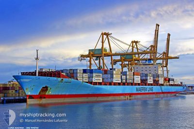
M/V LUNA MAERSK
Container Ship
Current Trip
| Time Travelled | 3 days |
|---|---|
| Remaining Time | 2 days |
| Distance Travelled | 905.60 nm |
| Remaining Distance | 986.75 nm |
| AVG Speed | 12.1 Knots |
| MAX Speed | 14.8 Knots |
| AVG Wind | 13.3 knots |
| MAX Wind | 28.9 knots |
| MIN Temp | 14.1°C / 57.38°F |
| MAX Temp | 26°C / 78.8°F |
| Dybgang | 12.8 m |
| Position Modtaget | 14 h, 24 m siden |
Current Position
| Longitude | 14.02422° |
|---|---|
| Latitude | 36.58817° |
| Status | Under way using engine |
| Fart | 13.6 Knots |
| Kurs | 286.8° |
| Område | Mediterranean Sea - Eastern Basin |
| Station | T-AIS |
| Position Modtaget | 14 h, 24 m siden |
Info
Information
The current position of M/V LUNA MAERSK is in Mediterranean Sea - Eastern Basin with coordinates 36.58817° / 14.02422° as reported on 2024-04-19 02:12 by AIS to our vessel tracker app. The vessel's current speed is 13.6 Knots and is heading at the port of TANGER MED. The estimated time of arrival as calculated by MyShipTracking vessel tracking app is 2024-04-22 04:58 LT
The vessel M/V LUNA MAERSK (IMO: 9190781, MMSI: 477648700) is a Container Ship that was built in 2002 ( 22 år gamle ). It's sailing under the flag of [HK] Hong Kong.
In this page you can find informations about the vessels current position, last detected port calls, and current voyage information. If the vessels is not in coverage by AIS you will find the latest position.
The current position of M/V LUNA MAERSK is detected by our AIS receivers and we are not responsible for the reliability of the data. The last position was recorded while the vessel was in Coverage by the Ais receivers of our vessel tracking app.
The current draught of M/V LUNA MAERSK as reported by AIS is 12.8 meters
Weather
| Temperature | 15.8°C / 60.44°F |
|---|---|
| Wind Speed | 18 knots |
| Direction | 302° WNW |
| Pressure | 1012.2 hPa |
| Humidity | 70.4 % |
| Cloud Coverage | 100 % |
Featured Company
Last Port Calls
| Port | Arrival | Departure | Time In Port |
|---|---|---|---|
| 2024-04-15 05:51 | 2024-04-15 22:50 | 16 h | |
| 2024-04-13 23:35 | 2024-04-15 00:21 | 1 d | |
| 2024-04-13 06:25 | 2024-04-13 16:17 | 9 h | |
| 2024-04-11 12:07 | 2024-04-12 05:02 | 16 h | |
| 2024-04-09 23:12 | 2024-04-10 20:57 | 21 h | |
| 2024-04-05 16:46 | 2024-04-06 11:45 | 18 h | |
| 2024-04-04 12:15 | 2024-04-05 13:49 | 1 d | |
| 2024-03-21 19:03 | 2024-03-24 02:05 | 2 d | |
| 2024-03-20 14:45 | 2024-03-21 07:41 | 16 h | |
| 2024-03-12 20:09 | 2024-03-13 22:33 | 1 d |
Most Visited Ports (Last year)
| Port | Arrivals | |
|---|---|---|
| 13 | ||
| 12 | ||
| 12 | ||
| 9 | ||
| 7 | ||
| 6 |
Last Trips
| Origin | Departure | Destination | Arrival | Distance | |
|---|---|---|---|---|---|
| 2024-04-15 03:21 | 2024-04-15 08:51 | 61.77 nm | |||
| 2024-04-13 19:17 | 2024-04-14 02:35 | 60.05 nm | |||
| 2024-04-12 08:02 | 2024-04-13 09:25 | 377.46 nm | |||
| 2024-04-10 23:57 | 2024-04-11 15:07 | 280.95 nm | |||
| 2024-04-06 13:45 | 2024-04-10 02:12 | 1513.71 nm | |||
| 2024-04-05 13:49 | 2024-04-05 18:46 | 31.01 nm | |||
| 2024-03-23 21:05 | 2024-04-04 12:15 | 4344.07 nm | |||
| 2024-03-21 02:41 | 2024-03-21 14:03 | 44.30 nm | |||
| 2024-03-13 17:33 | 2024-03-20 09:45 | 1517.06 nm | |||
| 2024-03-11 05:32 | 2024-03-12 15:09 | 364.72 nm |
Events
| Tid | Hændelsen | Detaljer | Position / Dest | Info |
|---|---|---|---|---|
| 2024-04-19 02:12 | Udenfor Dækning |
36.58817 / 14.02422
Mediterranean Sea - Eastern Basin
MAPTM
|
Fart: 13.6 kn Kurs: 286.8° |
|
| 2024-04-19 00:08 | ETA er ændret | 2024/04/21 21:30 2024/04/21 23:30 |
36.47123 / 14.58009
MAPTM
|
Fart: 12.8 kn Kurs: 283.1° |
| 2024-04-18 21:37 | Fundet i havområde | Italian part of the Mediterranean Sea - Eastern Basin |
36.43764 / 15.26440
Mediterranean Sea - Eastern Basin
MAPTM
|
Fart: 13.7 kn Kurs: 269.7° |
| 2024-04-18 21:37 | Indenfor Dækning |
36.43764 / 15.26440
Mediterranean Sea - Eastern Basin
MAPTM
|
Fart: 13.7 kn Kurs: 269.7° |
|
| 2024-04-17 17:13 | Status er ændret | Default Under way using engine |
36.25816 / 22.53551
MAPTM
|
Fart: 11.7 kn Kurs: 210.7° |
| 2024-04-17 17:10 | Udenfor Dækning |
36.26738 / 22.54274
Mediterranean Sea - Eastern Basin
MAPTM
|
Fart: 11.7 kn Kurs: 210.7° |
|
| 2024-04-17 16:31 | Status er ændret | Under way using engine Default |
36.34513 / 22.65780
MAPTM
|
Fart: 10.6 kn Kurs: 250° |
| 2024-04-17 15:50 | Status er ændret | Default Under way using engine |
36.38961 / 22.79851
MAPTM
|
Fart: 11.3 kn Kurs: 249.7° |
| 2024-04-17 15:16 | Ændre havområde | Greek part of the Mediterranean Sea - Eastern Basin Greek part of the Aegean Sea |
36.43360 / 22.92655
Mediterranean Sea - Eastern Basin
MAPTM
|
Fart: 12.7 kn Kurs: 266.9° |
| 2024-04-17 15:14 | Status er ændret | Under way using engine Default |
36.43358 / 22.93166
MAPTM
|
Fart: 12.4 kn Kurs: 279° |