
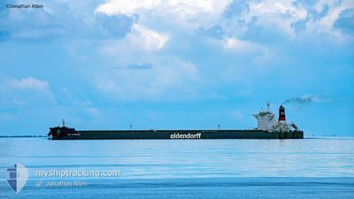
LUISE OLDENDORFF
Cargo
Current Trip
AU PHD
| Time Travelled | 8 days |
|---|---|
| Remaining Time | --- |
| Distance Travelled | 2096.12 nm |
| Remaining Distance | --- |
| AVG Speed | 11.4 Knots |
| MAX Speed | 15 Knots |
| AVG Wind | 9.2 knots |
| MAX Wind | 21.2 knots |
| MIN Temp | 21.9°C / 71.42°F |
| MAX Temp | 30.3°C / 86.54°F |
| Dybgang | 9.5 m |
| Position Modtaget | 5 d siden |
Current Position
| Longitude | 114.42311° |
|---|---|
| Latitude | 22.08727° |
| Status | Under way using engine |
| Fart | 12 Knots |
| Kurs | 126.5° |
| Område | South China Sea |
| Station | T-AIS |
| Position Modtaget | 5 d siden |
Info
Information
The current position of LUISE OLDENDORFF is in South China Sea with coordinates 22.08727° / 114.42311° as reported on 2024-04-19 07:52 by AIS to our vessel tracker app. The vessel's current speed is 12 Knots
The vessel LUISE OLDENDORFF (IMO: 9714240, MMSI: 255805685) is a Cargo It's sailing under the flag of [PT] Portugal.
In this page you can find informations about the vessels current position, last detected port calls, and current voyage information. If the vessels is not in coverage by AIS you will find the latest position.
The current position of LUISE OLDENDORFF is detected by our AIS receivers and we are not responsible for the reliability of the data. The last position was recorded while the vessel was in Coverage by the Ais receivers of our vessel tracking app.
The current draught of LUISE OLDENDORFF as reported by AIS is 9.5 meters
Weather
| Temperature | 28.9°C / 84.02°F |
|---|---|
| Wind Speed | 6 knots |
| Direction | 16° NNE |
| Pressure | 1008.3 hPa |
| Humidity | 74.5 % |
| Cloud Coverage | 28 % |
Featured Company
Last Port Calls
| Port | Arrival | Departure | Time In Port |
|---|---|---|---|
| 2024-04-15 08:30 | 2024-04-16 04:59 | 20 h | |
| 2024-04-10 06:33 | 2024-04-13 06:43 | 3 d | |
| 2024-03-29 21:13 | 2024-03-31 16:58 | 1 d | |
| 2024-03-08 11:38 | |||
| 2024-03-02 01:05 | 2024-03-03 05:54 | 1 d | |
| 2024-02-13 07:13 | 2024-02-16 04:52 | 2 d |
Most Visited Ports (Last year)
| Port | Arrivals | |
|---|---|---|
| 3 | ||
| 2 | ||
| 2 | ||
| 1 | ||
| 1 | ||
| 1 |
Last Trips
| Origin | Departure | Destination | Arrival | Distance | |
|---|---|---|---|---|---|
| 2024-04-13 14:43 | 2024-04-15 16:30 | 200.12 nm | |||
| 2024-04-01 00:58 | 2024-04-10 14:33 | 2670.47 nm | |||
| 2024-03-08 19:38 | 2024-03-30 05:13 | 3348.60 nm | |||
| 2024-02-16 12:52 | 2024-03-02 09:05 | 3197.91 nm | |||
| 2024-01-21 11:57 | 2024-02-13 15:13 | 3929.49 nm |
Events
| Tid | Hændelsen | Detaljer | Position / Dest | Info |
|---|---|---|---|---|
| 2024-04-19 07:52 | Udenfor Dækning |
22.08727 / 114.42311
South China Sea
AU PHD
|
Fart: 12 kn Kurs: 126.5° |
|
| 2024-04-19 05:52 | Destination er ændret | AU PHD HK HKG |
22.24816 / 114.11440
AU PHD
|
Fart: 5.1 kn Kurs: 109.5° |
| 2024-04-19 05:52 | ETA er ændret | 2024/04/30 14:00 2024/04/17 14:00 |
22.24816 / 114.11440
AU PHD
|
Fart: 5.1 kn Kurs: 109.5° |
| 2024-04-19 05:50 | START Sejllads | 4.5 nm, South West of HONG KONG |
22.24890 / 114.11236
HK HKG
|
Fart: 3.6 kn Kurs: 116° |
| 2024-04-19 05:36 | Status er ændret | Under way using engine At anchor |
22.25463 / 114.10850
HK HKG
|
Fart: 0.2 kn Kurs: 221° |
| 2024-04-19 04:30 | Dybgangen er ændret | 9.5 9.2 |
22.25428 / 114.10807
HK HKG
|
Fart: Kurs: 186° |
| 2024-04-18 02:14 | Status er ændret | At anchor Default |
22.25108 / 114.10990
HK HKG
|
Fart: 0.1 kn Kurs: 266° |
| 2024-04-18 02:02 | Status er ændret | Default At anchor |
22.25168 / 114.11004
HK HKG
|
Fart: 0.1 kn Kurs: 254° |
| 2024-04-18 01:23 | Status er ændret | At anchor Default |
22.25361 / 114.10844
HK HKG
|
Fart: 0.1 kn Kurs: 199° |
| 2024-04-18 01:20 | Status er ændret | Default At anchor |
22.25365 / 114.10829
HK HKG
|
Fart: 0.1 kn Kurs: 195° |