
LONGVIEW LOGGER
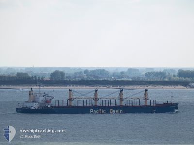
Bulk Carrier
Current Trip
| Time Travelled | 43 days |
|---|---|
| Remaining Time | --- |
| Distance Travelled | 11875.88 nm |
| Remaining Distance | --- |
| AVG Speed | 11.6 Knots |
| MAX Speed | 14.8 Knots |
| AVG Wind | 13.8 knots |
| MAX Wind | 28.7 knots |
| MIN Temp | 8.2°C / 46.76°F |
| MAX Temp | 31°C / 87.8°F |
| Dybgang | 7.5 m |
| Position Modtaget | 1 h, 59 m siden |
Current Position
| Longitude | -17.16162° |
|---|---|
| Latitude | 9.35579° |
| Status | Under way using engine |
| Fart | 12.5 Knots |
| Kurs | 323.1° |
| Område | North Atlantic Ocean |
| Station | T-AIS |
| Position Modtaget | 1 h, 59 m siden |
Info
Information
The current position of LONGVIEW LOGGER is in North Atlantic Ocean with coordinates 9.35579° / -17.16162° as reported on 2024-04-19 23:31 by AIS to our vessel tracker app. The vessel's current speed is 12.5 Knots and is heading at the port of ISKENDERUN. The estimated time of arrival as calculated by MyShipTracking vessel tracking app is 2024-05-02 12:00 LT
The vessel LONGVIEW LOGGER (IMO: 9338541, MMSI: 477969800) is a Bulk Carrier that was built in 2007 ( 17 år gamle ). It's sailing under the flag of [HK] Hong Kong.
In this page you can find informations about the vessels current position, last detected port calls, and current voyage information. If the vessels is not in coverage by AIS you will find the latest position.
The current position of LONGVIEW LOGGER is detected by our AIS receivers and we are not responsible for the reliability of the data. The last position was recorded while the vessel was in Coverage by the Ais receivers of our vessel tracking app.
The current draught of LONGVIEW LOGGER as reported by AIS is 7.5 meters
Weather
| Temperature | 25°C / 77°F |
|---|---|
| Wind Speed | 13 knots |
| Direction | 239° WSW |
| Pressure | 1009.5 hPa |
| Humidity | 86.6 % |
| Cloud Coverage | 100 % |
Featured Company
Last Trips
| Origin | Departure | Destination | Arrival | Distance | |
|---|---|---|---|---|---|
| 2024-03-01 16:19 | 2024-03-04 06:47 | 565.01 nm | |||
| 2024-02-28 15:16 | 2024-02-29 06:43 | 42.51 nm | |||
| 2024-02-14 05:14 | 2024-02-25 10:00 | 572.40 nm | |||
| 2024-02-08 17:39 | 2024-02-12 16:29 | 495.55 nm | |||
| 2024-01-25 12:28 | 2024-02-07 16:10 | 3342.93 nm |
Events
| Tid | Hændelsen | Detaljer | Position / Dest | Info |
|---|---|---|---|---|
| 2024-04-19 23:38 | Status er ændret | Default Under way using engine |
9.37700 / -17.17125
TR ISK
|
Fart: 12.5 kn Kurs: 323.1° |
| 2024-04-19 23:31 | Udenfor Dækning |
9.35579 / -17.16162
North Atlantic Ocean
TR ISK
|
Fart: 12.5 kn Kurs: 323.1° |
|
| 2024-04-19 23:22 | Ændre havområde | Guinean part of the North Atlantic Ocean Malaysian part of the Malacca Strait |
9.32863 / -17.14323
North Atlantic Ocean
TR ISK
|
Fart: 12.5 kn Kurs: 325.9° |
| 2024-04-19 23:22 | Status er ændret | Under way using engine Default |
9.32863 / -17.14323
TR ISK
|
Fart: 12.6 kn Kurs: 327° |
| 2024-04-19 23:09 | Indenfor Dækning |
9.32863 / -17.14323
North Atlantic Ocean
TR ISK
|
Fart: 12.5 kn Kurs: 325.9° |