
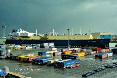
LNG PHECDA
Tanker
Current Trip
NE ASIA
| Time Travelled | --- |
|---|---|
| Remaining Time | --- |
| Distance Travelled | 22653.50 nm |
| Remaining Distance | --- |
| AVG Speed | 17.5 Knots |
| MAX Speed | 22.7 Knots |
| AVG Wind | 15.2 knots |
| MAX Wind | 36 knots |
| MIN Temp | -6.5°C / 20.3°F |
| MAX Temp | 29.6°C / 85.28°F |
| Dybgang | 11.5 m |
| Position Modtaget | 1 d siden |
Current Position
| Longitude | 104.17205° |
|---|---|
| Latitude | 1.25418° |
| Status | Under way using engine |
| Fart | 16.5 Knots |
| Kurs | 84.4° |
| Område | Singapore Strait |
| Station | T-AIS |
| Position Modtaget | 1 d siden |
Info
Information
The current position of LNG PHECDA is in Singapore Strait with coordinates 1.25418° / 104.17205° as reported on 2024-04-19 05:31 by AIS to our vessel tracker app. The vessel's current speed is 16.5 Knots
The vessel LNG PHECDA (IMO: 9834313, MMSI: 477345700) is a Tanker It's sailing under the flag of [HK] Hong Kong.
In this page you can find informations about the vessels current position, last detected port calls, and current voyage information. If the vessels is not in coverage by AIS you will find the latest position.
The current position of LNG PHECDA is detected by our AIS receivers and we are not responsible for the reliability of the data. The last position was recorded while the vessel was in Coverage by the Ais receivers of our vessel tracking app.
The current draught of LNG PHECDA as reported by AIS is 11.5 meters
Weather
| Temperature | 28.6°C / 83.48°F |
|---|---|
| Wind Speed | 6 knots |
| Direction | 109° ESE |
| Pressure | 1008.8 hPa |
| Humidity | 74 % |
| Cloud Coverage | 5 % |
Featured Company
Last Port Calls
Most Visited Ports (Last year)
| Port | Arrivals | |
|---|---|---|
| 5 | ||
| 5 | ||
| 2 | ||
| 2 | ||
| 2 | ||
| 1 |
Last Trips
| Origin | Departure | Destination | Arrival | Distance |
|---|
Events
| Tid | Hændelsen | Detaljer | Position / Dest | Info |
|---|---|---|---|---|
| 2024-04-19 05:31 | Udenfor Dækning |
1.25418 / 104.17205
Singapore Strait
NE ASIA
|
Fart: 16.5 kn Kurs: 84.4° |
|
| 2024-04-19 02:02 | Fundet i havområde | Indonesian part of the Singapore Strait |
1.13341 / 103.48255
Singapore Strait
NE ASIA
|
Fart: 13.7 kn Kurs: 122.8° |
| 2024-04-19 02:02 | Indenfor Dækning |
1.13341 / 103.48255
Singapore Strait
NE ASIA
|
Fart: 13.7 kn Kurs: 122.8° |
|
| 2024-04-11 07:18 | START Sejllads | 7.56 nm, North West of PORT LOUIS |
-20.04500 / 57.39500
NE ASIA
|
Fart: 11 kn Kurs: 14° |
| 2024-04-11 06:06 | STOP Sejllads | 7.19 nm, North West of PORT LOUIS |
-20.05333 / 57.39500
NE ASIA
|
Fart: Kurs: -1° |
| 2024-04-11 05:07 | START Sejllads | 2.87 nm, West of PORT LOUIS |
-20.14286 / 57.43161
NE ASIA
|
Fart: 4.7 kn Kurs: 255° |
| 2024-04-11 03:57 | STOP Sejllads | 2.48 nm, West of PORT LOUIS |
-20.13434 / 57.43910
NE ASIA
|
Fart: 0.3 kn Kurs: 91° |
| 2024-04-10 20:47 | Status er ændret | Default Under way using engine |
-20.60228 / 55.64566
NE ASIA
|
Fart: 17.2 kn Kurs: 74° |
| 2024-04-10 20:41 | Udenfor Dækning |
-20.61076 / 55.61424
Indian Ocean
NE ASIA
|
Fart: 17.2 kn Kurs: 74° |
|
| 2024-04-10 18:45 | ETA er ændret | 2024/04/26 16:01 2024/04/27 16:01 |
-20.75247 / 55.04741
NE ASIA
|
Fart: 16.8 kn Kurs: 72.6° |