
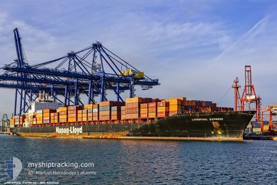
LIVERPOOL EXPRESS
Container Ship
Current Trip
| Time Travelled | 7 days |
|---|---|
| Remaining Time | 8 h, 34 mins |
| Distance Travelled | 2825.74 nm |
| Remaining Distance | 142.77 nm |
| AVG Speed | 15.9 Knots |
| MAX Speed | 20 Knots |
| AVG Wind | 17.9 knots |
| MAX Wind | 31.8 knots |
| MIN Temp | -4.4°C / 24.08°F |
| MAX Temp | 11°C / 51.8°F |
| Dybgang | 10 m |
| Position Modtaget | 1 m siden |
Current Position
| Longitude | -70.90902° |
|---|---|
| Latitude | 46.89537° |
| Status | Under way using engine |
| Fart | 15.3 Knots |
| Kurs | 231.3° |
| Område | Gulf of St-Lawrence |
| Station | T-AIS |
| Position Modtaget | 1 m siden |
Info
Information
The current position of LIVERPOOL EXPRESS is in Gulf of St-Lawrence with coordinates 46.89537° / -70.90902° as reported on 2024-04-25 20:23 by AIS to our vessel tracker app. The vessel's current speed is 15.3 Knots and is heading at the port of MONTREAL. The estimated time of arrival as calculated by MyShipTracking vessel tracking app is 2024-04-26 04:58 LT
The vessel LIVERPOOL EXPRESS (IMO: 9232565, MMSI: 310823000) is a Container Ship that was built in 2002 ( 22 år gamle ). It's sailing under the flag of [BM] Bermuda.
In this page you can find informations about the vessels current position, last detected port calls, and current voyage information. If the vessels is not in coverage by AIS you will find the latest position.
The current position of LIVERPOOL EXPRESS is detected by our AIS receivers and we are not responsible for the reliability of the data. The last position was recorded while the vessel was in Coverage by the Ais receivers of our vessel tracking app.
The current draught of LIVERPOOL EXPRESS as reported by AIS is 10 meters
Weather
| Temperature | 5.5°C / 41.9°F |
|---|---|
| Wind Speed | 10 knots |
| Direction | 289° WNW |
| Pressure | 1024.7 hPa |
| Humidity | 32.1 % |
| Cloud Coverage | 90 % |
Featured Company
Last Port Calls
| Port | Arrival | Departure | Time In Port |
|---|---|---|---|
| 2024-04-17 19:04 | 2024-04-18 15:34 | 20 h | |
| 2024-04-11 06:59 | 2024-04-12 05:02 | 22 h | |
| 2024-04-08 09:13 | 2024-04-09 01:10 | 15 h | |
| 2024-04-05 17:06 | 2024-04-06 14:49 | 21 h | |
| 2024-03-22 06:38 | 2024-03-24 12:19 | 2 d | |
| 2024-03-11 00:00 | 2024-03-12 00:11 | 1 d | |
| 2024-03-07 12:42 | 2024-03-08 12:06 | 23 h | |
| 2024-03-04 06:32 | 2024-03-05 05:39 | 23 h | |
| 2024-03-01 21:41 | 2024-03-02 16:07 | 18 h | |
| 2024-02-17 15:02 | 2024-02-20 13:38 | 2 d |
Last Trips
| Origin | Departure | Destination | Arrival | Distance | |
|---|---|---|---|---|---|
| 2024-04-12 07:02 | 2024-04-17 20:04 | 745.30 nm | |||
| 2024-04-09 03:10 | 2024-04-11 08:59 | 496.53 nm | |||
| 2024-04-06 16:49 | 2024-04-08 11:13 | 354.44 nm | |||
| 2024-03-24 08:19 | 2024-04-05 19:06 | 3354.08 nm | |||
| 2024-03-12 00:11 | 2024-03-22 02:38 | 2992.38 nm | |||
| 2024-03-08 13:06 | 2024-03-11 00:00 | 586.59 nm | |||
| 2024-03-05 06:39 | 2024-03-07 13:42 | 513.68 nm | |||
| 2024-03-02 17:07 | 2024-03-04 07:32 | 370.99 nm | |||
| 2024-02-20 08:38 | 2024-03-01 22:41 | 3276.23 nm | |||
| 2024-02-08 21:36 | 2024-02-17 10:02 | 2967.95 nm |
Events
| Tid | Hændelsen | Detaljer | Position / Dest | Info |
|---|---|---|---|---|
| 2024-04-25 19:27 | Dybgangen er ændret | 10 9.9 |
47.10307 / -70.71025
CAMTR
|
Fart: 16.6 kn Kurs: 206.1° |
| 2024-04-25 19:14 | Ændre havområde | Canadian part of the Gulf of St-Lawrence Irish part of the Inner Seas off the West Coast of Scotland |
47.15584 / -70.66265
Gulf of St-Lawrence
CAMTR
|
Fart: 17.1 kn Kurs: 212.9° |
| 2024-04-25 19:13 | Status er ændret | Under way using engine Default |
47.16057 / -70.65807
CAMTR
|
Fart: 17 kn Kurs: 216° |
| 2024-04-25 19:03 | Indenfor Dækning |
47.15584 / -70.66265
Gulf of St-Lawrence
CAMTR
|
Fart: 17.1 kn Kurs: 212.9° |
|
| 2024-04-19 04:09 | Status er ændret | Default Under way using engine |
55.54539 / -7.46030
CAMTR
|
Fart: 17.3 kn Kurs: 271.3° |
| 2024-04-19 03:58 | Udenfor Dækning |
55.54410 / -7.37042
Inner Seas off the West Coast of Scotland
CAMTR
|
Fart: 17.3 kn Kurs: 271.3° |
|
| 2024-04-19 02:58 | Ændre havområde | Irish part of the Inner Seas off the West Coast of Scotland United Kingdom part of the Inner Seas off the West Coast of Scotland |
55.52197 / -6.85286
Inner Seas off the West Coast of Scotland
CAMTR
|
Fart: 17.1 kn Kurs: 273.8° |
| 2024-04-18 22:48 | Status er ændret | Under way using engine Default |
54.68986 / -5.26937
CAMTR
|
Fart: 19.2 kn Kurs: 339° |
| 2024-04-18 22:41 | Status er ændret | Default Under way using engine |
54.65575 / -5.24659
CAMTR
|
Fart: 19.3 kn Kurs: 339° |
| 2024-04-18 22:20 | Ændre havområde | United Kingdom part of the Inner Seas off the West Coast of Scotland United Kingdom part of the Irish Sea and St. George's Channel |
54.55004 / -5.17406
Inner Seas off the West Coast of Scotland
CAMTR
|
Fart: 19.1 kn Kurs: 331.3° |