
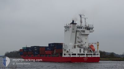
LINDA
Container Ship
Current Trip
| Time Travelled | 9 h, 5 mins |
|---|---|
| Remaining Time | 2 days |
| Distance Travelled | 114.98 nm |
| Remaining Distance | 688.91 nm |
| AVG Speed | 11.9 Knots |
| MAX Speed | 15.5 Knots |
| AVG Wind | 11.9 knots |
| MAX Wind | 24.7 knots |
| MIN Temp | 4.5°C / 40.1°F |
| MAX Temp | 8.9°C / 48.02°F |
| Dybgang | 8 m |
| Position Modtaget | Nu |
Current Position
| Longitude | 1.84520° |
|---|---|
| Latitude | 51.28943° |
| Status | Under way using engine |
| Fart | 10.9 Knots |
| Kurs | 209.7° |
| Område | North Sea |
| Station | T-AIS |
| Position Modtaget | Nu |
Info
Information
The current position of LINDA is in North Sea with coordinates 51.28943° / 1.84520° as reported on 2024-04-25 12:54 by AIS to our vessel tracker app. The vessel's current speed is 10.9 Knots and is heading at the port of EL FERROL. The estimated time of arrival as calculated by MyShipTracking vessel tracking app is 2024-04-27 23:34 LT
The vessel LINDA (IMO: 9354325, MMSI: 230984000) is a Container Ship that was built in 2007 ( 17 år gamle ). It's sailing under the flag of [FI] Finland.
In this page you can find informations about the vessels current position, last detected port calls, and current voyage information. If the vessels is not in coverage by AIS you will find the latest position.
The current position of LINDA is detected by our AIS receivers and we are not responsible for the reliability of the data. The last position was recorded while the vessel was in Coverage by the Ais receivers of our vessel tracking app.
The current draught of LINDA as reported by AIS is 8 meters
Weather
| Temperature | 8.7°C / 47.66°F |
|---|---|
| Wind Speed | 24 knots |
| Direction | 220° SW |
| Pressure | 1003.6 hPa |
| Humidity | 82.3 % |
| Cloud Coverage | 100 % |
Featured Company
Last Port Calls
| Port | Arrival | Departure | Time In Port |
|---|---|---|---|
| 2024-04-24 00:41 | 2024-04-25 03:50 | 1 d | |
| 2024-04-24 00:36 | |||
| 2024-04-20 21:29 | 2024-04-21 14:21 | 16 h | |
| 2024-04-19 05:50 | 2024-04-19 14:13 | 8 h | |
| 2024-04-14 17:08 | 2024-04-15 04:28 | 11 h | |
| 2024-04-14 05:03 | 2024-04-14 11:13 | 6 h | |
| 2024-04-12 15:46 | 2024-04-13 03:29 | 11 h | |
| 2024-04-07 05:34 | 2024-04-07 14:10 | 8 h | |
| 2024-04-06 17:51 | 2024-04-07 01:36 | 7 h | |
| 2024-03-30 18:20 | 2024-03-31 14:01 | 19 h |
Most Visited Ports (Last year)
| Port | Arrivals | |
|---|---|---|
| 18 | ||
| 17 | ||
| 17 | ||
| 14 | ||
| 14 | ||
| 14 |
Last Trips
| Origin | Departure | Destination | Arrival | Distance | |
|---|---|---|---|---|---|
| 2024-04-21 16:21 | 2024-04-24 02:41 | 333.45 nm | |||
| 2024-04-21 16:21 | 2024-04-24 02:36 | 333.35 nm | |||
| 2024-04-19 15:13 | 2024-04-20 23:29 | 420.35 nm | |||
| 2024-04-15 06:28 | 2024-04-19 06:50 | 1279.28 nm | |||
| 2024-04-14 13:13 | 2024-04-14 19:08 | 49.66 nm | |||
| 2024-04-13 03:29 | 2024-04-14 07:03 | 201.99 nm | |||
| 2024-04-07 15:10 | 2024-04-12 15:46 | 562.97 nm | |||
| 2024-04-07 02:36 | 2024-04-07 06:34 | 55.19 nm | |||
| 2024-03-31 16:01 | 2024-04-06 18:51 | 1875.38 nm | |||
| 2024-03-29 18:19 | 2024-03-30 19:20 | 322.82 nm |
Events
| Tid | Hændelsen | Detaljer | Position / Dest | Info |
|---|---|---|---|---|
| 2024-04-25 10:41 | Fundet i havområde | United Kingdom part of the North Sea |
51.63242 / 2.27605
North Sea
ESFRO
|
Fart: 8.9 kn Kurs: 224.8° |
| 2024-04-25 09:28 | Ændre havområde | Belgian part of the North Sea Dutch part of the North Sea |
51.83197 / 2.58552
North Sea
ESFRO
|
Fart: 15.4 kn Kurs: 220.1° |
| 2024-04-25 08:22 | Status er ændret | Under way using engine Default |
52.01957 / 2.92385
ESFRO
|
Fart: 14.5 kn Kurs: 260° |
| 2024-04-25 08:11 | Status er ændret | Default Under way using engine |
52.02833 / 2.99500
ESFRO
|
Fart: 14.4 kn Kurs: 261° |
| 2024-04-25 07:19 | Status er ændret | Under way using engine Default |
52.05173 / 3.32582
ESFRO
|
Fart: 13.9 kn Kurs: 263° |
| 2024-04-25 07:15 | Status er ændret | Default Under way using engine |
52.05325 / 3.35243
ESFRO
|
Fart: 13.9 kn Kurs: 264.4° |
| 2024-04-25 07:07 | Status er ændret | Under way using engine Default |
52.05598 / 3.40178
ESFRO
|
Fart: 14 kn Kurs: 269° |
| 2024-04-25 06:56 | Status er ændret | Default Under way using engine |
52.05833 / 3.47167
ESFRO
|
Fart: 13.9 kn Kurs: 267.3° |
| 2024-04-25 03:50 | Afsejlet fra sidste havn |
|
51.89465 / 4.39690
ESFRO
|
Fart: 7.6 kn Kurs: 299° |
| 2024-04-25 03:41 | START Sejllads |
51.88048 / 4.40773
[NL] ROTTERDAM WAALHAVEN
|
Fart: 3.2 kn Kurs: 352° |